Choosing the right drone mapping software can be the difference between making decisions that move your projects forward and the ones that hold them back.
With a good drone mapping software, you can get insights that guide million-dollar decisions like construction projects, infrastructure assets, predictive maintenance, and utilities. You can turn spatial data into a dependable decision-making asset. But a wrong one? The wrong choice would still arm you with the maps, but it might not be reliable. The data would be rife with errors, distortions, or gaps that won’t give decision-making the confidence it demands. And as a result, it’ll waste resources, erode confidence, risk the success of the project, and cut into both money and public safety.
So, how do you choose a platform that delivers certainty instead of bottlenecks? Let’s walk through what matters most…
What is drone mapping software?
Drone mapping software is a computer application that lets you plan and execute drone flights, collect data and images, and then process collected data into high-resolution, complex models.
Insights sourced from such a software then guides decisions across industries like agriculture, transport, defense, utilities, and mining. In short, it’s the drone mapping software that converts a drone from being just a flying camera and LiDAR sensor into a surveying, processing, and analysis tool. The tool processes and analyzes the data the drone collects, like images, LiDAR maps, and multispectral data, to extract useful insights.
The best platforms go beyond just processing and visualizing data. They can create automated drone missions and comprehensively plan flight paths to gather data without any gaps or discrepancies.
Top features to look for in a drone mapping software
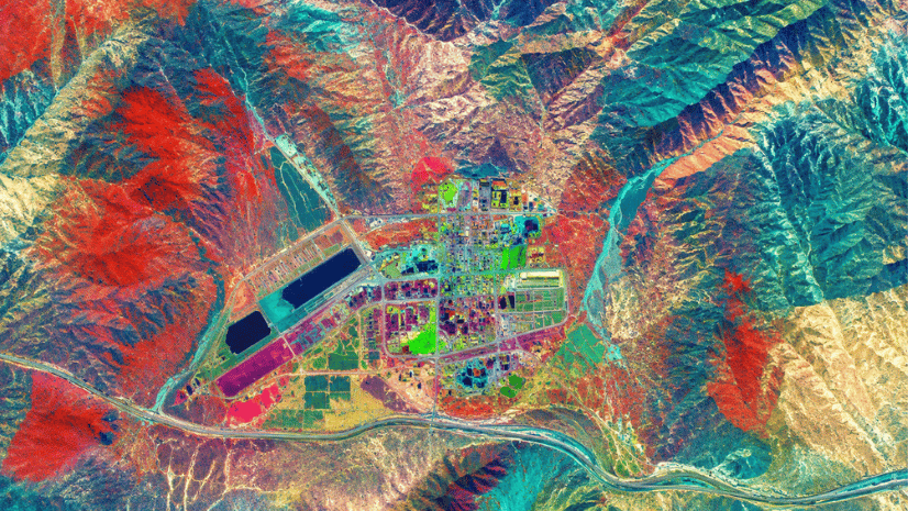
Not all drone mapping software is built the same. Some come with more comprehensive capabilities than others. They can plan flight paths, automate data collection, and process raw data from different sensors and cameras. Then the software can stitch it all together into high-res 2D and 3D models, rich with detail and full of insights.
The effectiveness of a drone 3D mapping software for your use case depends on the accuracy, resolution, and the suite of capabilities it comes with.
Here’s how you can evaluate different drone survey mapping applications on all of these parameters:
1. Accuracy and resolution
In drone mapping applications, both the collected data and the analysis need to reflect the true measurements and spatial relationships of the area surveyed. The resolution usually determines the quality or level of detail of the data that’s collected, like drone imagery and LiDAR maps. While accuracy refers to their consistency and integrity of insights.
Here’s how it affects the outcome:
- Construction: The right information at the right time helps create error-free, high-resolution 3D models, empowering engineers to reduce risks and errors. For example, plotting roads or pipelines at centimeter-level accuracy.
- Mining: Accurate terrain models that don’t have any gaps in data allow engineers to calculate the exact volume of the pit, blast site, and even stockpile, to avoid low-yield areas. Moreover, it can also help ensure the safety of the operations.
- Agriculture & Urban Planning: High-resolution data collected from drones can reveal the small changes in soil and crop health, allowing farmers to prevent crop loss or mitigate soil depletion. In urban planning, accuracy of data supports zoning, smart city planning, and land-use decisions.
2. 2D/3D Map generation
Since raw data alone can’t tell the entire story, 2D and 3D mapping capabilities are essential. Engineers and planners need to look at models that mirror the site on the ground to analyze and make the right decisions.
A drone 3D Mapping software can stitch together multiple drone images to build these high-resolution 3D models and 2D maps.
These aren’t just pretty visuals; they’re georeferenced, measurable, and ready to plug into planning workflows.
Here’s why this capability matters:
- Site visibility: Teams need accurate site views to analyze and plan efficiently, but physical inspections slow things down. Drone surveys give a true bird’s-eye view from above, eliminating the need for manual site visits while planning.
- Depth and volume analysis: 3D models capture elevation, slopes, and volume of ground objects, helping gauge flood risk, calculate mining stockpile, and ideate cut-and-fill actions.
- Design validation: This data helps validate CAD drawings and construction plans, pointing out any misalignments and minimizing errors, even before the construction begins.
In short, 2D and 3D drone survey mapping isn’t just about data collection,; it’s about extracting the insights that reduce risks, maximize efficiency, and build project momentum faster.
3. Cloud-based processing
It takes a lot of processing power to turn raw data collected by drones into models and visualizations that enable the right decisions. Cloud-based processing helps you get that processing power on demand and crunch those large data sets to analyze images faster.
Moreover, it also gives you the scale and flexibility that a desktop solution can’t provide due to cost and efficiency limitations. The result? A solution that’s faster, scalable, cost-effective, and accessible from anywhere.
Here’s how cloud processing changes the game:
- Speed at scale: Cloud servers can analyze large 3D and 2D models in a matter of minutes, not days.
- Collaboration-friendly: Teams can access files and programs from anywhere – eliminating physical barriers and facilitating cross-functional collaboration.
- Data security & backup: Leading platforms ensure encrypted storage and redundancy, keeping valuable survey data safe.
In short, cloud computing makes drone survey mapping more reliable, faster, and accessible.
4. Compatibility with mobile apps
A mobile app is critical for drone-mapping operations as it is more accessible than desktop software, and helps plan flight paths, control flight, and collect data, in the field and on the move.
Moreover, it enables stakeholders to monitor projects in real-time, facilitate collaboration, and streamline the planning and mapping process.
Here’s why it matters in the real-world:
- Mission planning on-site: You can use mobile apps to edit critical information like boundaries, waypoints, and more without needing a desktop.
- Real-time monitoring: You can track the flight and ensure coverage in real-time with a smartphone.
- Seamless sync: You can use the mobile app to transfer the collected data directly to the cloud or desktop software, syncing backups and servers in real-time.
5. Integration with GIS platforms
Data collected with drones is powerful. But integrating it with GIS platforms makes it even more valuable, as the 2D and 3D models created with drones can reveal so much more within a GIS.
They can be layered with geospatial data like maps, zoning, and environmental data to identify relationships, trends, and patterns between objects on the site. Moreover, they can offer richer insights on terrain, guiding decisions across industries like mining, utilities, and construction.
Here’s why GIS integration matters:
- It helps stack aerial data with existing spatial layers for clearer, more reliable insights.
- It lets drone maps be used alongside GIS data to help identify real-world patterns of land-use, environmental impact, and infrastructure network.
- Eliminates manual data exports and imports by syncing directly into platforms like ArcGIS.
- Enables urban planners, surveyors, and project managers to work together in the same geospatial environment.
What are some key applications of drone mapping software?
Data captured via drones is usually collected to build 3D models, perform volumetric calculations over a site, monitor project progress, and inspect and visually analyze areas to guide efficient usage. Thus, it finds its applications in various industries like agriculture, construction, mining, urban planning, and disaster management.
Here’s how these industries leverage drone mapping software:
Agriculture
Drone agriculture mapping software is incredibly useful in agriculture. It can help map field boundaries, monitor crop health, analyze soil variation, and diagnose and predict irrigation issues with precise data.
These granular and predictive insights can help farmers mitigate issues before they snowball into problems, for example:
- Multispectral data and NDVI analysis reveal crop health and pinpoint stressed plants.
- Maps soil variability to guide targeted fertilization and seeding.
- Analyzes soil variations to guide targeted seeding, harvesting, and fertilization.
- Tightens yield forecasting by tracking and analyzing historical crop patterns across seasons.
- Pinpoints irrigation gaps or waterlogging areas for timely fixes.
- Reduces manual labour to monitor big farms and irrigation sites.
In summary, drones can revolutionize the agriculture industry and find many use cases in it.
Construction
Most construction projects battle issues like budget overruns, delays, labour risks, and planning errors. Surprisingly, a big chunk of these problems can be solved with the data and insights that reveal patterns, trends, and relationships between different objects, driving better planning and construction decisions.
But traditional methods of surveying a site are slow, filled with gaps, and create issues that result in larger problems later on.
Drone mapping software steps in as a faster, more reliable way to track progress and catch issues before they escalate.
Here’s why:
- You get high-resolution data with no gaps, all without needing to stop the work on the ground.
- You get accurate volumetric measurements of stockpiles and more.
- Let’s you rapidly compare design plans with true-to-scale 2D and 3D models.
- Makes it much easier for stakeholders to track and visualize project progress.
- Reduces reliance on manual surveys, cutting both cost and delays.
- With effective drone surveying and monitoring, construction teams get a clear view of the site and the accuracy they need to keep projects safe, on budget, and on schedule.
Mining
Traditional land surveys of mining sites help reduce risks and overall costs by powering better mining decisions. However, uneven and risky terrain limits and slows manual surveying, leading to data and information gaps.
Drone mapping software offers speed, efficiency, accuracy, and ability to map complex terrain with aerial views, making mining safer and faster.
Here’s exactly how it does this:
- Produces accurate 3D terrain models for mine planning and design.
- Calculates pit volumes and stockpile measurements with centimeter-level precision.
- Monitors slope stability and blast sites to improve safety.
- Cuts down survey time from days to hours, even in hard-to-access areas.
By combining accuracy with safety, aerial drone surveying is helping mining companies extract more value from every operation while reducing risks and costs.
Urban planning
Drones can collect high-resolution imagery and LiDAR maps that are used by urban planners to plan infrastructure upgrades, new cities, and model and test outcomes before even investing a single rupee.
With data gathered from drones, planners create 3D models, triage different designs, and understand the relationships between different objects to drive urban and regional infrastructure projects.
It basically gives planners up-to-date, high-resolution views of urban areas, which allows them to do things like:
- Build base maps for zoning, land-use, and development planning.
- Test different 3D city models to identify the optimum infrastructure design.
- Monitor green cover and water bodies to assess environmental impact.
- Track the development lifecycle of urban areas.
- Support smart city initiatives with geospatial data.
In short, drone mapping shifts urban planning from reactive guesswork to informed, data-driven decision making.
Disaster management
Disaster management hinges on timely and accurate decision-making. From planning responses to mitigating threats, everything needs to be fast and error-free. That’s where traditional surveying holds it back, as it is too slow or unsafe in high-risk situations.
Data collected with drones offers a rapid, reliable supply of intelligence that can guide high-stakes response and mitigation efforts.
Here’s how:
- Get a real-time aerial view of the affected areas.
- Predict progression with 3D models of flood paths and landslide-prone areas.
- Map damaged infrastructure to prioritize repair and resource allocation.
- Expedite search and rescue programs with high-resolution aerial imagery.
Drone 3D mapping turns aerial data into clear insights, giving disaster teams the speed and accuracy they need when every second matters.
How to choose the right drone mapping software?
The right drone mapping software for you depends on your budget and priorities. For example, you might not need software that helps with automating drone flights, but just the analytical capabilities of the program that turns raw data into insights.
We have extensively discussed the features and capabilities you should look for in a drone mapping software. Now, let’s look at the different parameters like pricing, use cases, and more that can make or break your decision.
- Match the software to your use case: Every industry has different demands; what works for agriculture might not work for mining. So, look at the unique needs of your industry.
- Decide on the pricing model: You can get free tools with limited capabilities, or enterprise ones with end-to-end capabilities with enterprise-grade data security. It depends on your needs and the trade-offs you’re comfortable with.
- Check data type support: Whether you need photogrammetry, LiDAR, or multispectral imagery, not every platform handles them equally well.
- Look beyond the tool itself: Factor in pricing transparency, local vendor support, and whether training is available to help your team ramp up quickly.
Final thoughts
Drone mapping software has evolved into an indispensable tool that informs strategic choices in nearly every sector today. It converts hundreds of aerial snapshots into precise, relevant, and readily applicable information.
With the Indian agenda focused on smart agronomy, urban innovation, and large-scale infrastructure, aerial mapping will occupy an ever-greater seat at the planning table. The decisive consideration, therefore, has shifted from a binary choice of “if” to a strategic deliberation of “which platform” serves the mission-critical objectives and caters to industry native needs. The right choice, however, is the one that sits at the intersection of price, capabilities, and the trade-offs you’re willing to make.
FAQ
What is GSD in drone mapping?
Ground Sampling Distance, or GSD, is the separation between the center points of adjacent pixels as measured on the earth’s surface when you view a drone map or image. In simple terms, GSD regulates the true breadth and depth that you can see on the map.
Decreasing it enables sharper, more accurate insights, which makes it a vital tool for construction site monitoring, agriculture, and mining.
What industries benefit the most from drone mapping?
Almost every industry can benefit from drone mapping. However, industries like mining, construction, and disaster management benefit the most from drone mapping, as it eliminates data gaps with high-resolution images, and also eliminates the need to risk humans for surveying risky sites.
Can drone mapping software be used for agriculture?
The high-resolution and accuracy of data collected from drones reveal even the tiniest variations in soil and crop health patterns, allowing farmers to intervene early and prevent catastrophic losses. It can also guide fertilization, harvesting, and seeding processes, driving up efficiency and ROI for farmers.
Which software is used for drone data processing?
Especially for businesses, Esri’s Site Scan for ArcGIS is the top choice for a drone mapping software. It offers tools to analyze data and plan flights. With this software, you can map complex sites and terrains, carry out autonomous flights, and analyze the collected data directly. Additionally, it provides strong data security, keeping your project data safe from outside threats.
Written by
Esri India Marketing