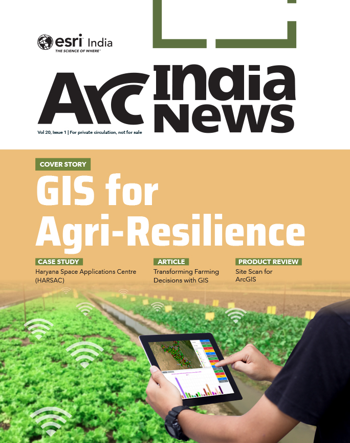
Cover Story
GIS Mapping a Better Future
GIS provides a platform to store, manage, and analyze geospatial data to help make informed decisions in a variety of fields.
Cover Story
Table of contents
India is one of the major players in the agriculture sector worldwide, and it is the primary source of livelihood for ~45% of the country’s population. The sector plays a major role in supporting livelihoods and ensuring food security for millions. In addition to providing food, feed, fuel, and fiber to meet the growing needs of the burgeoning population, it supplies raw materials to the country’s agri-based industry. Climate change and depleting natural resources are seriously threatening agricultural productivity and incomes. To enhance agricultural production and farmers’ incomes, remove poverty, and ensure food and nutritional security on a sustainable basis, suitable location-specific climate-smart agriculture technologies must be identified, created, and adopted at field levels. Integrated farming systems must also be promoted. Modern tools and technologies such as GIS, remote sensing, AI, drone technology, crop modelling, site specific nutrient management, and mobile applications must be adopted for farmers to make informed decisions about better nutrient management, reducing wastage, and minimizing environmental footprints. These tools can also significantly aid in improving farm productivity and farmer’s income. GIS is pivotal in modern agriculture as it allows farmers to optimize resource utilization, reduce environmental impact, and tailor farming practices to the unique conditions of each field. The result is a more efficient, productive, and sustainable approach to agriculture, particularly through precision agriculture. Esri’s ArcGIS is making agronomic understanding more accessible and empowering those responsible for feeding the planet.
One of the major benefits of GIS is its role in increasing agricultural productivity, which is vital to global food security. By using spatial data to optimize planting patterns and resource allocation, farmers can achieve higher yields without expanding agricultural land. This technology enables precision farming, where each aspect of farm management is tailored to the specific needs of individual crops, resulting in better yields and more efficient resource use.
Precision agriculture is a modern farm management approach that focuses on observing, measuring, and responding to variability within and between fields. It aims to optimize farm inputs by targeting the inherent differences in the land through Variable Rate Application (VRA). To implement VRA effectively, detailed spatial data must be gathered across fields using tools like GIS and remote sensing. Some of the major precision farming technologies include precision irrigation systems, yield mapping and monitoring tools, and information management systems. By utilizing advanced descriptive, predictive, and prescriptive analytics, precision agriculture enables farmers to make data-driven decisions that promote cost-effective, environmentally friendly, and sustainable farming practices. According to the World Economic Forum, adopting precision agriculture technologies on 15-25% of farms could increase global food production by 10-15% by 2030, while reducing greenhouse gas emissions and water consumption by 10-20%, respectively.
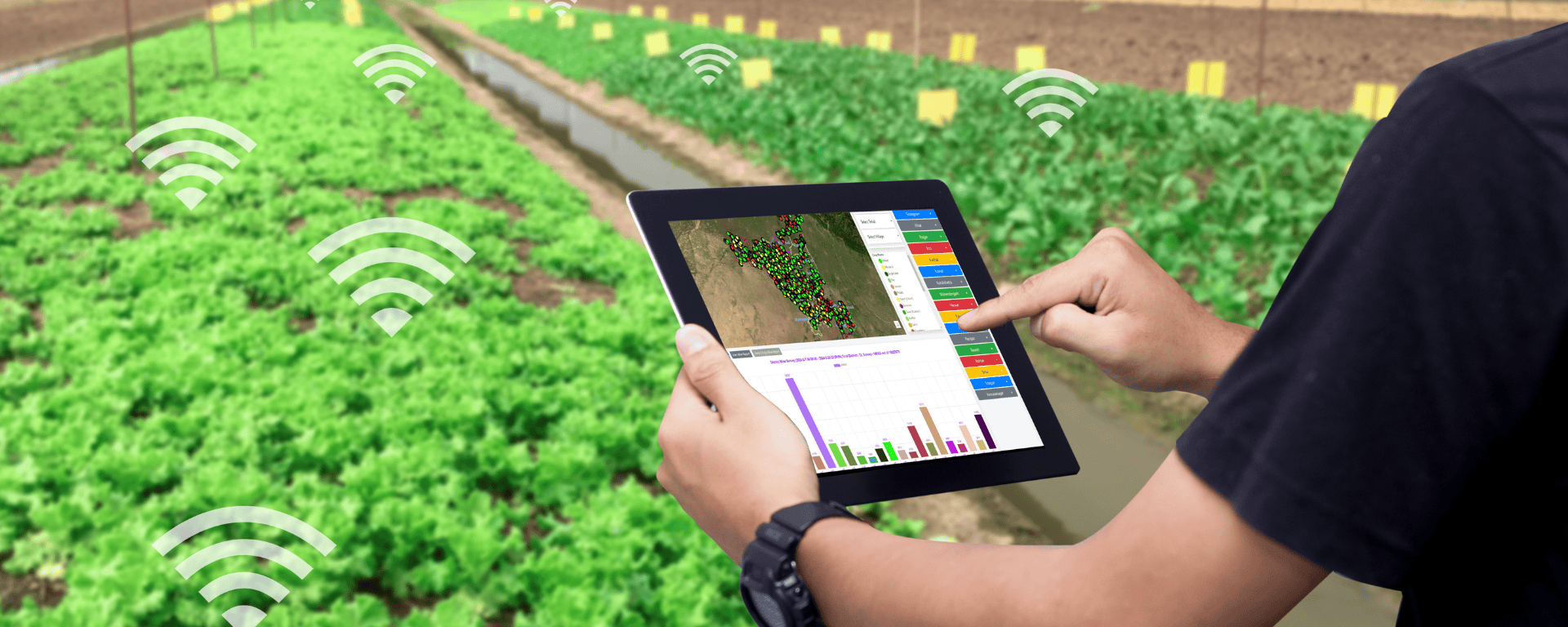
Tools like ArcGIS play a crucial role in precision agriculture by providing farmers with detailed data about soil types, crop health, moisture levels, and other relevant factors. This information helps them monitor field variability, identify areas that need attention, and apply inputs like water, fertilizers, and pesticides more accurately.
Haryana Space Applications Centre (HARSAC) has developed and deployed a Geospatial Technologybased Crop Management Solution to address challenges in agricultural management. This solution empowers farmers, enhances transparency, and strengthens agricultural reforms in Haryana. The solution, which is part of HARSAC’s OneMap Gurugram Portal, enables the authority to capture real-time, ground-truth intelligence on the total crop produced in Haryana. It allows the government to precisely record, measure, and analyze agricultural produce, leading to more effective governance in yield management and agricultural income generation. By bringing transparency to the lifecycle from seed to market, farmers feel more empowered. The system has led to significant improvements in yield management, cost reduction, and resource optimization, resulting in substantial financial savings for the state.
The Crop Management Solution, built using Esri’s Geospatial Technology, enables complete data collection of crop types and conditions across Haryana. It performs precise measurements of farmland size in each district, helping HARSAC manage farmlands and crops more effectively, reduce labor costs, and minimize resource waste. The accurate, up-to-date data allows for the formulation of feasible funding and agricultural development plans. The system encourages farmers to register on a common portal, promoting transparency. Currently, about 1.2 million farmers are registered. This registration facilitates complete knowledge of farmland, easing crop monitoring and management. Farmers receive updated market rates and can schedule appointments to sell produce at government-approved centers, saving time and effort.

Instead of manual inspections, GIS enables remote monitoring of crop health using satellite imagery, providing insights about humidity, temperature, and overall growth. This helps in identifying areas needing attention. By monitoring changes in crop health indicators over time, GIS enables early detection of stress factors such as nutrient deficiencies, water scarcity, diseases, and pest outbreaks. Early identification allows farmers to take timely corrective actions, preventing potential yield losses and reducing the need for extensive interventions later in the season.
GIS also helps to monitor terrain slope and runoff patterns, enabling the stakeholders to track changes in soil health over time. This data can predict areas at risk of degradation, ensuring that timely interventions are made to prevent soil erosion and maintain long-term soil health.
Accurate yield predictions are vital for food security and financial planning. Crop yield prediction using GIS involves combining spatial data with advanced analytics to forecast agricultural output. GIS integrates a variety of data types, including soil quality, topography, weather patterns, and satellite imagery, to provide a comprehensive view of the factors influencing crop growth. By mapping climate data such as temperature, precipitation, and growing-degree days (GDD), GIS helps farmers determine the optimal times for planting and harvesting to maximize yield. Soil analysis, through GIS-generated maps, identifies the nutrient levels, pH, and texture of the soil, guiding decisions on which crops are most suited for specific field areas. Remote sensing technologies, including satellite imagery and drones, provide real-time data on crop health, enabling early detection of stress factors like pests or nutrient deficiencies that could affect yield. Additionally, GIS incorporates historical yield data to predict future crop production trends, enhancing the accuracy of forecasts. With the integration of machine learning, GIS can analyze large datasets to create predictive models, allowing farmers to forecast crop yields with higher precision. Precision agriculture techniques, supported by GIS, enable farmers to optimize field inputs based on locationspecific data, increasing efficiency and yield. Overall, GIS serves as a powerful tool for making informed decisions, improving crop management, and enhancing yield prediction accuracy.
Farmers in South Odisha have achieved significant improvement in crop choices and income through the Agri-GIS app, built using ArcGIS by the Centre for Spatial Analytics and Advanced GIS (C-SAG).
The app delivers personalized advisories via text messages, phone calls, or smartphone notifications, offering weather forecasts, crop recommendations, market analysis, and alerts for events like cyclones. Agri-GIS integrates spatial data from satellites, weather services, and GIS systems, along with social, economic, and family data, to provide tailored advice for individual farms.
The app uses advanced GIS tools like ArcGIS and AI to generate insights based on factors such as soil, climate, and family circumstances. It provides real-time updates every crop season, with a focus on personalized, hyperlocal advisories. Farmers who followed the app’s advice have seen their income increase by almost 60%, with an estimated total income boost for 150,000 farmers in the region.

GIS provides farmers and agricultural specialists with a powerful way to map, analyze, and manage pest populations, improving the efficiency of pest control efforts while minimizing the use of pesticides. By integrating spatial data with environmental factors such as temperature, rainfall, soil type, and crop distribution, GIS enables precise monitoring of pest outbreaks. It helps in identifying areas of high pest density, allowing for targeted interventions rather than broadspectrum pesticide applications, which not only saves costs but also reduces environmental harm. GIS tools can also support the creation of predictive models, assessing how pest populations might spread based on climatic conditions, land use, and crop types. This predictive capability aids in early detection and intervention, preventing widespread infestations and crop damage. Furthermore, GIS plays a crucial role in Integrated Pest Management (IPM) strategies, where it assists in combining various pest control methods, such as biological controls, habitat manipulation, and chemical treatments, tailored to specific regions. By tracking pest populations over time, GIS also facilitates the evaluation of control measures, ensuring that pest management strategies are both effective and sustainable. Overall, GIS empowers agricultural professionals to make informed decisions, optimize pest control resources, and protect crops, thereby enhancing productivity and reducing environmental and economic risks associated with pest infestations.

Today more than ever, farmers rely on inputs to increase the quality of the produce they grow. These inputs vary from seed, fertilizer, and pesticides to machinery parts and monitoring equipment. In past generations, farmers tended to spread fertilizer evenly over the entire field. Now, thanks to geospatial technology, spreading methods can be more exact by type, quantity, and location of application. Outfitting the spray rig with computerized controllers and GPS navigation systems is an approach to farming that is both friendly to the environment and profitable for the farmer. Ravensdown, New Zealand’s largest manufacturer and distributor of fertilizers, is using geospatial technology to improve the way New Zealand farmers manage their inputs. By using GIS and GPS to guide the application of fertilizers, farmers are decreasing the amount of wasted resources that can potentially cause harmful runoff into streams and waterways. At the same time, they are reducing their total fertilizer expenditure by up to 10 percent per year. Ravensdown worked with Eagle Technology Group to design the solution that is built on Esri’s ArcGIS software. The system accurately records where and how much fertilizer has been applied to a certain area. This information is merged with digital orthophotos and the farm’s relational databases to create a vivid picture of the farm’s overall soil sustainability.
Once the raw spatial and attribute data is captured from GPS transceivers on the trucks, it is transmitted wirelessly to Ravensdown’s facility where it is loaded into the GIS and processed in near real time. The onboard GIS creates a map-based display that shows fertilizer application data as a series of color-coded “snail trails” that are overlaid on the map, giving a very good representation of the process. An additional benefit is that the system can be used as evidence to verify “proof of placement.” With geospatial technology, it is easy to demonstrate that the fertilizer has been spread in a manner consistent with best environmental practices. Eagle used the development capabilities available in ArcGIS Server to embed the map interface in Ravensdown’s customer relationship management (CRM) system. Ravensdown wanted seamless access to the spatial and attribute data, so Eagle developers used the .NET framework to build an interactive map viewer that the call center staff can access with a click of the mouse. Staff members can query the database, manipulate the display, and print or fax hard-copy maps.
GIS facilitates the development of irrigation schedules tailored to specific field conditions and crop water needs. By analyzing spatial data on soil moisture, rainfall patterns, and evapotranspiration rates, GIS helps farmers and water managers optimize the timing, duration, and frequency of irrigation events to minimize water waste and maximize crop yields.
GIS can assist in monitoring water quality parameters such as salinity levels and contamination risks. By analyzing spatial data on soil types, land use practices, and proximity to sources of pollutants, GIS helps in identifying areas vulnerable to water quality degradation and implementing measures to protect irrigation water sources. As much as 70% of good water is used in agriculture, saving on this water use can help in addressing water stress. Wise usage of water can be made possible by adopting precision technology.
In periods of catastrophic events like floods, heavy rainfall, drought, etc., GIS can be used to determine exactly how much of a given crop has been damaged and the progress of the remaining crop on the farm. GIS can generate crop condition and distribution analytics, leading to faster loss adjustment and payout to the farmers. In the crop insurance business, high-resolution imagery plays a key role in speeding up the claim process. Using ArcGIS and image processing software like ENVI, farmers and insurance providers can achieve the benefits of faster claim processes and payouts, visibility on in-season crop conditions at different time intervals fostering risk analysis and decision making, crop classification and crop risk analysis, acreage estimation of different crops, identification of inundation area and exposure monitoring, reduced operational and data processing cost, and more.
In line with the Pradhan Mantri Fasal Bima Yojana (PMFBY), Reliance General Insurance (RGI) provides crop insurance schemes protecting farmers against financial losses due to unforeseen crop losses. The level of risks involved in agriculture insurance made it necessary for RGI to ensure its crop insurance solution not only covers farmers’ production and financial risks but also the ability to first analyze and assess the potential risk to farmland and accordingly charge a premium. RGI invested in satellite-based analysis, which helped in addressing risks in crop health during the ongoing season, sowing patterns, area sown, localized calamity, and yield estimates.
ArcGIS-based analysis helped RGI gain visibility on crop classification and acreage estimation; crop health monitoring; loss event monitoring, and yield estimation. The GIS technology intervention helped RGI eliminate the on-field physical visits to every gram panchayat/ village/ to monitor crop health and identify risks and also reduced the operational and administrative costs involved.
ArcGIS ensured rapid data collection and real-time analysis. ENVI assisted in processing satellite images and revealed the below insights:
Providing the current population and future generations with an indefinite food supply is an economic, environmental, and social concern. Geographic information system (GIS) technology enables community planners, economists, agronomists, and farmers to research and devise practices that will enable the sustainability of food production to ensure the survival of the human race. Whether implementing organic farming methods, finding the most profitable and healthy places to plant new crops, or allotting farmland for preservation to secure future food production, GIS has the capabilities to collect, manage, analyze, report, and share vast amounts of agricultural data to aid in discovering and establishing sustainable agriculture practices.
Farmers can make well-informed decisions based on precise spatial data, such as soil variability, moisture levels, and pest distribution. These insights allow farmers to treat specific areas of their land according to their exact needs, thus reducing waste and minimizing environmental harm. Recent studies indicate that over 70% of farms use some form of geoinformatics, making it a growing trend in agriculture. By integrating geospatial data, farmers are not only enhancing their productivity but also improving environmental sustainability.
GIS aids in sustainable farming practices by:

Extreme weather events linked to climate change are increasingly threatening the security of food and water supply across the globe. Africa, already struggling with low agricultural production and heavily degraded soils, is disproportionally affected. To help support government and nonprofit organizations on the continent to address these challenges, Esri has collaborated with Microsoft on a sustainable agriculture development initiative in Africa.
Across the African continent, there is an urgent need to improve agricultural productivity. Deeper understanding of the current agricultural landscape, close monitoring of crop conditions throughout the growing season, and mitigation of climate change impacts will all contribute to better production and food security. Crop patterns and health can be identified, extracted, and monitored seasonally by combining Esri’s geospatial artificial intelligence (GeoAI) capabilities, satellite imagery, as well as Microsoft’s infrastructure and AI devices.
Having data related to water, fertilizer, and seed use accessible at the right time helps enable more sustainable agricultural practices and improve crop yield forecasts. Key stakeholders can derive insights from the data through intuitive visualizations, applications, and dashboards to make better-informed business and policy decisions.
The future of agriculture lies in connected farms that are location-aware, with seed selection being an excellent starting point. Major seed companies invest in research on hybrid seeds, and with the advent of advanced technologies like IoT sensors, drone-based imagery, automated field equipment, and AI, they can capture more performance data than ever before. This wealth of information helps them understand which seed will perform best in specific locations, and more importantly, when to plant it to optimize growing-degree days for the best yield.
AI-based robots that can navigate fields to pick produce are another promising development in the agriculture sector. Significant investment is going into making this a reality, as these robots can be spatially aware, enhancing efficiency in harvesting. Additionally, the combination of drones and AI is transforming the way crop health and damage are monitored. Farmers can fly drones over their fields, and AI technology can analyze the images to identify potential problems, eliminating the need for field workers to manually scout crops. This capability allows farmers to quickly pinpoint issues in their crops.
Insurance companies are also using drones to conduct damage assessments and expedite claims processing. By deploying drones equipped with AI, they can distinguish between crops damaged by hail and those that remain unaffected, enabling a swift response that helps farmers recover more efficiently. Furthermore, machine learning models are being used to crunch vast amounts of data to support planning decisions. Farmers and seed companies are using historical weather data, past yield performance, and other relevant information to feed into location-intelligent systems. These systems continuously work to determine the optimal placement of seeds, while GIS technology provides the smart maps necessary to interpret the results.

GIS helps land use planners and managers select the best sites for agricultural projects. It can be used to map the location of resources such as water, soil, and transportation, as well as the location of potential hazards such as flooding and pollution. This information can be used to identify sites suitable for the proposed agricultural project and unlikely to be affected by hazards. By collecting data from field samples or sensors measuring soil characteristics such as texture (sand, silt, clay), organic matter, pH, electrical conductivity, and nutrient levels (nitrogen, phosphorus, potassium), stakeholders can generate detailed soil maps. These maps aid in visualizing spatial variability in soil properties, allowing for targeted application of fertilizers and soil amendments (e.g., lime, organic matter) at varying rates based on the specific needs of different areas within the field. Also, suitability analyses, facilitated by GIS, help the stakeholders to determine the optimal crops for each plot of land, based on its soil, climate, and social conditions, and conceptualize the best practices at all stages of the farming season. This understanding helps in improving farm productivity and farmer’s income.

By utilizing GIS, agriculture becomes more efficient, sustainable, and cost-effective. Farmers can make betterinformed decisions, leading to increased productivity, reduced environmental impact, and improved food security. GIS in agriculture offers a powerful approach to optimizing the management of resources, crops, and land, which is essential for meeting the growing global demand for food. GIS supports crop health monitoring through multispectral and hyperspectral imagery, which can detect early signs of plant stress or disease. This proactive approach allows farmers to address issues before they escalate, further enhancing resource management.
As the technology continues to evolve, its role in precision agriculture will only grow, contributing to higher productivity, improved environmental sustainability, and a more resilient agricultural sector. Using GIS, predictive models can be developed to forecast crop yields based on historical data and current environmental conditions. By embracing GIS and other advanced technologies like AI, and IoT, the agricultural community can move towards a future where farming practices are both efficient and sustainable, ensuring food security for generations to come.
To download the PDF version of this article, click the button below.
GIS provides a platform to store, manage, and analyze geospatial data to help make informed decisions in a variety of fields.
The MCD GIS citizen portal is a step towards better governance taken by the Municipal Corporation of Delhi to allow the citizens of Delhi to avail various services through an easy-to-use interface along with geo-referential data.
In the heart of Rajasthan, R-CAT (Rajasthan Centre of Advanced Technology) emerges as a beacon of innovation and knowledge. Established by the Government of Rajasthan, it’s not just an institute- it’s a gateway to the future.

Suez Group has been active in the Indian water and wastewater market since 1978 and established an Indian subsidiary in 1986. Suez uses Esri products to enable comprehensive study and planning through GIS mapping, field surveys, and door-to-door surveys.