Exploration
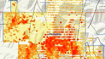
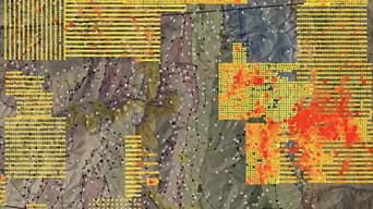
Analyze mineral exploration and sample drilling in a spatial context to identify and qualify new opportunities.

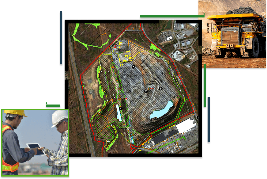
From mineral exploration to mine remediation, Esri ArcGIS software supports decision-making throughout the entire mining life cycle. Everyone in your company can access data and smart maps for project planning, mine operations, transportation management, and risk analysis.
SUCCESS STORY
The New Mexico Energy, Minerals and Natural Resources Department's Mining and Minerals Division uses GIS to process operations and exploration permit applications, report economic impacts, track mining activity, and enforce reclamation regulations
Transform your data into maps & actionable information with ArcGIS Pro, Esri’s flagship desktop GIS application.
Improve operational efficiencies in field workforce activities.
Turning drone collections into authoritative images and 3D models, in minutes.
Videos
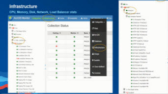
ArcGIS Enterprise Architecture
Esri Mining Webinar

Streamlining Image Management
Esri Mining Webinar
Implementing Workflows in ArcGIS Pro - Part 1
Esri Mining Webinar
Implementing Workflows in ArcGIS Pro - Part 2
Esri Mining Webinar
Improve operational efficiency with mapping and spatial analysis. Use ArcGIS to achieve goals and compliance while mitigating environmental impacts.
Please fill out your details below for us to contact you for the demo.
Write to us at info@esri.in
Talk to us over the phone