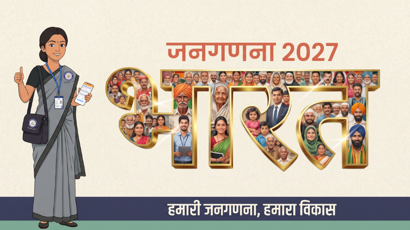
VB-G RAM G is India’s new rural employment law, under which every work starts from a Viksit Gram Panchayat Plan prepared by the village and approved by the Gram Sabha. Geographic Information System (GIS) platforms such as the Yuktdhara portal on Bhuvan help Gram Panchayats map local needs and assets, so that village plans can connect with national platforms like PM Gati Shakti.
Introduction: From MGNREGA to VB-G RAM G
India’s rural employment program has entered a new phase. The Viksit Bharat – Guarantee for Rozgar and Ajeevika Mission (Gramin) Act, 2025, known as VB-G RAM G, came into force across the country on 1 July 2026, and the Mahatma Gandhi National Rural Employment Guarantee Act (MGNREGA), 2005 was repealed from the same date. The new law raises the employment guarantee to 125 days a year and links wage work to durable public assets.
The biggest change is in how works are chosen. Under VB-G RAM G, every work must come from a village plan, and those plans are meant to be digitally and spatially joined with national platforms. That makes maps and location data central to rural planning, from the first Gram Sabha meeting to the asset that is finally built.
| Aspect | Works Chosen One by One | Plan-Led Works Under VB-G RAM G |
| Starting point | Individual work demands | An approved Viksit Gram Panchayat Plan |
| Spatial view | Works listed in registers | Works placed on a village map |
| Convergence | Each scheme plans separately | Plans linked with national platforms such as PM Gati Shakti |
| Proof of work | Paper records and site visits | Geo-tagged photos at each stage |
| Big picture | Village data stays local | Plans rolled up into a national rural infrastructure stack |
What Is VB-G RAM G and the Viksit Gram Panchayat Plan?
VB-G RAM G is the law that now governs rural wage employment in India, and it guarantees 125 days of work a year. Work under the Act is aligned with four thematic domains: water security and water-related works, core rural infrastructure, livelihood-related infrastructure, and works to mitigate extreme weather events. States can also notify a pause period of up to sixty days in a financial year during peak sowing and harvesting seasons.
A Viksit Gram Panchayat Plan (VGPP) is the village plan from which all works under the Act originate. It is prepared at the Gram Panchayat level through a participatory process and approved by the Gram Sabha. According to the Ministry of Rural Development, these plans are digitally and spatially integrated with national platforms, including PM Gati Shakti.
Funding is shared between the Centre and States in a 60:40 ratio, with 90:10 for North Eastern and Himalayan States and full central funding for Union Territories without legislatures. All assets created under the Act are aggregated into the Viksit Bharat National Rural Infrastructure Stack (VB-NRIS), so that village-level works add up to a national view of rural infrastructure.
The Yuktdhara Portal: Bhuvan-Based GIS Planning on Watershed Principles
The Yuktdhara portal is a GIS-based planning tool launched by the Ministry of Rural Development on 23 August 2021. It was developed on the Bhuvan platform by the National Remote Sensing Centre (NRSC), ISRO, and uses open-source GIS tools. The portal helps Gram Panchayats develop plans based on watershed principles, known as the ridge to valley approach.
The ridge to valley approach plans water works from the highest point of a watershed down to the valley floor. Treating the upper slopes first slows runoff and lets more water soak into the ground before it reaches the lower fields. This needs elevation, drainage, and land use layers on one map, which is exactly what a GIS planning portal provides.
According to the Ministry’s Year End Review, Gram Panchayat planning on Yuktdhara has started as a pilot with one Gram Panchayat per block. A total of 6,709 Gram Panchayats have been identified, and all of them have started their planning on the portal.
The Data Inside a Viksit Gram Panchayat Plan: PM Gati Shakti, Bhuvan, and India-WRIS Layers
The draft VGPP framework released by the Centre in June 2026 proposes that village plans draw on geospatial data from three national sources. Each layer answers a different planning question.
PM Gati Shakti
This layer shows facilities and infrastructure already in place across a region. Before a Gram Sabha proposes a new road, building, or water structure, planners can check whether something similar already exists nearby or is planned by another department. This helps avoid duplicate works and puts money where the gap is real. It also lets departments see each other’s plans on the same map, which supports the whole-of-government convergence the Act aims for.
Bhuvan
Bhuvan layers cover land use and drainage. Land use shows how each part of the village is used today, such as cropland, forest, settlement, or open land. Drainage lines show how water moves across the village, which tells planners where check dams, farm ponds, or soil conservation works would hold water best. Together, these layers turn the ridge to valley approach into a map that a Gram Sabha can discuss.
India-WRIS
The India Water Resources Information System adds data on water bodies and water resources. It helps a village see which tanks and ponds already exist, which may need repair, and where new storage or recharge works could add value. Since water security is one of the four domains under the Act, this layer is likely to shape a large part of many village plans.
Groundwater Stress and the Budget
The draft framework also proposes minimum spending on water-related works based on a block’s groundwater status: at least 65 percent in over-exploited blocks, 40 percent in semi-critical blocks, and 30 percent in safe blocks. This turns groundwater maps into a budgeting input, because a block’s category decides how much of its plan must go to water. A village in an over-exploited block, for example, would need to put most of its plan into water works, while a village in a safe block would have more room for roads and livelihood assets.
Under the draft framework, each plan must be presented to the Gram Sabha and approved through a formal resolution. Approved plans would then be uploaded to Yuktdhara and consolidated into block, district, and state plans.
From Plan to Asset: Geo-Tagging, Field Verification, and Monitoring
A plan is only as good as the assets it produces. Under VB-G RAM G, Sections 23 and 24 of the Act provide for technology-enabled transparency through biometric authentication, geo-tagging, and real-time dashboards, while Section 20 strengthens social audits by Gram Sabhas. The digital tools that the Ministry of Rural Development built under MGNREGA show how this kind of tracking works in practice.
Geo-Tagging at Every Stage
Under MGNREGA, the Ministry used space technology to geo-tag assets at the “Before,” “During,” and “After” stages, and 6.44 crore assets had been geo-tagged as of 1 January 2026. Each geo-tagged photo ties an asset to an exact location and a point in time. Together, the three stages show that a work started at the right place, was built as approved, and was completed. For village planning, this record also shows which assets already exist, so the next plan does not repeat them.
Worksite Attendance
The National Mobile Monitoring Service (NMMS) captures worker attendance at worksites with geo-tagged, time-stamped photographs taken twice a day. In November 2025, 95.09 percent and 91.50 percent of attendance in the two fortnights was captured through the app. Records like these link each day of wage work to a specific site on the map.
Field Inspections
The Area Officer Monitoring Visit Application lets officials record field visit findings online, with time-stamped and geo-tagged photographs of each worksite visited. Officials at state, district, and block level inspected 16,67,847 worksites through the app in FY 2025-26, up to November 2025. This adds an independent check on the photos taken during the work, and inspection points can be mapped to show which areas have been visited and which have not.
Water Level Monitoring
The JALDOOT App enables Gram Rojgar Sahayaks to measure the water level of selected wells twice a year, before and after the monsoon. In 2025, post-monsoon water level data was captured for around 3.92 lakh wells across 2.57 lakh villages and 1.08 lakh Gram Panchayats. Comparing these readings year by year can show whether water works in a village are actually raising groundwater levels.
Where GIS Supports State and District Planning Teams
National platforms set the base, but state and district teams still need their own tools to check plans, collect field data, and track progress across many villages.
Field Data Collection
ArcGIS Survey123 can support structured field surveys with photos and locations. A block team could use it to record the condition of existing assets, note local needs raised by residents, or check a proposed work site before the Gram Sabha meets. Because each response is tied to a location, the results can be placed straight onto the village map.
District Review
ArcGIS Dashboards can give district officials one view of plan progress, completed works, and pending approvals across blocks. Officials can spot blocks that are behind schedule, compare spending on water works with the proposed minimum share, and follow up where needed. This turns periodic reporting into a live view that is easier to act on.
Analysis and Sharing
ArcGIS Pro can be used for watershed and land suitability analysis at block or district level. For example, it can help identify slopes and drainage lines where check dams would hold the most water. ArcGIS Hub can then help departments share maps and data with other agencies and the public.
Ready-to-Use Layers
Indo ArcGIS Living Atlas provides India content such as village and district boundaries and demographics. These layers save time for teams that would otherwise build base maps from scratch, and they can sit alongside planning data on the same map.
GIS-based panchayat planning is not new in India. In Himachal Pradesh, the Aryabhatta Geo-informatics and Space Application Centre (AGiSAC) built a GIS-based Decision Support System on ArcGIS for several state departments. It includes a system showcasing the Panchayat Level Development Plan for the Rural Development Department, and supports tasks such as action plan generation for MNREGA works, checking duplicate works, and finding the nearest routes.
“ArcGIS effectively meets AGiSAC’s GIS-based analytical requirements. By facilitating easier management of complex datasets, the technology enables officials to make quick, informed decisions. The DSS enhances collaboration, allows effective analysis of the developmental gaps, and works as an effective tool in spatial planning and decision-making processes.”
Sh. D.C. Rana, IAS, Director cum Member Secretary, AGiSAC, and Sh. Satpal Dhiman, HPFS, Joint Member Secretary, AGiSAC
State departments can explore State and Local Government solutions, and central ministries can explore National Government solutions, from Esri India to support village planning at scale.
Challenges and the Road Ahead
Panchayat Staff Capacity
Many Gram Panchayats run with small teams that handle several schemes at once, and many staff have limited GIS experience. Preparing a map-based plan means reading layers, marking proposed works, and checking them against existing assets, which is new work for many panchayats. Block and district teams will need to provide regular training and hands-on support, especially in the first planning cycles. Simple tools and clear templates can make the task easier for staff who are not GIS specialists.
Connectivity in Remote Villages
Geo-tagging, attendance capture, and plan uploads all depend on mobile networks, which can be weak or missing in hilly, forest, and border areas. When uploads fail, records are delayed and progress looks slower than it really is. Tools that capture data offline and upload it once a signal is available can close part of this gap. Planners also need to allow for these areas when they set deadlines for planning and reporting.
Keeping Asset Inventories Current
A village plan depends on an accurate list of what already exists, from ponds and roads to community buildings. If records are not updated after works are completed or after an asset is damaged, the next plan may repeat a work or miss one that is needed. Geo-tagged records help, but only if they are linked back to the village asset list each season. Regular checks during Gram Sabha meetings can keep the list close to what is on the ground.
Aligning With Department Data
Village plans draw on data from many sources, including PM Gati Shakti, Bhuvan, India-WRIS, and state department records. Each source may use its own formats, names, and boundaries, so the same pond or road can appear differently in two datasets. Matching these sources so that they describe the same place in the same way will take steady coordination between departments. Until that happens, planners may need to check key layers on the ground before they finalize works.
VB-G RAM G puts the village plan at the center of rural spending, and that makes good maps a basic need for every Gram Panchayat. When local knowledge from the Gram Sabha meets clear spatial data on water, land, and facilities, villages can choose works that last. Over time, those plans can add up to a national picture of rural India built one village at a time.
FAQs
1.What is VB-G RAM G and how is it different from MGNREGA?
VB-G RAM G is the Viksit Bharat – Guarantee for Rozgar and Ajeevika Mission (Gramin) Act, 2025, which replaced MGNREGA from 1 July 2026. It guarantees 125 days of employment a year and requires all works to come from approved village plans.
2.What is a Viksit Gram Panchayat Plan (VGPP)?
A VGPP is the village plan from which all works under VB-G RAM G originate. It is prepared by the Gram Panchayat and approved by the Gram Sabha.
3.What is the Yuktdhara portal and who developed it?
Yuktdhara is a GIS-based planning portal for Gram Panchayats, launched in August 2021. It was developed on the Bhuvan platform by NRSC, ISRO, and supports planning based on the ridge to valley approach.
4.How is GIS used in Gram Panchayat planning?
GIS places land use, drainage, water resources, and existing facilities on one map, so a village can see what it has and what it needs. It also helps track assets through geo-tagged photos from start to finish.
5.How is VB-G RAM G linked with PM Gati Shakti?
Village plans under VB-G RAM G are digitally and spatially integrated with national platforms, including PM Gati Shakti. This helps different ministries and departments plan works together and avoid duplication.
Written by
Esri India Marketing