
ArcGIS Pro
The next generation desktop GIS supports 2D and 3D data visualization, advanced analysis, and authoritative data maintenance.


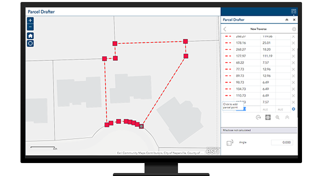
Mapping land and infrastructure sets the foundation for recording authoritative information, spatial analysis, modeling, and network analysis. Maps allow staff to layer related information and show spatial relationships between parcels, rights-of-way, streets, and utilities. Buildings can be mapped in the same way to support your workflows.
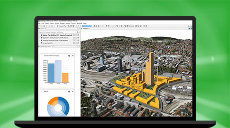
To build sustainable and resilient communities, you need GIS and capital improvement planning software to show how projects fit into an existing landscape. Test alternative scenarios by analyzing environmental, fiscal, and social impacts. Enhanced 3D models and building information modeling (BIM) allow engineers to mitigate negative impacts and build great communities.
Manage projects with end-to-end, location-aware project tracking dashboards and digital twins. Deconflict infrastructure development projects that are happening in the same location to avoid high costs and uncoordinated efforts between agencies. Integrate construction management, permitting, and inspections to reduce risk and keep your projects moving.

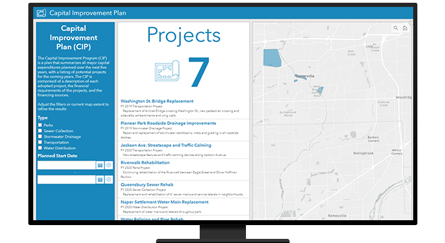
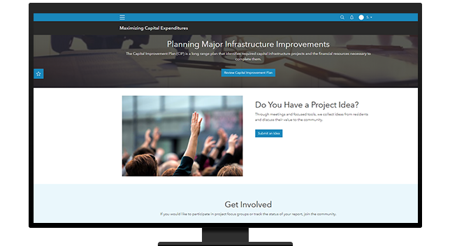
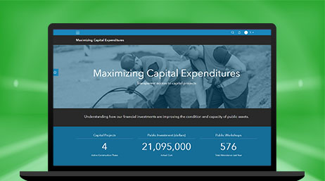
Capital improvement plans (CIP) represent taxpayers' dollars at work. Use GIS to educate residents and gain support for transportation, parks, or infrastructure projects or proposed taxes or fees. GIS provides a clearer picture of what is being proposed. Information portals and participatory budgeting instill confidence that leaders hear the public's voice.
Explore ArcGIS Solutions and product offerings that enhance design and engineering.
ArcGIS Pro
ArcGIS Online

Capital Project Planning
ArcGIS Enterprise
ArcGIS Hub

Plans and Drawings

Participatory Budgeting
ROW Permitting
Please fill out your details below for us to contact you for the demo.
Write to us at info@esri.in
Talk to us over the phone