
Park Infrastructure Management
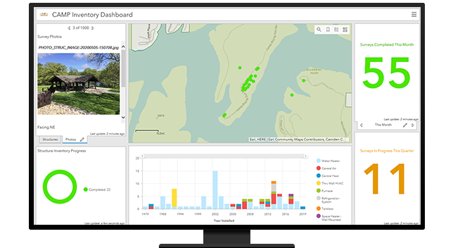
Inventory park assets, understand asset condition, and communicate changing asset conditions that impact park services.


As open space and recreation take a more important role in the lives of residents, you need to better understand gaps in accessibility and equity. Use GIS to monitor facility usage, real-time data feeds, and demographic changes and inform community program planning. Prioritize capital and operation budgets and set maintenance schedules.
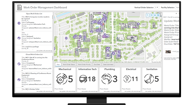
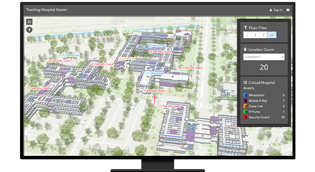
GIS no longer stops at the front door. Mapping your facilities—including assets, space, and amenities—provides a view into operations. Indoor GIS improves work order management, space planning, security, and emergency planning. Smart devices and appliances can be monitored in real time. Navigation provides wayfinding for visitors and employees.
Managing your property and building portfolio through GIS results in improved efficiency and cost savings. Location intelligence offers a lens to see and balance workloads and provides optimized prioritization of maintenance. Operations gain a boost when staff allocate resources to the right locations in real time to control costs.
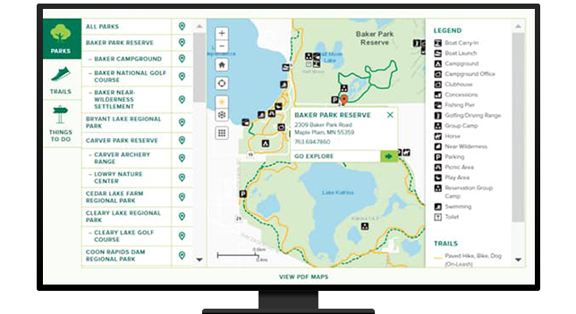
A critical aspect of parks management is using GIS data hubs to connect residents to the events, opportunities, and community centers that are most accessible and relevant to their needs. Educate the public on new projects and open-space plans as well as how fees are calculated in the context of where residents work and live to make for a more informed citizenry.
Explore ArcGIS Solutions and product offerings that enhance public grounds and facilities.
Park Infrastructure Management
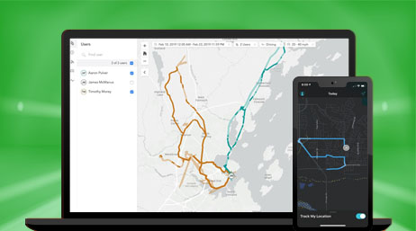
Apps for field operations
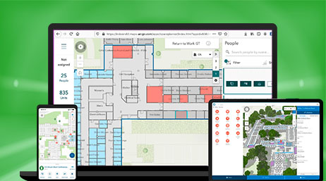
ArcGIS Indoors
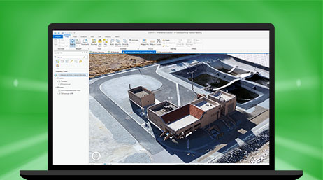
ArcGIS Drone2Map
Please fill out your details below for us to contact you for the demo.
Write to us at info@esri.in
Talk to us over the phone