
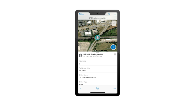
Road Network Data Management
Maintain an authoritative inventory of roads, intersections, and physical road characteristics and track legal agreements.


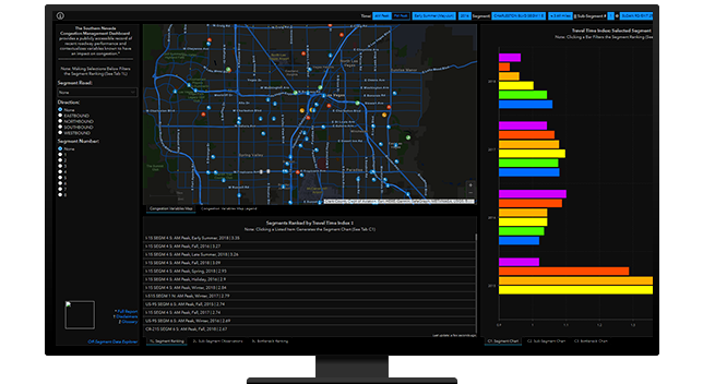
Public works agencies must understand current conditions to better prioritize road and bridge management. With GIS, agencies can analyze travel patterns, shifting lifestyles, and future trends such as autonomous vehicles to target problematic infrastructure spots before it's too late. Help residents understand why and where you are investing their tax dollars.
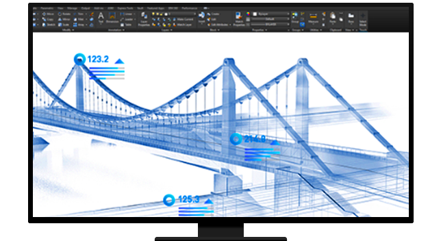
Public works agency staff must step out of repair-and-rebuild mode. They must rethink their capital improvement plan. Sensors, artificial intelligence, drones, and driverless cars will affect everything we plan and build. GIS allows agency leaders to be forward-thinking and build infrastructure that is ready to support the technology of tomorrow.
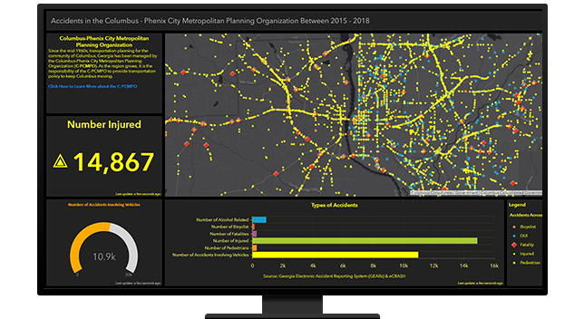
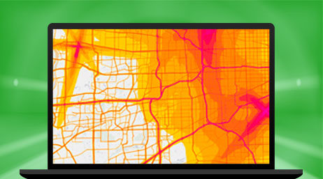
With GIS, you can capture and analyze accurate traffic crash data. Historical records help you understand where accidents have occurred in the past and what measures you can take to prevent them in the future. GIS gives you effective ways to communicate safety plans, show the impact of safety improvements, and increase the public's confidence.
Communicate road closures, preventative maintenance, capital projects, and new traffic patterns with the public to build confidence that you have made the most strategic and cost-effective decisions regarding the public's tax dollars. Provide tools that allow residents to voice their concerns, submit 311 service requests, or provide feedback.
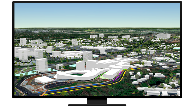
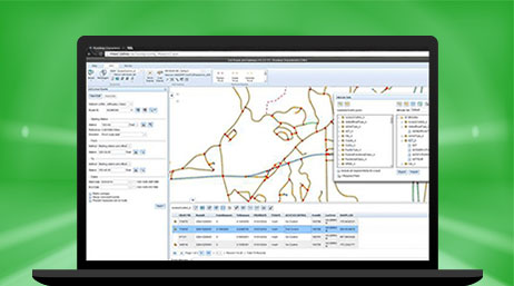
Map and monitor your streets and roads to understand the exact location of utilities for construction or permitting. Better supervise vegetation management within your rights-of-way. Create situational awareness of right-of-way permits, work orders, road closures, and construction projects in real time.
Explore ArcGIS Solutions and product offerings that enhance streets, roads, and bridges.
Road Network Data Management

ROW Asset Inventory
ArcGIS Network Analyst
ArcGIS Roads and Highways
Road Closures

Traffic Crash Analysis

Winter Weather Operations

Plans and Drawings
Please fill out your details below for us to contact you for the demo.
Write to us at info@esri.in
Talk to us over the phone