research paper

APPLIED RESEARCH

Optimize Subzone Boundaries for Effective Outage Management

Mr. Manoj Kumar Singh, Mr. Kaushal Shah

Business Analyst, Tata Consultancy Services Ltd

Abstract

This paper presents an innovative Geographic Information System (GIS) solution designed for utility companies to effectively identify and propose new subzone boundaries for operational and maintenance purposes. As utility providers face increasing demands for efficiency and reliability, the need for precise spatial analysis and data-driven decision-making becomes most important. TCS designed GIS solution integrates advanced spatial analytics, real-time data visualization, and user-friendly interfaces to empower utility operation managers in assessing infrastructure performance, optimizing resource allocation, and enhancing service delivery. By leveraging geospatial data, the tool facilitates the identification of subzone boundaries based on factors such as service demand, customer & substation density asset condition, and geographical constraints. This approach not only improves operational efficiency but also supports proactive maintenance strategies, ultimately leading to enhanced customer satisfaction and reduced operational costs. The implementation of this GIS solution positions utility companies to meet future challenges while fostering sustainable growth and resilience in their service areas.

Introduction

The most important characteristic of a utility company is to minimize the outage. Better outage management helps utility companies in the following areas:

  1. Minimizing outage.
  2. Improving customer satisfaction.
  3. Preventing revenue loss caused by interrupted services.
  4.  Preventing accidents and increasing public safety.
  5. Streamlining the processes and compliance with the regulatory authority, avoiding penalties.

Power companies divide the operational area into zones and subzones for easy distribution and work allocation. The zones and subzones are identified based on the customer type, customer density, power demand etc. The outage management team is distributed between the zones and subzones. 

Applying GIS Technology to redefine the subzones to minimize the restoration time 

In a utility company, the operation management team is responsible for performing the following:

  1. Operation and Network Monitoring
  2. Workorder Management
  3. Crew Management
  4. Emergency Response
  5. Asset Management
  6. Performance Metric and Report
  7. Analyzing the Budget and Cost Management

The strategic operation management team keeps monitoring the operations team and their work allocation. This is achievable by utilizing the data and network analysis available via Esri’s state of the art technology.

A utility company divides the operational area into zone and subzone levels. TCS implemented a solution at one of the client organizations, where the utility company had 3 zones (A, B and C). Every zone was subdivided into subzones. Zone A has ~55 subzones, Zone B has ~90 subzones and Zone C has ~110 subzone service around 1 million customers. Field crews were divided into different zones based on customer, substation and historical outage record density. The counts were as follows:

  1. Zone A had 12 Field Crews 
  2. Zone B had 15 Field Crews
  3. Zone C had 20 Field Crews

Outage management has predefined MTTR (Mean time to Restore), SAIDI (System Average Interruption Duration Index), SAIFI (System Average Interruption Frequency) and Outage duration. The key activity was to improve these metrices by using GIS Analysis and Effectively utilizing the Man and material Cost budget.

Today, GIS technology has expanded and provides comprehensive capabilities that support all aspects of the outage management team. GIS solution enables outage Management team to manage complex operations by delivering critical capabilities that support the entire mission.
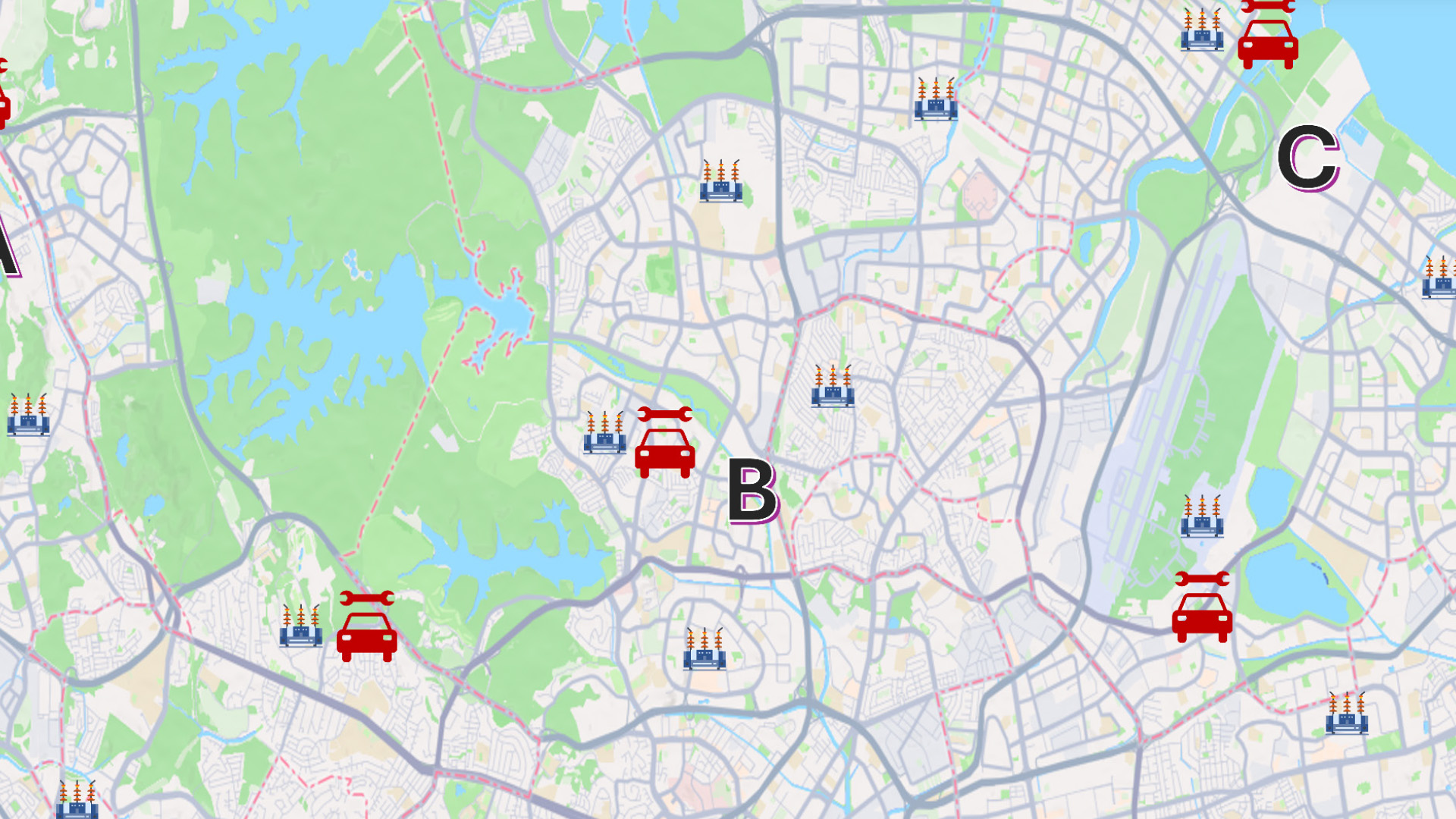
Following are the key points of the solution which can help utility companies to optimize their operations by reducing the impact, enhance emergency operations, improving key metrics, and improve customer experience:

Zone Boundary Layer

This layer is used to divide the complete operational area into three Main segments. Their names are used as A, B and C.

Subzone Boundary

This layer denotes a small grouping or subsection of Zone called Subzone boundary. This subzone boundary is created based on customer and substation density.

Operational Crew

Operation crew are users who is using the Tablet device having Field map installed to track the user location.

Crew Vehicle

Crew vehicles which are stationed into a substation can move to any other substation based on Outage incident reported.

Solution Approach

The key solution developed to meet the requirements utilize the Esri Network Analysis modules. Custom Analysis module was developed which perform the following modules in sequence.

1: Execute Location Allocation tool to identify the substation where crew and vehicle can be stationed. This analysis take all substation data and load into Facility and Demand layers. It identifies the 1 best substation which can be used to station the crew.

2: Execute the OD Cost Matix tool to identify the min and max time between identified substation and all other substations. This also needs substation data to use as Origin and Destination. This analysis’ results help to understand the current reach time to any substation within zone. 

3: Execute the Service Area Tool from this substation to all other substation within reach of 15 Minutes time. This generates a new subzone boundary so that all other substation boundary is not intersected. Manager can provide the different parameters of time and redefine the subzone boundary. 

Conclusion

This paper presents the overview of extensive use of GIS analysis collectively to efficiently manage outages. 

The outage management team now generates the GIS Report which displays:

  1. Subzone boundary count before and after analysis.
  2. Best and Optimum substation location where field crews can be stationed.
  3. New subzone boundary helps the management team to take decision to revise their metrics and plan their workforce

The GIS Solution generates reports which help the strategic team in following decision making.

  • Optimizing the staff for maintenance as per new subzone boundary.
  • Finalizing the subzone boundary keeping metrics in mind.
  • Optimizing the key metrics to improve the customer satisfaction.
  • Increase revenue by reducing the impact due to outage. 

References

  1. arcindia-vol-17-issue-1-case-study.pdf (esri.in) 
  2. How GIS is transforming predictive maintenance in the utility sector (12thwonder.com) 
  3. p9_f1_2014.pdf (tuiasi.ro

To download the PDF version of this article, click the button below.