Urban heat island mapping with GIS is the process of using satellite imagery, remote sensing data, and geospatial analysis to measure, visualize, and monitor the temperature difference between urban areas and their surrounding rural environments. It identifies hotspot zones, tracks their growth over time, and generates the spatial evidence base that city planners and health authorities need to protect residents from extreme heat.
India’s Cities Are Heating Up
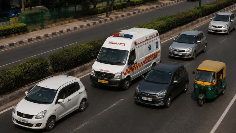
In late April 2026, something with no modern precedent occurred. Every single one of the planet’s top 50 hottest cities was in just one country: India. According to data compiled by the air quality monitoring platform AQI, on April 27 average peak temperatures across all 50 Indian cities on the list hit 44.72 celsius.
India was experiencing record-breaking heat across multiple regions simultaneously, with temperatures in many cities surpassing 40 degrees Celsius and some locations reaching close to 45 degrees Celsius, including Delhi, Lucknow, Nagpur, Akola, Bhubaneswar, and Bhopal.
This is not a one-season anomaly. Between 1993 and 2024, India recorded a 15-fold increase in extreme heatwave days during the summer months of March to September. The last decade alone saw a 19-fold spike in such events. Delhi logged 40 consecutive days above 40°C in 2024.
At the center of this crisis is a specific urban phenomenon that GIS can map, measure, and help cities begin to reverse: the Urban Heat Island effect.
What Is the Urban Heat Island (UHI) Effect?
The Urban Heat Island (UHI) effect is the phenomenon where urban areas experience significantly higher temperatures than their surrounding rural or peri-urban areas due to the concentration of heat-absorbing surfaces, reduced vegetation, waste heat from buildings and vehicles, and modified airflow patterns.
Concrete roads, rooftops, and paved surfaces absorb solar radiation during the day and radiate it back as heat at night, preventing temperatures from dropping. Dense construction reduces sky view factors, trapping outgoing radiation. Loss of tree canopy eliminates evapotranspiration cooling. Together, these factors create an urban environment that is measurably, sometimes dangerously, hotter than the land surrounding it.
Peer-reviewed research quantifies the scale of India’s UHI problem precisely. Bangalore has a measured UHI intensity of 1.9°C, rising at 0.04°C per year as the city expands. Hyderabad records an intensity of 2.44°C. In Lucknow, Land Surface Temperature rose from approximately 38°C in 2000 to 46°C by 2023, an 8°C increase in just over two decades driven by rapid urban expansion.
Why GIS Is Critical for UHI Mapping
Heat is not uniformly distributed across a city. A ward with a dense informal settlement, low vegetation cover, and a high concentration of tin-roofed structures may record surface temperatures 8 to 10°C higher than a well-treed residential neighbourhood three kilometers away. A municipal administrator, health officer, or urban planner cannot see this difference from a spreadsheet. They need a map.
Using satellite imagery and remote sensing tools available through ArcGIS Pro, planners can generate Land Surface Temperature maps that pinpoint the hottest zones in a city down to the neighbourhood level. These maps reveal where concrete density is highest, where tree canopy is lowest, and where surface temperatures reach dangerous levels. A municipal planner in Chennai or Delhi can identify which ward needs emergency cooling centers before a heatwave arrives, not after.
GIS also enables predictive heat vulnerability modelling by layering historical temperature data, land cover, population density, infrastructure data, and climate projections into a single spatial analytical environment. This moves urban heat management from reactive emergency response to proactive planning.
How GIS Maps Urban Heat Islands
The core workflow for UHI mapping in Indian cities uses multi-temporal satellite imagery processed through ArcGIS tools to derive quantitative temperature and land cover indices:
Land Surface Temperature (LST) retrieval
ArcGIS Image processes Landsat 8/9 thermal infrared bands and Sentinel-2 imagery to extract LST maps at 30-meter to 10-meter spatial resolution. MODIS provides coarser daily LST products useful for monitoring seasonal and inter-annual temperature trends across entire metropolitan regions. For higher resolution thermal mapping at the neighbourhood scale, drone-mounted thermal sensors processed through Site Scan for ArcGIS capture surface temperature variation down to individual rooftops and street segments.
Time-series change analysis
ArcGIS Pro compares LST rasters from multiple dates, years, or decades to generate heat trend surfaces showing where urban heating has accelerated most rapidly. This temporal dimension is what reveals the relationship between urban expansion and temperature rise, and identifies which land use changes, whether conversion of agricultural land, wetland loss, or vegetation clearance, drove the most significant local warming.
ECOSTRESS for daytime and nighttime heat
NASA’s ECOSTRESS instrument provides high-frequency, high-resolution LST data at 70-meter resolution, enabling monitoring of both peak daytime surface temperatures and nighttime cooling rates, the latter being especially important for assessing heat stress on sleeping populations in dense informal settlements.
Indices and Data Layers Behind UHI Analysis
Here are the spatial indices and data layers that a GIS-based UHI analysis combines to produce actionable heat vulnerability maps:
- NDVI (Normalized Difference Vegetation Index): Measures green cover density from Sentinel-2 or Landsat imagery. Low NDVI zones with sparse vegetation are strongly correlated with high LST
- NDBI (Normalized Difference Built-up Index): Quantifies built-up surface density. High NDBI zones represent dense impervious surfaces that absorb and retain solar heat
- MNDWI (Modified Normalized Difference Water Index): Identifies water bodies and wetlands that contribute evaporative cooling, and maps their loss over time as urban encroachment proceeds
- Surface albedo: Measures the reflectivity of urban surfaces. Low-albedo dark surfaces absorb significantly more solar radiation than high-albedo reflective ones
- Sky view factor: Quantifies how much of the sky is visible from a point on the urban surface, determining how effectively outgoing longwave radiation can escape the urban canyon
- Geographically weighted regression (GWR): Applied in ArcGIS Pro to spatially model the relationship between LST and its drivers, NDVI, NDBI, surface albedo, and population density, at the local level rather than assuming a uniform city-wide relationship
Indo ArcGIS Living Atlas provides ready-to-use global and India-specific spatial layers for UHI analysis, including LULC classifications, DEM data, population density grids, and pre-processed Landsat-derived LST datasets that analysts can directly overlay with local survey data.
How Indian Cities Are Using UHI Maps to Plan Mitigation
GIS enables predictive heatwave modelling by layering historical temperature data, land cover, population density, infrastructure data, and climate projections. Esri India’s spatial analytics capabilities allow users to generate district-level heat risk indices and forecast where conditions will worsen under different climate scenarios.
In practice, Indian cities are translating these GIS outputs into operational heat governance in the following ways:
Ward-level heat vulnerability prioritization
By combining LST maps with socio-economic vulnerability layers including slum settlement density, outdoor worker concentrations (construction workers, street vendors, gig delivery riders), elderly population distribution, AC penetration rates, and hospital proximity, ArcGIS Spatial Analyst generates composite heat vulnerability indices at the ward level. These indices show planners not just where it is hottest, but where the most vulnerable people are exposed to the most heat with the least capacity to cope.
Cool roof programme prioritization
Building footprint extraction using deep learning models available through Indo ArcGIS Living Atlas identifies rooftop area in low-income neighbourhoods that are both thermally stressed and physically accessible for cool roof retrofits. Ahmedabad and Hyderabad have piloted cool roof programmes, and Telangana and the Mahila Housing Trust have deployed rooftop coating interventions in informal settlements. GIS makes it possible to scale these pilots by spatially identifying which neighbourhoods should be prioritized first for maximum health and cooling impact per rupee spent.
Cooling center and mist shelter siting
ArcGIS Urban overlays heat vulnerability maps with the spatial distribution of existing public facilities, including schools, community halls, and health centers, to identify gaps in the cooling shelter network relative to where thermally vulnerable populations live and work. This spatial gap analysis directly informs where new cooling shelters, mist parks, and shaded streetscape interventions are most needed.
Heat Action Plans, Cool Roofs, and Urban Greening
Ahmedabad implemented South Asia’s first Heat Action Plan in 2013, an effort integrating heat forecasting with improved municipal governance, health risk communication, and landcover interventions including reflective cool roofs.
The plan uses a 7-day probabilistic weather forecast to trigger phased responses, activating ward-level communication networks, cooling shelter operations, and ASHA and ANM outreach to high-risk populations before dangerous heat arrives. Since Ahmedabad’s pioneering plan, more than 23 Indian states and cities have developed Heat Action Plans, many now explicitly incorporating GIS-derived heat vulnerability maps to target early warning communications and cooling resource deployment at the ward level. GIS also supports the blue-green infrastructure planning that delivers lasting UHI mitigation:
- Urban tree canopy analysis: ArcGIS Spatial Analyst quantifies existing tree cover by ward and models the LST reduction achievable from targeted canopy expansion, prioritizing areas where shade trees deliver the greatest cooling per unit of investment
- Miyawaki forest siting: High-density native tree planting initiatives can be spatially targeted using GIS to identify pockets of available public land within thermally stressed urban wards
- Wetland and water body protection: MNDWI analysis maps remaining urban water bodies that provide evaporative cooling, flagging those at risk of encroachment and generating the spatial evidence for protective land use regulations
- Permeable surface mapping: ArcGIS Pro maps the distribution of impervious surfaces by ward, identifying where replacing concrete pavements with permeable alternatives would generate the greatest cooling benefit
Connecting UHI Maps to Urban Planning Frameworks
UHI mapping feeds directly into India’s primary urban governance instruments:
AMRUT 2.0
The Atal Mission for Rejuvenation and Urban Transformation 2.0 requires cities to develop Urban Master Plans that address climate resilience. GIS-derived heat vulnerability maps provide the spatial evidence base for allocating urban greening budgets, blue-green infrastructure investments, and zoning revisions that reduce impervious surface ratios in thermally stressed areas.
Climate Smart Cities Assessment Framework (CSCAF)
MoHUA’s CSCAF scores Indian cities on climate resilience across multiple dimensions. UHI intensity reduction and urban green cover targets are explicit CSCAF metrics. Cities that maintain spatially indexed, annually updated LST and NDVI maps through ArcGIS can directly demonstrate progress against these metrics with verifiable spatial data.
Smart Cities Mission and ICCCs
Smart City ICCCs that integrate ArcGIS Velocity with real-time weather station data can generate live heat stress maps during heatwave events, triggering automated alerts to cooling shelter operators, health departments, and outdoor worker safety coordinators based on observed temperature conditions at specific city locations.
Tier-2 Cities: The Emerging Heat Frontier
Most coverage of India’s UHI problem focuses on megacities. But Tier-2 cities are emerging as the fastest-growing heat risk zones, because their rapid, often unplanned expansion is converting agricultural and green land to dense built-up surfaces without the cooling infrastructure investments that larger cities are beginning to make.
Lucknow’s LST increase from 38°C to 46°C over 22 years is one of the starkest documented examples. Surat, Indore, Bhubaneswar, and peri-urban zones around Chandigarh and Pune show similar patterns of accelerating heat island development as construction expands outward from city cores into previously green peripheral areas. GIS-based early detection of emerging heat hotspots in Tier-2 cities, before the impervious surface lock-in becomes irreversible, is the most cost-effective point at which planning interventions can prevent the heat trajectories that megacities are now struggling to reverse.
Explore how Esri India supports Smart Cities and Urban Planning with GIS-powered heat mapping and climate resilience solutions.
Challenges and the Road Ahead
Data resolution for ward-level action
Landsat 8/9 thermal imagery at 30-meter resolution is adequate for city-scale UHI analysis but too coarse for ward-level intervention targeting in dense urban environments. Integrating ECOSTRESS, drone thermal imagery processed through Site Scan for ArcGIS, and high-resolution commercial satellite data improves local precision but requires investment in data acquisition and processing capability.
Linking heat maps to health outcomes
LST maps show where surfaces are hot. Translating that into heat-related morbidity and mortality risk requires integrating hospital admissions data, outdoor worker registrations, and community health survey data with the spatial temperature picture. Building this compound vulnerability layer requires inter-departmental data sharing across health, urban development, and labor departments that most Indian cities have not yet institutionalised.
Keeping maps current
Urban land cover changes continuously. A heat vulnerability map based on 2022 imagery may misclassify a ward where a new housing colony or commercial complex was built in 2024. Annual or bi-annual LST and LULC update cycles through ArcGIS Image are essential for maintaining the operational relevance of heat maps in rapidly growing Indian cities.
Monsoon interruption
Optical satellite imagery cannot penetrate cloud cover, which means LST-derived heat maps have data gaps during the monsoon months. Using SAR-based land cover products and pre-monsoon imagery as proxies for the subsequent heat season is a workflow compromise that most Indian cities have yet to systematize.
India’s heat crisis is spatial. It is concentrated in specific wards, specific building types, specific communities with specific vulnerabilities. Managing it effectively requires precisely the spatial intelligence that GIS provides. Every degree of UHI reduction, achieved by targeting cool roofs, street trees, and permeable surfaces at the right locations, translates directly into lives protected during the heatwave seasons that are now arriving earlier, lasting longer, and hitting harder than any previous generation of Indian city residents has experienced.
FAQs
1.What is the urban heat island effect?
The urban heat island effect occurs when cities are significantly warmer than surrounding rural areas due to heat-absorbing built surfaces, reduced vegetation, and waste heat from buildings and vehicles. In Indian cities, UHI intensities range from 1.9°C in Bangalore to 2.44°C in Hyderabad, with larger metros showing even greater temperature differentials during peak summer months.
2.How is GIS used to map urban heat islands?
GIS processes satellite imagery from Landsat 8/9, Sentinel-2, and ECOSTRESS through ArcGIS Image and ArcGIS Pro to derive Land Surface Temperature maps at ward and neighbourhood level. These LST maps are combined with NDVI and NDBI indices to model heat concentration drivers and identify the most at-risk populations.
3.Which Indian cities have the highest UHI intensity?
Hyderabad records the highest UHI intensity at 2.44°C, followed by Bangalore at 1.9°C with an increasing trend of 0.04°C per year. Delhi, Ahmedabad, Nagpur, and Akola regularly record urban core temperatures exceeding 44 to 46°C during peak pre-monsoon months.
4.What data is used for urban heat island analysis?
Landsat 8/9 thermal bands, Sentinel-2 imagery, MODIS LST products, and ECOSTRESS surface temperature data form the primary inputs. These are combined with LULC maps, building footprints, and socio-economic data in ArcGIS Pro to build comprehensive heat vulnerability models.
5.How can Indian cities reduce the urban heat island effect?
Cool roof programmes reduce rooftop temperatures by 3 to 5°C, while urban tree canopy expansion in high-LST wards delivers evapotranspiration cooling. ArcGIS Urban supports scenario modelling to evaluate which green infrastructure investments deliver the greatest temperature reduction before capital is committed.
Written by
Esri India Marketing