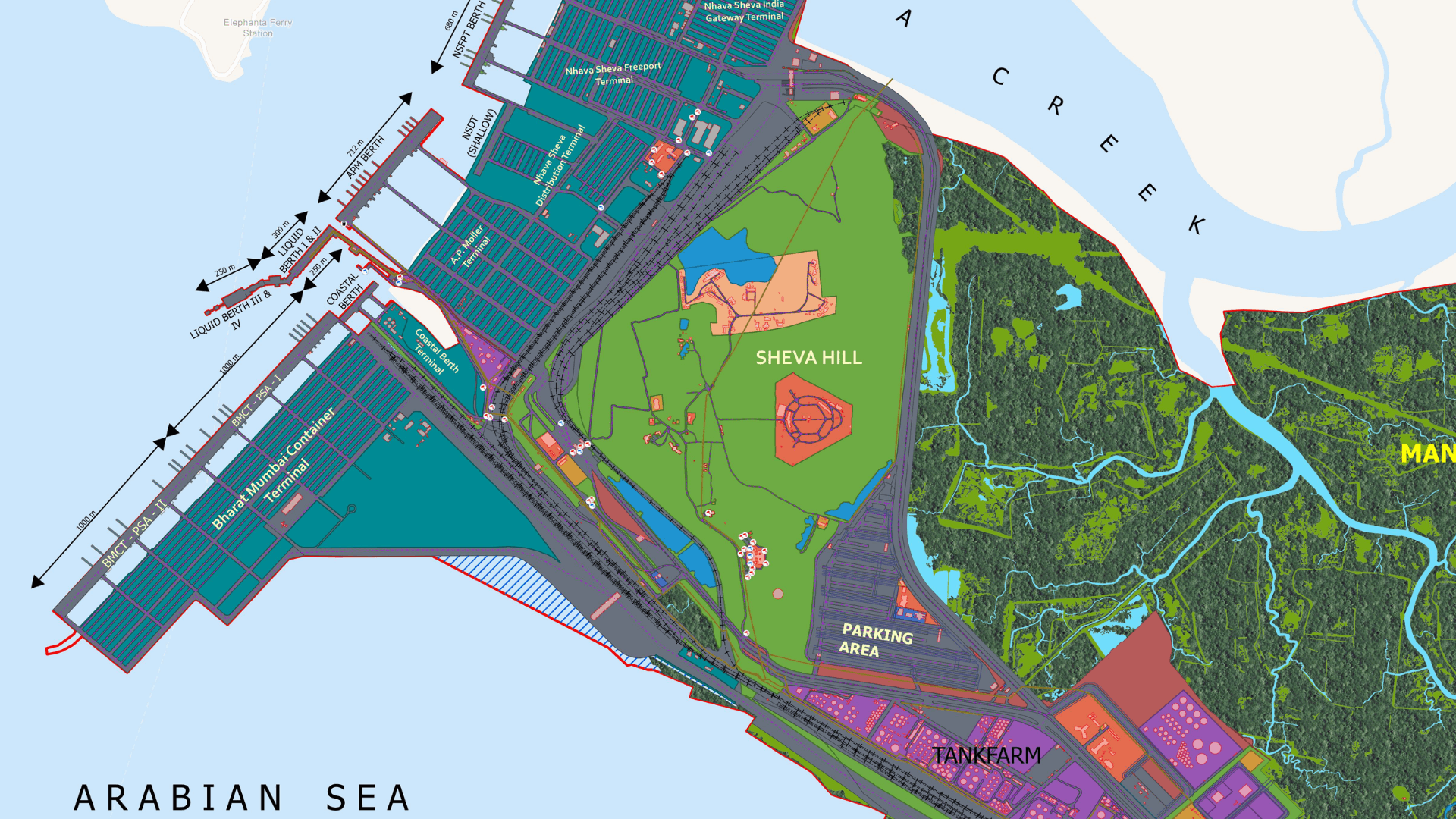
Rajesh Phadke, Jawaharlal Nehru Port Authority (JNPA), Maharashtra Call for Maps 2026 Winner: Land Use Map Jawaharlal Nehru Port Authority (JNPA) LULC Map provides a clear spatial view of port operations, industrial areas.
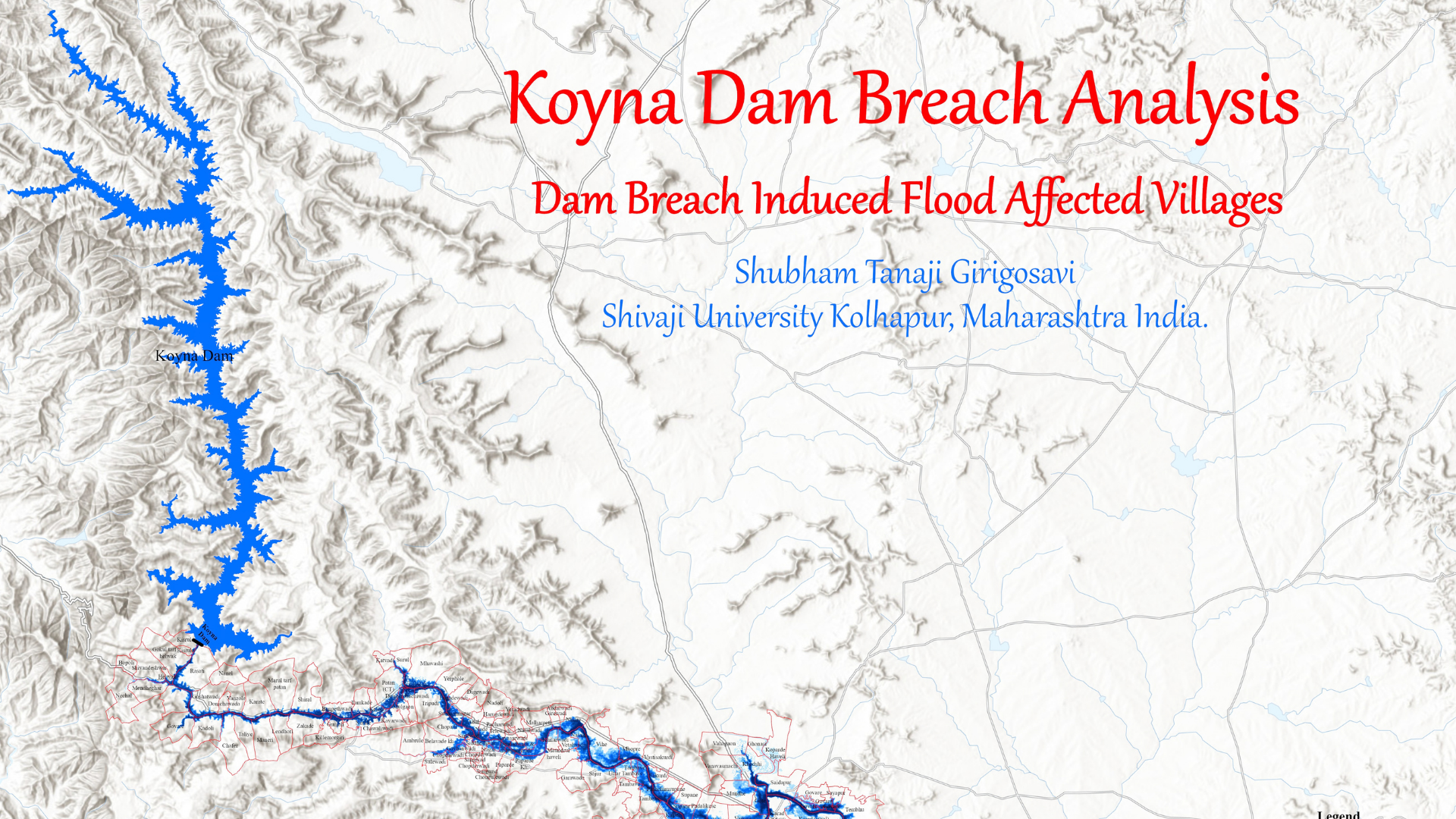
Shubham Tanaji Girigosavi, Shivaji University, Kolhapur Call for Maps 2026 Winner: Koyna Dam Breach Analysis This study presents a flood inundation analysis for a hypothetical failure of the Koyna Dam in Maharashtra, India. The dam is located in the Western Ghats.
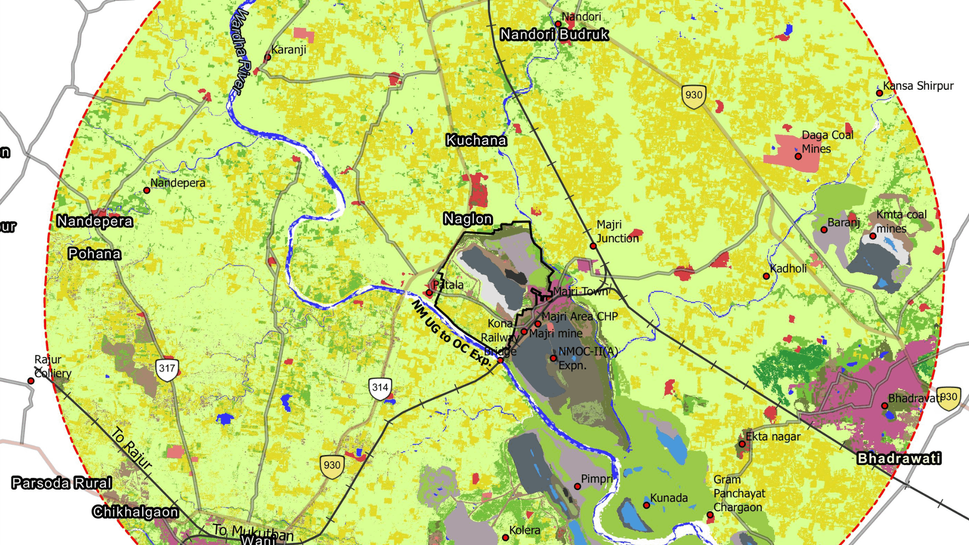
Central Mine Planning and Design Institute, Jharkhand LULC Map of Core and Buffer Zone of New Majri The Land Use/Land Cover (LULC) map presents the spatial distribution of different land use and land cover classes, classified into Level 1.
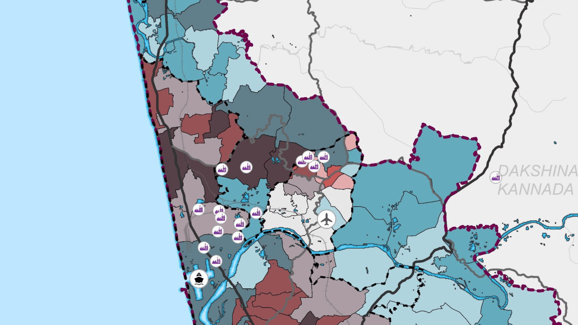
Divyanshi Gupta, Abhishek Singh, School of Planning and Architecture, Bhopal From MSME Activity to Spatial Opportunity The map brings together MSME turnover, investment and road accessibility to understand the distribution of economic activity across Mangalore’s areas.
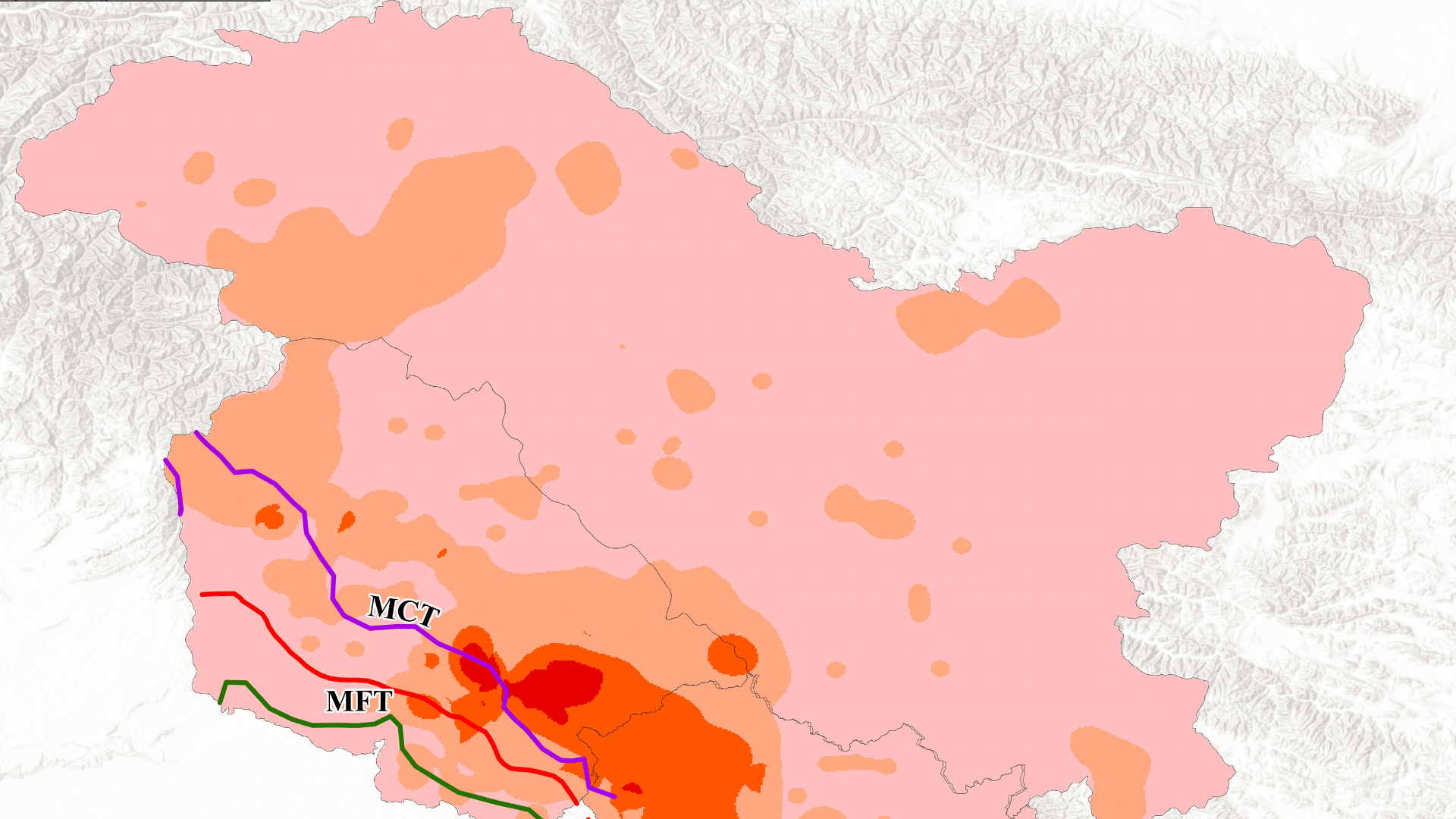
Koshil Kapoor, Panjab University, Chandigarh North Western Himalayan Region Earthquake-Landslide This map represents earthquake-landslide hazard density, with tectonic Himalayan faults overlaid to show their relationship to hazard concentration.
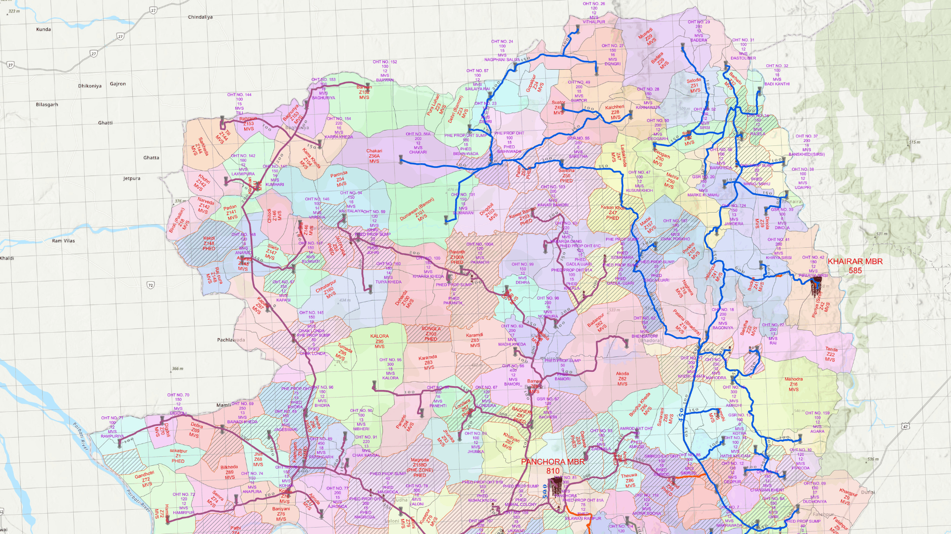
Mithun Naskar, WPIL Ltd., Kolkata Rural Water Supply Network The GIS map has been developed using MIS-based daily monitoring data integrated with ArcGIS. Raw Water Rising Main (RWRM) alignment is delineated.
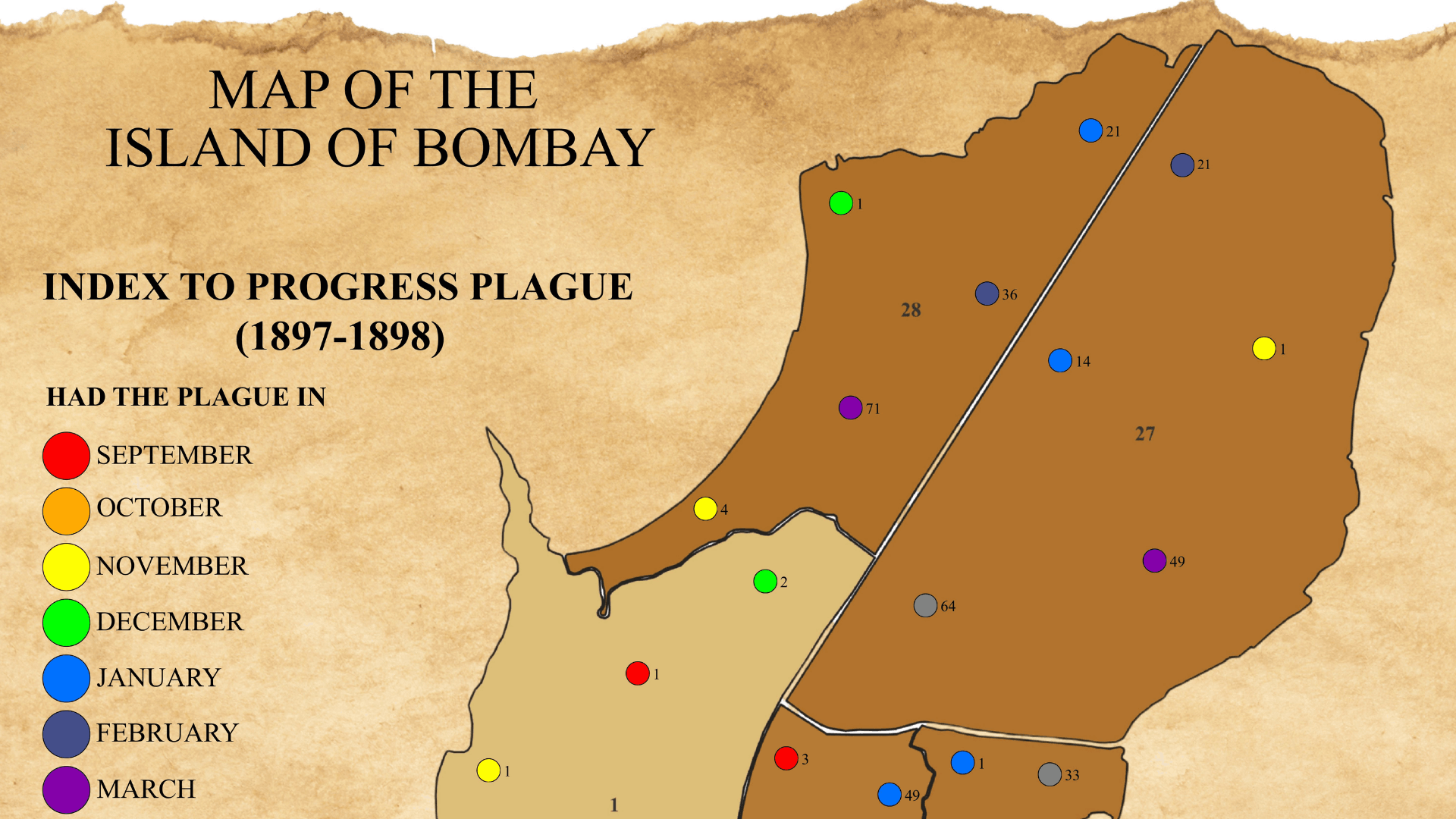
Mohd Islam, Centre for Sustainability, Environment and Climate Change, FLAME University, Pune Progress of Plague in Bombay (1897-1898) In 1897, Bombay municipal administration declared the plague an epidemic. This map shows the spatio-temporal spread of plague across Bombay Island.
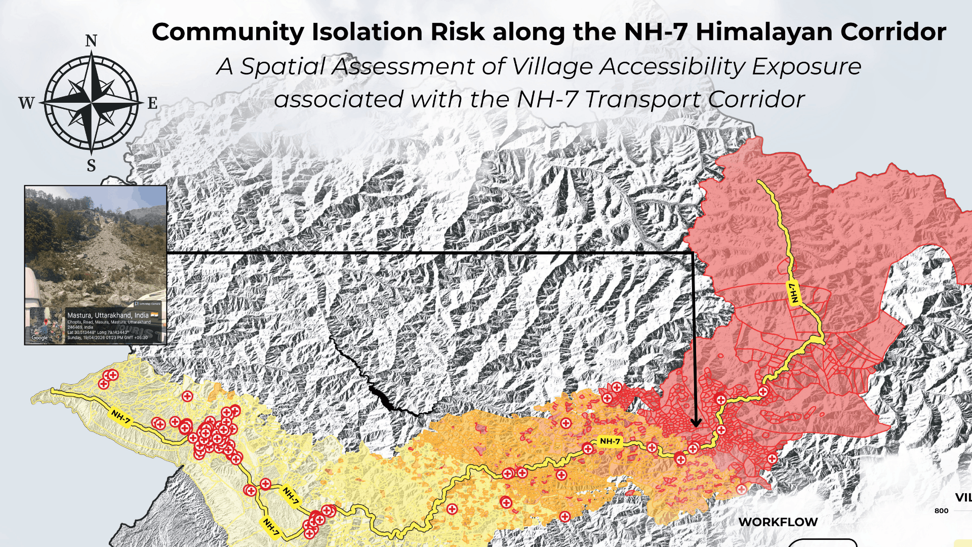
Prince, University of Delhi Community Isolation Risk along the NH-7 Corridor This map assesses relative community isolation among villages along the NH-7 Himalayan corridor in Uttarakhand. A 15 km corridor buffer was analyzed.
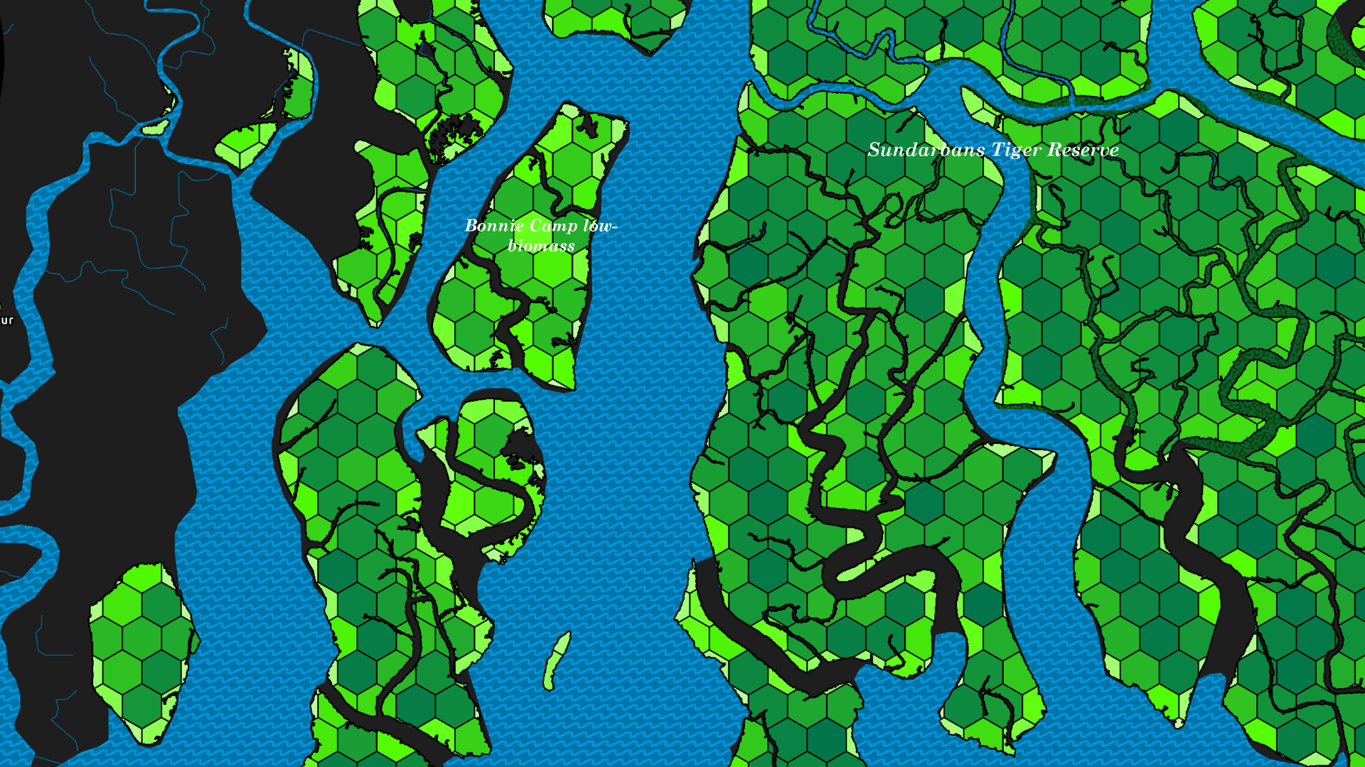
Rudra Debnath, Adamas University, Kolkata Spatial Distribution of Blue Carbon Indian Sundarbans Biomass distribution across the Indium Sundarbans is spatially heterogeneous and strongly influenced by salinity and freshwater availability.
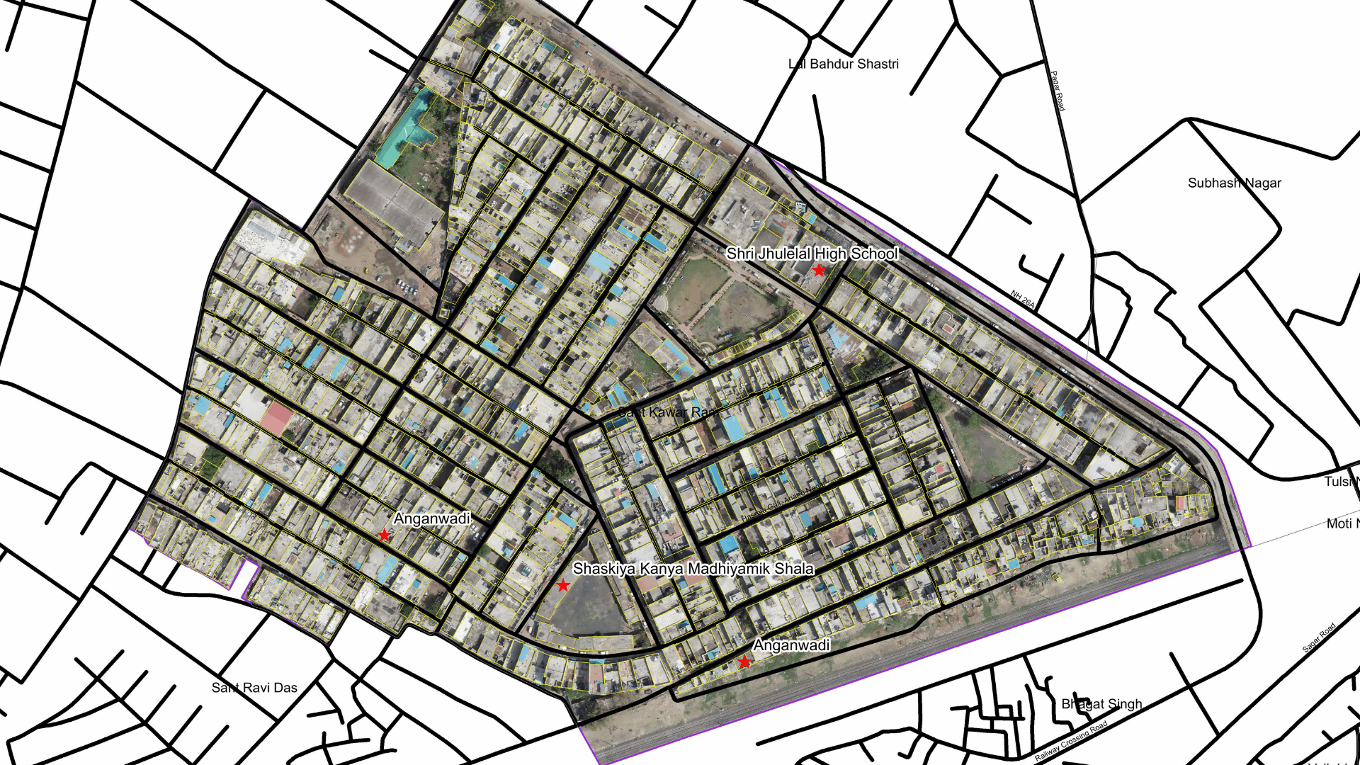
Dr. Shyam Agrawal, Urban Data Analytics Center UADD, Bhopal Ward 21 – Sagar Municipal Corporation This Ward Map maps ward boundaries, roads, properties and public infrastructure to support urban planning, property tax and field operations.
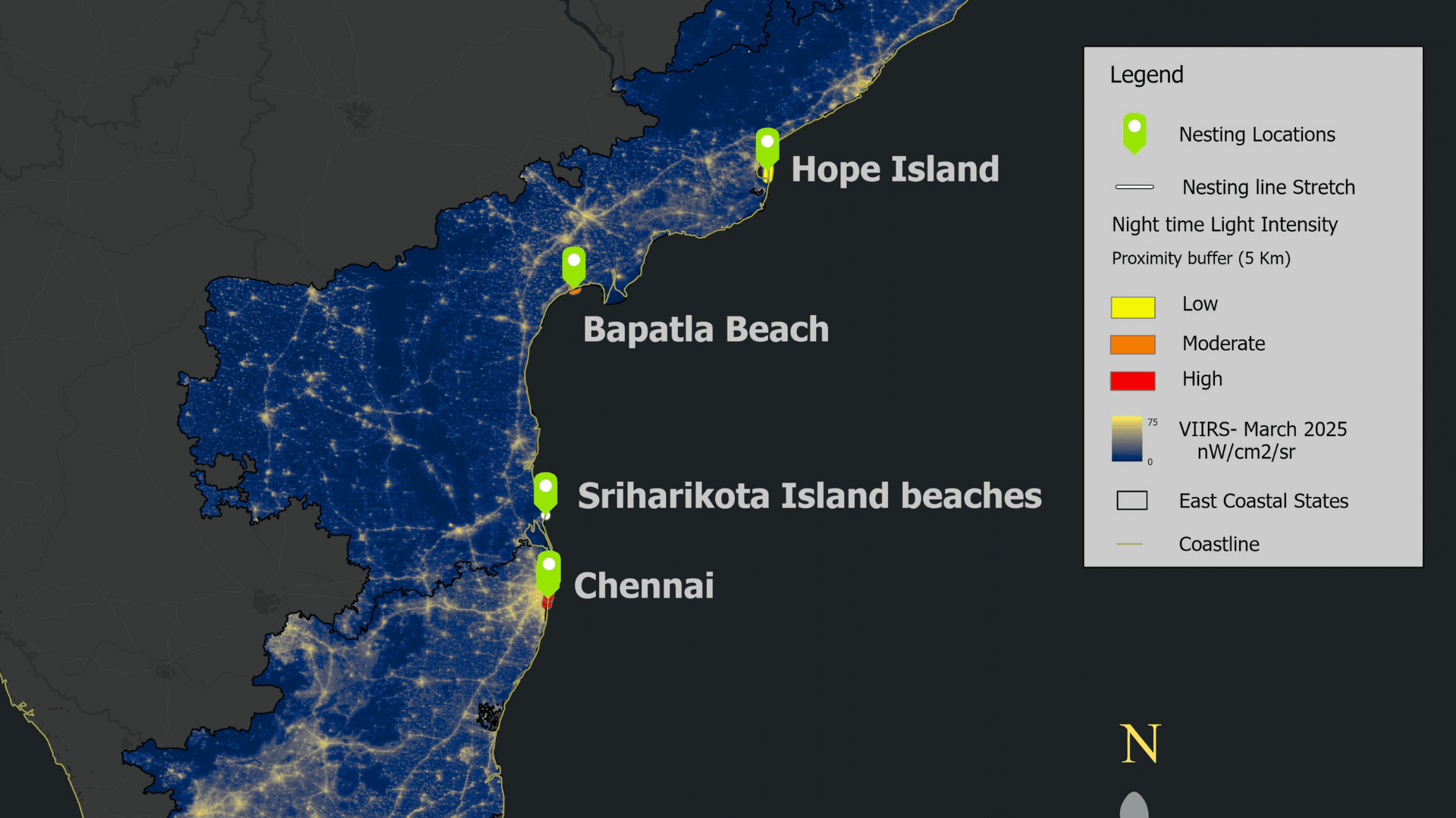
Sivanesan K, Care Earth Trust A Coast that Never Sleeps: Night time Illumination This map highlights where artificial nighttime illumination overlaps with critical nesting habitats, supporting conservation and sustainable coastal management.
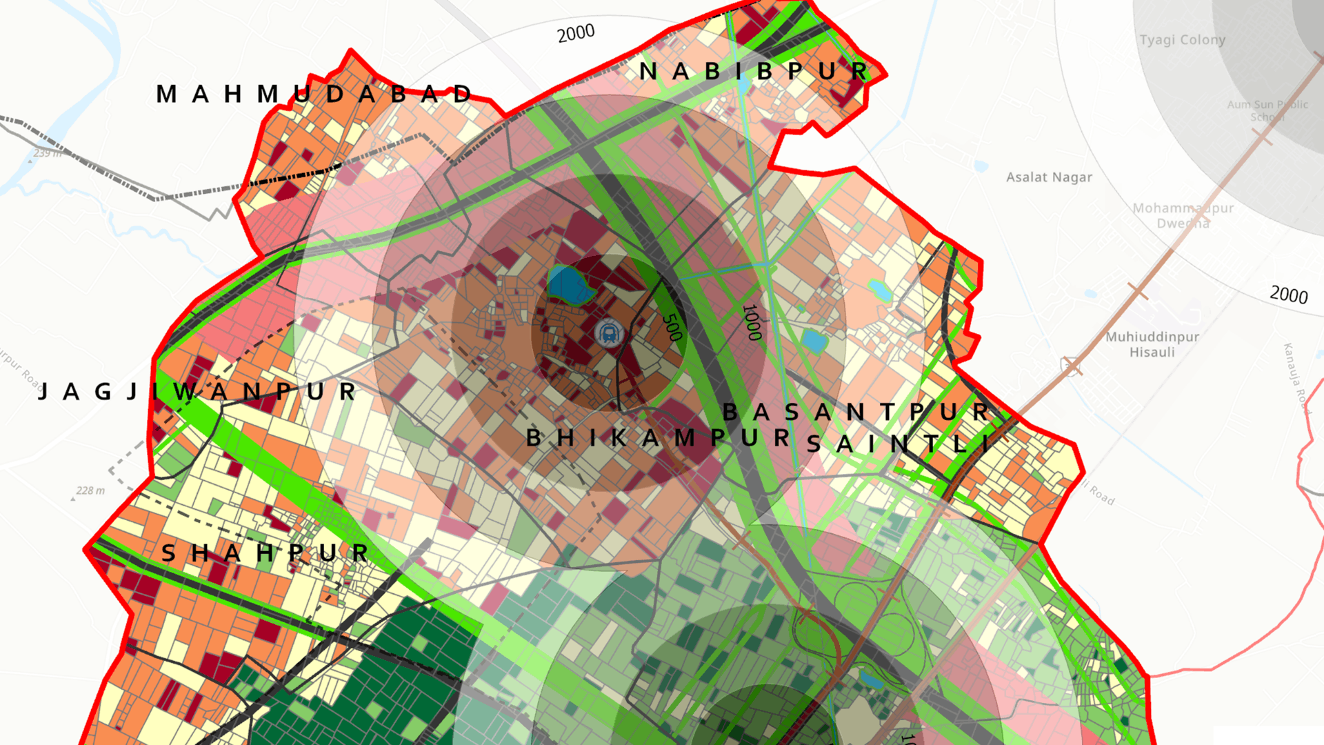
Swasti Jain, School of Planning and Architecture, Bhopal Land Value Capture Readiness Index (LVC-RI) This map was developed using ArcGIS Pro to assess the spatial readiness of public land assets for Land Value Capture (LVC) along the Delhi Ghaziabad Meerut RRTS corridor.
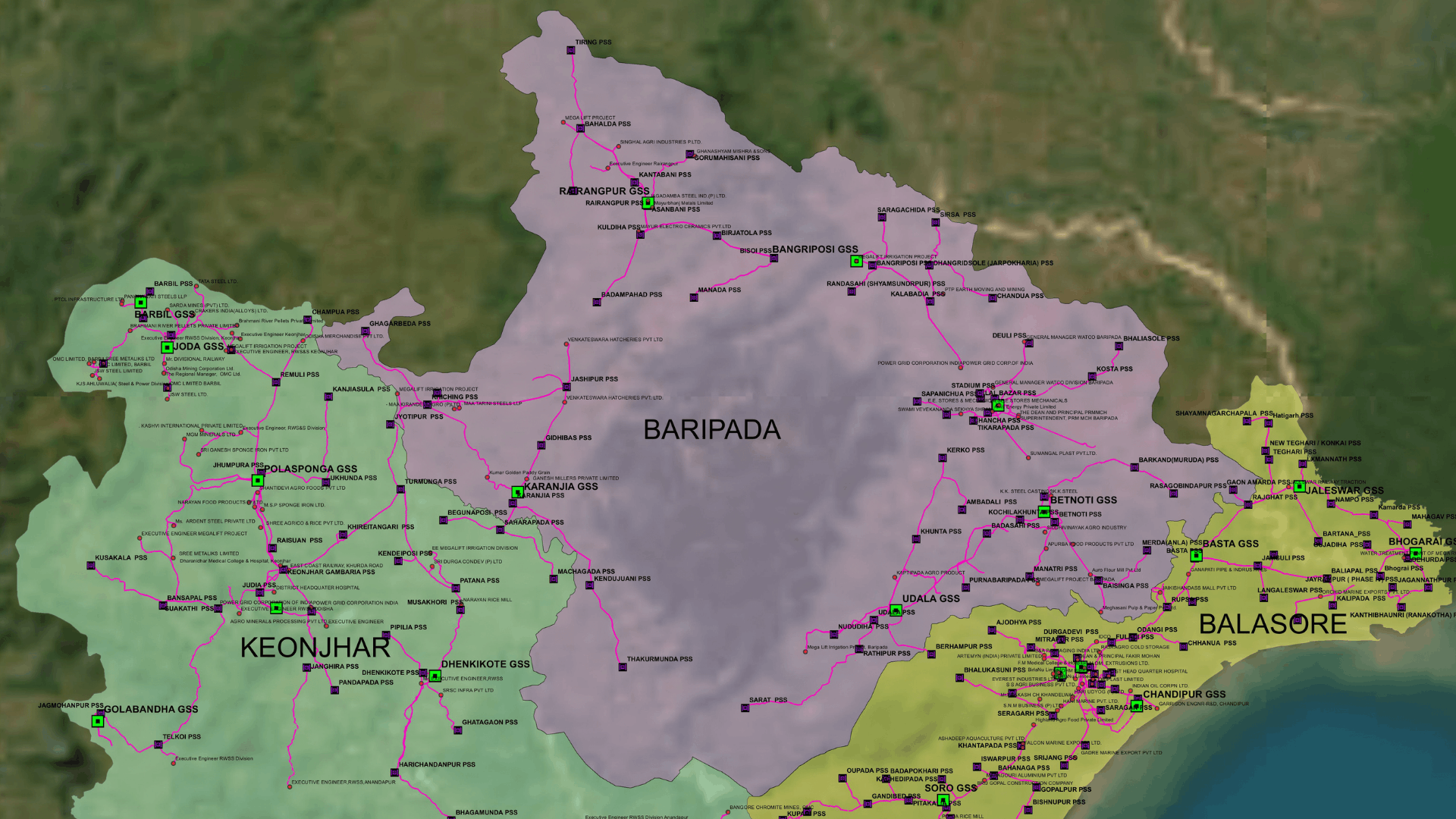
GIS Group, TPNODL Tata Power Northern Odisha Distribution Limited (TPNODL) Power Map The Power Map reflects the entire network supply of TPNODL, showing Grid Stations connectivity to Primary Sub-Stations.
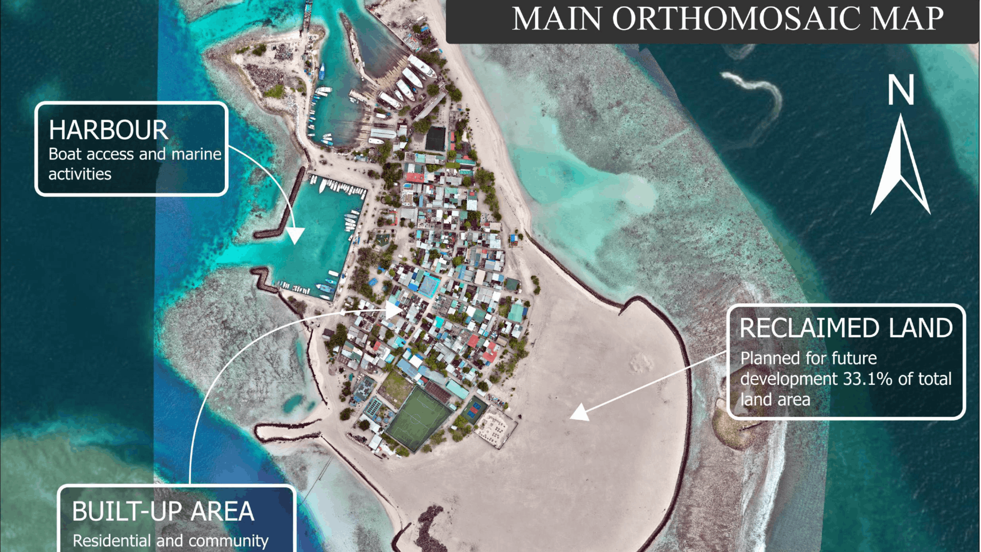
Abilakshan Vadivel, Maldives Drone-Based Coastal Planning Map of Gulhi Island, South Malé Atoll, Maldives This map presents a drone-based spatial assessment of Gulhi Island, South Malé Atoll, integrating high-resolution orthomosaic imagery.
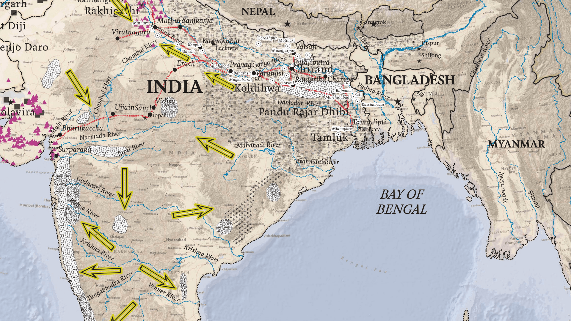
Dr. Ajoy Das, Department of Earth Sciences, Gujarat University Indus to Ganga: Iron Technology and the Evolution of Urbanization in Ancient South Asia This map speaks about the transitional trajectory from the collapse of the Indus urban grid to the rise of territorial polities in the Ganga-Yamuna plains.