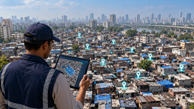
A Geographic Information System (GIS) ties data to the exact place on a map it belongs to, whether that data is a sensor reading, a survey point, or a household’s water connection. Jal Jeevan Mission 2.0, India’s extended rural drinking water program, has built its next phase around a digital framework called Sujalam Bharat, which assigns every village a unique ID and maps its water supply system from source to tap. Verifying and maintaining that record across 19.36 crore rural water connections is what determines whether the mission’s next phase actually holds up over time.
Introduction: Mapping Water Infrastructure for 19.36 Crore Rural Households
The Union Cabinet approved the extension of Jal Jeevan Mission to December 2028 on 10 March 2026, alongside a restructured framework built around Sujalam Bharat. As of the Cabinet’s release, states and union territories had identified 19.36 crore rural households nationally, of which around 15.80 crore, or 81.61 percent, were reported to have tap water connections.
Confirming that tens of crores of individual water connections actually exist, work, and are tied to a specific, findable location is not a task a spreadsheet can do well. Sujalam Bharat’s own mapping system already covers part of that job, and additional geospatial tooling could extend what it does further.
What Is Sujalam Bharat and Why Does Every Water Asset Need an ID?
Sujalam Bharat is the digital framework introduced alongside Jal Jeevan Mission 2.0, built around a uniform national data model. Under it, every village receives a unique Sujal Gaon or Service Area ID, and the complete drinking water supply system serving that village, from its source to the household tap, is digitally mapped against that ID.
The reasoning is straightforward once the scale is visible. A rural water connection is not one object but a chain: a source, treatment infrastructure, a distribution network, and a household tap, often spanning difficult terrain and multiple villages. Without a way to uniquely identify and locate each part of that chain, tracking whether it was actually built, and whether it is still functioning years later, depends on paper records that do not travel well between the state, district, and Gram Panchayat levels responsible for it.
Inside Jal Jeevan Mission 2.0: Outlay, Timeline, and the Shift to Service Delivery
Jal Jeevan Mission 2.0 carries a total outlay of Rs 8.69 lakh crore, including central assistance of Rs 3.59 lakh crore, an increase of Rs 1.51 lakh crore over the mission’s original 2019-20 approval. The extended mission now runs through December 2028.
The mission’s own framing marks a shift from building infrastructure to sustaining it. Jal Arpan formalizes the handover of completed schemes to Gram Panchayats and Village Water and Sanitation Committees, giving these bodies documented ownership of the infrastructure they now operate. Har Ghar Jal certification is granted only once a Gram Panchayat confirms that operation and maintenance mechanisms are actually in place, not simply that construction is complete. Jal Utsav, an annual community-led review event, and Jal Seva Aankalan, a community-led assessment of service delivery, both reinforce that shift toward ongoing accountability rather than a one-time construction milestone.
Since 2019, more than 12.56 crore additional rural households have been connected, up from a 2019 baseline of 3.23 crore households, or 17 percent coverage. These figures are dated to the Cabinet’s 10 March 2026 release and will move as the mission progresses toward its December 2028 target.
Why Rural Water Infrastructure Needs Geo-Tagging From Source to Tap
What is actually documented is that Sujalam Bharat’s geo-tagging and digital mapping of rural water supply infrastructure runs on the PM Gati Shakti platform, the same national geospatial platform used for infrastructure planning across sectors.
Mapping from source to tap, rather than only marking a village’s approximate location, is what makes this data usable for verification rather than just record-keeping. A source-to-tap record shows not just that a village has water infrastructure, but which specific source feeds it, what treatment and distribution infrastructure sits in between, and which households at the end of that chain are actually connected. That level of detail is what a Gram Panchayat needs to know exactly what it is taking ownership of under Jal Arpan.
What GIS Adds to Rural Water Asset Mapping Beyond an ID Number
A Sujal Gaon or Service Area ID answers what a village’s water system is called and that it has been mapped. It does not, on its own, answer where each component of that system sits relative to the terrain, other infrastructure, or a field team’s current location, or whether a mapped asset is still operating months or years after it was recorded.
From a Static Record to a Working Map
This is the gap between an ID number and a spatial layer. A geospatial system can place each asset relative to roads, settlements, and terrain, support queries like which villages in a district still lack a mapped connection, and flag assets that have not been reverified within a given period, none of which a flat ID registry does by itself.
That distinction matters more as Jal Jeevan Mission 2.0 shifts its own emphasis from construction to service delivery. A map built once at construction answers whether an asset was built. A map that supports repeated field verification is what confirms whether it is still working, which is the actual question a Gram Panchayat and state PHED need answered years into a scheme’s life.
How ArcGIS Enterprise and ArcGIS Field Maps Could Support Field-Level Water Asset Verification
A platform such as ArcGIS Enterprise can consolidate water asset records submitted by different state and district agencies into a single, spatially referenced system of record, with the kind of role-based access controls that matter when handling infrastructure data across multiple government bodies.
ArcGIS Field Maps, a mobile data collection tool, is the kind of tool that could support the field verification step specifically. A field officer visiting a village to confirm a water connection is still operational could record that visit against the asset’s existing location, attach photos or condition notes, and sync that update back to a central system, turning a one-time construction record into infrastructure that gets periodically reverified rather than assumed to still be working.
ArcGIS Pro would sit behind this kind of system as the tool for building and analyzing the underlying spatial datasets, such as service area boundaries and source locations, that field verification depends on. A reference layer from the Indo ArcGIS Living Atlas, covering India’s villages, administrative boundaries, and terrain, could give asset records geographic context without every state building its own base layers from scratch.
Jal Seva Aankalan’s community-led assessment model points to a separate, complementary need: a way for the community itself to see and engage with scheme status, not just for officials to track it internally. A platform such as ArcGIS Hub is built for that kind of open, community-facing engagement, letting an implementing agency share scheme progress publicly and gather input directly from the villages a water scheme serves.
How Indian States Are Approaching Rural Water Infrastructure Mapping Today
The documented reality is that Sujalam Bharat’s mapping already runs on a shared national platform, not a state-by-state patchwork. PM Gati Shakti integrates data across 44 central ministries and 36 states and union territories on a common ISRO-satellite-imagery-based foundation, and Sujalam Bharat’s geo-tagging sits within that same infrastructure. Fund flows are tracked separately, through the SNA SPARSH scheme-based payment platform, which released Rs 5,289.09 crore to 10 states and a further Rs 865.87 crore through SNA SPARSH to 13 states in FY 2026-27. That financial tracking is a distinct system from the geo-tagging and asset-mapping work and should not be conflated with it.
State PHEDs evaluating how to strengthen their own verification capacity can look to solutions built on ArcGIS for National Government and State and Local Government, given that Jal Jeevan Mission 2.0 spans both a national framework and state-level implementation.
Challenges and the Road Ahead
GPS Accuracy in Remote and Hilly Terrain
Geo-tagging depends on reliable satellite positioning and connectivity, both of which are harder to guarantee in hilly, forested, or remote areas where a meaningful share of unconnected households remain. Field teams working in these areas need workflows that tolerate weaker signals and intermittent connectivity, not just the tools themselves.
Gram Panchayat Capacity to Maintain Records
Jal Arpan hands ownership of mapped infrastructure to Gram Panchayats and Village Water and Sanitation Committees, but maintaining and updating those records after handover requires staff time and digital literacy that varies widely across Gram Panchayats nationally. A record that is accurate at handover can go stale quickly without a body equipped to keep it current.
Keeping Records Current as Infrastructure Ages
A water asset mapped at construction is not static. Pumps fail, pipes are repaired or rerouted, and sources can degrade. Asset records need a mechanism for periodic reverification to stay useful for the operation and maintenance decisions Jal Jeevan Mission 2.0 now emphasizes.
Reconciling Legacy Paper Records With Digital Mapping
States entered this exercise from very different starting points, some with partial digital records from earlier rural water schemes, others largely on paper. Migrating and reconciling that legacy data into a single digital framework is a sustained data-cleaning task, not a simple upload.
A Sujal Gaon ID and a source-to-tap map are only as useful as the verification that follows them. Whether Jal Jeevan Mission 2.0 closes the gap between a household counted as connected and one that actually has reliable water will come down to how consistently Gram Panchayats and state PHEDs can reverify what Sujalam Bharat has already mapped, long after the initial survey teams have moved on.
FAQs
1.What is Sujalam Bharat under Jal Jeevan Mission 2.0?
Sujalam Bharat is a digital framework introduced alongside Jal Jeevan Mission 2.0 that assigns every village a unique Sujal Gaon or Service Area ID and digitally maps its complete drinking water supply system from source to tap.
2.How does geo-tagging work for rural water assets under JJM 2.0?
Geo-tagging and digital mapping of rural water supply infrastructure runs on the PM Gati Shakti platform, giving every state a shared, satellite-imagery-based foundation for locating and tracking water assets from source to tap.
3.What is the outlay and timeline for Jal Jeevan Mission 2.0?
The mission carries a total outlay of Rs 8.69 lakh crore, including central assistance of Rs 3.59 lakh crore, and has been extended through December 2028, as approved by the Union Cabinet on 10 March 2026.
4.How can GIS support rural water asset verification and monitoring?
Tools such as ArcGIS Field Maps could support field officers in reverifying that a mapped water connection is still operational, while ArcGIS Enterprise could consolidate those records into a shared, spatially referenced system.
5.What are the main challenges in mapping rural water infrastructure at national scale?
GPS accuracy in remote and hilly terrain, Gram Panchayat capacity to maintain records after handover, keeping records current as infrastructure ages, and reconciling legacy paper records with a new digital framework are the main practical hurdles.
Written by
Esri India Marketing