GIS for last-mile logistics is the use of geographic information system (GIS) technology to plan delivery routes, site fulfillment infrastructure, geocode customer addresses, track fleets in real time, and analyze demand patterns at the neighbourhood level. In India’s e-commerce market, where last-mile delivery accounts for up to 53% of total shipping costs, GIS is the spatial intelligence layer that turns a fragmented network of warehouses, delivery hubs, and customer doorsteps into an optimized, measurable, and operationally controllable system.
India’s E-Commerce Surge and the Last-Mile Problem
According to IMARC Group, India’s logistics market reached $317 billion in 2024 and is projected to hit $484 billion by 2029. The country’s e-commerce volume has expanded rapidly across metros, Tier-2, and Tier-3 cities, with daily shipments growing from millions to tens of millions of parcels. Amazon India, Flipkart, Meesho, and Myntra are expanding their reach while quick commerce platforms like Blinkit, Zepto, and Swiggy Instamart have raised the bar with 10-minute delivery promises.
Yet every kilometer closer to the customer adds cost non-linearly. Last-mile delivery represents the final, most expensive, and most operationally complex stage of the supply chain. Failed or rescheduled deliveries alone account for 8 to 10% of total delivery expenses. Manual route planning generates 10 to 15% more mileage than optimized routing. And 60% of delivery delays in Indian cities are caused by traffic congestion alone. The solution to this challenge is not more delivery agents or more vehicles. It is better spatial intelligence.
What Is Last-Mile Logistics, and Why Is It So Hard in India?
Last-mile logistics is the final stage of the delivery journey, where a package moves from a local distribution hub or fulfillment center to the customer’s address. It is called last-mile not because it covers one mile but because it is the last link in the supply chain, the most granular, the least predictable, and the hardest to scale efficiently.
India’s last-mile challenge has several layers that most markets do not face to the same degree
The address problem
India lacks a standardized addressing system across most of its geography. Delivery instructions like “third house after the blue temple, near the old post office” are common in Tier-2 towns. Lookalike colony names, missing house numbers, and inconsistent PIN code assignments make geocoding, the process of converting an address into a mappable coordinate, extremely difficult without India-calibrated spatial data.
Terrain and density variety
A single 3PL may serve dense urban blocks in Mumbai, narrow lanes in Varanasi’s old city, and a village accessible only by a dirt track in Rajasthan, often within the same day’s delivery run. No single route template works across this diversity
India-specific disruption variables
Monsoon flooding, religious processions, local elections, protest closures, and festival-season surges create disruption patterns that standard global logistics models do not account for. These are predictable in their seasonality but unpredictable in their exact timing and geographic footprint.
How GIS Powers Last-Mile Logistics
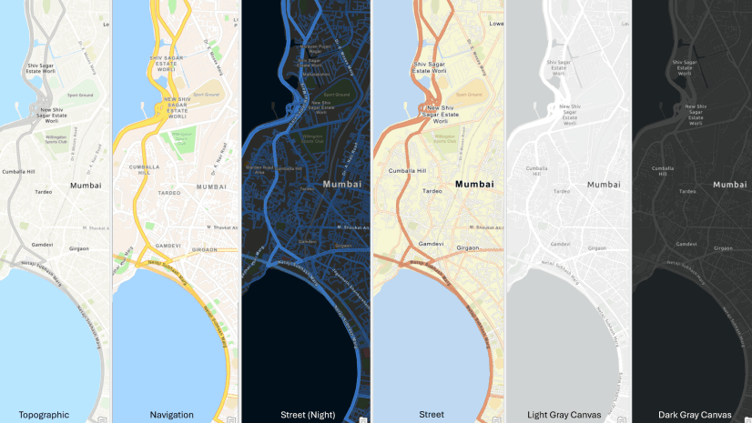
GIS addresses these challenges by giving every delivery operation a location-aware foundation. Every customer address becomes a geocoded coordinate. Every delivery hub, dark store, and fulfillment center sits on a map. Every road segment carries attributes like real-time congestion, restriction type, vehicle class eligibility, and flood risk. And every delivery agent’s movement generates a live spatial data feed that the operations team can monitor and respond to.
ArcGIS Network Analyst is the core routing engine. It solves the Vehicle Routing Problem (VRP) for a fleet of delivery agents simultaneously, assigning orders to vehicles, sequencing stops, respecting capacity and time window constraints, and minimizing total route cost. It generates geographically clustered routes so drivers serve adjacent customer addresses in a logical sequence rather than criss-crossing a service zone inefficiently.
ArcGIS Pro provides the analytical environment where logistics planners run route modelling, delivery zone design, and network performance analysis. ArcGIS Velocity ingests live GPS feeds from delivery fleets, mapping vehicle positions in real time and flagging deviations from planned routes as conditions change on the ground.
Key GIS Capabilities Across the Last-Mile Workflow
Here are the GIS capabilities that matter most across a last-mile logistics operation in India:
Geocoding and address standardization
ArcGIS geocoding tools convert ambiguous, landmark-based Indian addresses into precise GPS coordinates, using address interpolation, point-of-interest matching, and PIN-level spatial data to resolve locations that standard mapping tools cannot handle. Every failed geocoding attempt is a potential delivery failure before the van even leaves the hub.
Isochrone analysis for hub and dark store siting
ArcGIS Business Analyst generates drive-time isochrones, service area polygons that show how far a delivery agent can travel in 10, 20, or 30 minutes from a given hub location. For quick commerce players siting dark stores, this analysis determines whether a proposed location can deliver to its target demand zone within the promised time window before any lease is signed.
Demand hotspot analysis
ArcGIS GeoAnalytics identifies spatial clusters of high order density, peak delivery time windows, and return-to-origin (RTO) concentrations at the sub-PIN level. Planners use this to size hub capacity, allocate agents by zone, and position buffer stock at micro-fulfillment centers closest to demand concentration.
Geofencing and dynamic ETA
ArcGIS Velocity creates geofences around delivery zones, triggering automated customer notifications when a delivery agent enters the zone and updating ETAs dynamically as real-world conditions deviate from the planned route.
Fleet dispatch and field crew coordination
ArcGIS Workforce assigns and dispatches delivery agents spatially, giving supervisors a live map of where every agent is, which deliveries are complete, and which assignments need reassignment because of failed delivery attempts or route deviations. ArcGIS Field Maps gives the delivery agent turn-by-turn navigation through India’s road network with offline capability for areas with poor connectivity.
From Warehouse to Doorstep: Where GIS Adds Value
Fulfillment center and hub siting
Before any facility is committed, ArcGIS Business Analyst layers road network data, population density, e-commerce penetration rates, competitor hub locations, and real estate availability to score potential sites for logistics facilities. In Tier-2 and Tier-3 cities, where infrastructure data is less complete, Indo ArcGIS Living Atlas provides satellite imagery and demographic layers to supplement local data gaps.
Service area design
ArcGIS Network Analyst divides a metro’s delivery geography into service zones that balance delivery agent workload, minimize inter-zone crossings, and align with the physical boundaries of road networks and natural barriers. This zone design directly determines route efficiency and delivery attempt success rates.
India-specific disruption modeling
ArcGIS Pro integrates monsoon flood inundation grids, religious procession route data, election schedule calendars, and historical traffic restriction patterns as network impedance layers. Routes that cross vulnerable corridors during known disruption windows are automatically flagged or rerouted before the day’s dispatch begins.
Reverse logistics mapping
Returns, or RTO (Return to Origin) and RTM (Return to Merchant) flows, add a second routing problem on top of the forward delivery run. GIS maps the spatial distribution of return pickup requests alongside pending deliveries, enabling agents to combine forward deliveries and return pickups in a single optimized circuit rather than running separate return trips.
How Indian E-Commerce and 3PL Players Are Using GIS
India’s leading logistics players are actively building geospatial intelligence into their operations. Delhivery, one of India’s largest 3PLs, has invested in spatial analytics to design delivery zones, optimize hub locations, and analyze serviceability for new PIN code expansion across Tier-2 and Tier-3 markets. Shadowfax, which specializes in hyperlocal and gig-economy delivery, uses location intelligence to assign gig agents dynamically based on proximity to pending orders.
For quick commerce players like Blinkit and Zepto, the dark store siting decision is existential. Each dark store must serve its surrounding neighborhood within 10 to 15 minutes, and the wrong location, even by 500 meters, can price a platform out of a profitable delivery zone. ArcGIS Business Analyst’s isochrone and demographic enrichment capabilities provide the spatial evidence base for these decisions before any inventory is committed.
India’s Unified Logistics Interface Platform (ULIP), part of the National Logistics Policy 2022, is building a shared data environment across carriers, shippers, and regulatory agencies. GIS forms the spatial layer that makes multimodal logistics intelligence, linking rail nodes, road corridors, warehouses, and last-mile delivery zones, operationally coherent within the PM Gati Shakti National Master Plan framework. The same logic applies to ONDC, where GIS enables small-seller fulfillment points to be mapped, evaluated for serviceability, and connected to the nearest 3PL delivery hub.
Benefits for Operators, Customers, and Cities
For delivery operators and 3PLs
Fewer failed delivery attempts because geocoded addresses are deliverable before dispatch. Lower fuel costs through optimized multi-stop routing. Better agent productivity through spatial zone design that minimizes dead mileage. Faster expansion into new service areas through satellite imagery and demographic analysis that replaces expensive ground surveys.
For quick commerce platforms
Dark store locations chosen with spatial precision, not intuition. Demand heatmaps that reveal which micro-neighborhoods are underserved and which dark stores are overloaded. Real-time geofence triggers that power the customer-facing delivery ETA experience.
For customers
More accurate delivery time windows because routes are planned on real road networks with real constraints, not crow-flight distances. Better communication when delays occur because GIS-powered systems can identify affected deliveries spatially and push proactive notifications.
For cities
Logistics operators using GIS-optimized routes generate fewer vehicle-kilometers of travel per delivery, reducing congestion, emissions, and road wear. Spatial analysis of delivery concentration patterns also helps ULBs plan loading zones, curb access policies, and last-mile EV charging infrastructure in the right locations. Explore Esri India’s Transportation solutions for logistics and supply chain operations across India.
Challenges and What’s Next: Drones, Quick Commerce, and ONDC
India’s address gap is structural
Despite improvements in digital mapping, large parts of India’s Tier-2 and rural address space remain unmapped or inconsistently geocoded. Logistics players are addressing this through ArcGIS Survey123 field surveys, where agents capture precise GPS coordinates and address attributes for new localities as they expand coverage, building proprietary spatial datasets that improve geocoding accuracy over time.
Quick commerce has compressed the time margin
When the delivery promise is 10 minutes, there is no room for route re-optimization after dispatch. GIS must be embedded in the pre-dispatch planning system, with dark store layouts, delivery zones, and agent assignments pre-calculated for every demand scenario the system might encounter, from a normal Tuesday to a festival surge to a monsoon afternoon.
Drone delivery is arriving
India’s DGCA has begun approving Beyond Visual Line of Sight drone operations for logistics. When drones enter the last-mile mix, GIS adds an aerial dimension to the routing problem, managing no-fly zones, landing zone suitability, wind pattern overlays, and urban canyon effects on signal reliability. ArcGIS Pro and ArcGIS Network Analyst provide the 3D network modeling foundation for this workflow.
ONDC is democratizing logistics data
As ONDC scales, small sellers across Tier-2 and Tier-3 India will generate delivery demand from locations that existing 3PL networks map poorly. GIS-based serviceability analysis, combining road network reach, agent density maps, and pickup point proximity, will determine which ONDC seller locations can be profitably served and which require new hub investment to unlock. India’s last-mile delivery problem is ultimately a spatial problem. Solving it at the scale of 350 million online shoppers, across 22,000 PIN codes, in a country with India’s geographic diversity and urban complexity, requires GIS as the operating system beneath every route, every hub, and every delivery attempt.
FAQs
1.What is last-mile logistics in e-commerce?
Last-mile logistics is the final delivery stage where a parcel moves from a fulfillment hub to the customer’s doorstep, accounting for up to 53% of total shipping costs. In India, unstructured addresses, urban congestion, diverse terrain, and monsoon and festival disruptions make it especially complex.
2.How does GIS help in last-mile delivery?
GIS geocodes customer addresses into deliverable coordinates and optimizes multi-stop routes using ArcGIS Network Analyst’s Vehicle Routing Problem solver. ArcGIS Velocity provides real-time fleet visibility, while ArcGIS Field Maps empowers delivery agents with offline-capable navigation, reducing failed deliveries and fuel costs.
3.Why is last-mile delivery costly in India?
Unstructured addresses increase failed first-attempt deliveries, effectively doubling per-order costs, while traffic congestion and low delivery density in Tier-2 and rural areas reduce deliveries per kilometer. High return rates of 15 to 30% in certain categories add a significant reverse logistics burden.
4.How is route optimization done using GIS?
ArcGIS Network Analyst’s VRP solver assigns orders to vehicles, sequences stops to minimize travel time, and respects constraints like vehicle capacity and customer time windows. Optimized routes are pushed to agents through ArcGIS Field Maps, with ArcGIS Velocity monitoring actual movement against planned routes in real time.
5.What is the role of GIS in quick commerce?
ArcGIS Business Analyst generates drive-time isochrones from dark store locations to determine whether a 10-minute delivery window is achievable, while ArcGIS GeoAnalytics maps demand density to identify zones that justify a dark store. ArcGIS Velocity then dynamically assigns incoming orders to the nearest available agent.
Written by
Esri India Marketing