

RSAC-UP Optimizes Green Organ Corridor Route with ArcGIS
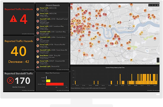
The Road Network Analysis helped in finding the best route to healthcare facilities among the four possible routes. Network connectivity can explain significant variance in the spatial pattern of the network structure.