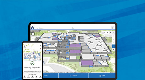
ArcGIS Indoors
Support facilities, workplace, operations, and maintenance workflows across your defence organization with indoor maps and apps.


Prepare for the future with a smart installation that allows staff to:
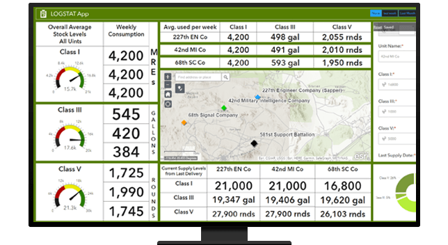
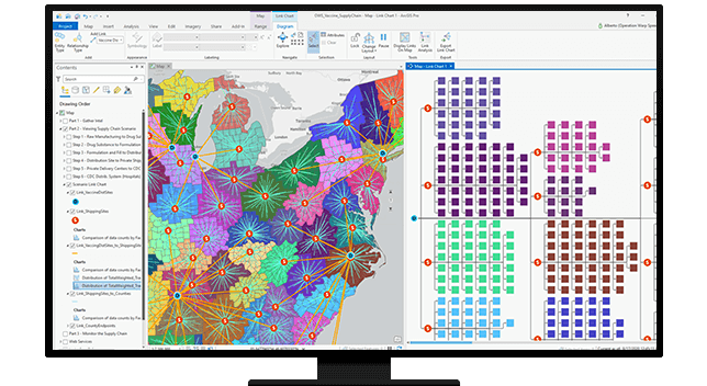
Create a geographic framework for logistics using GIS to improve network planning, control costs, enhance deliveries, and make more strategic decisions. With ArcGIS, you can plan routes based on unit location, potential threats, and multi-modal supply route transfer locations.
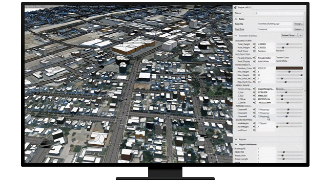
ArcGIS integrates geography into training, modeling, and simulation. ArcGIS allows users to harness models and tools to build the most realistic environments to simulate military options and actions. Support the full lifecycle including:
Spatial data and GIS technology can help military staff understand health coverage in military populations, opportunities to improve access to needed care and protect the force against unforeseen events. Applied GIS leads to improved health outcomes, healthier military communities, and an effective, resilient force.
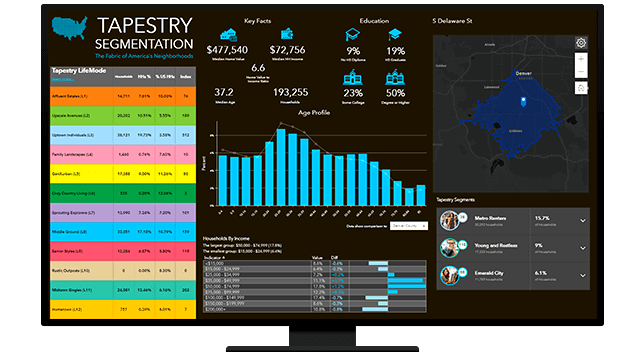
ArcGIS provides recruiters and analysts actionable knowledge about influences, habits, and demographics for capable populations to serve. This information and associated analyses can target recruiting focus to meet readiness and retention goals.
ArcGIS Indoors
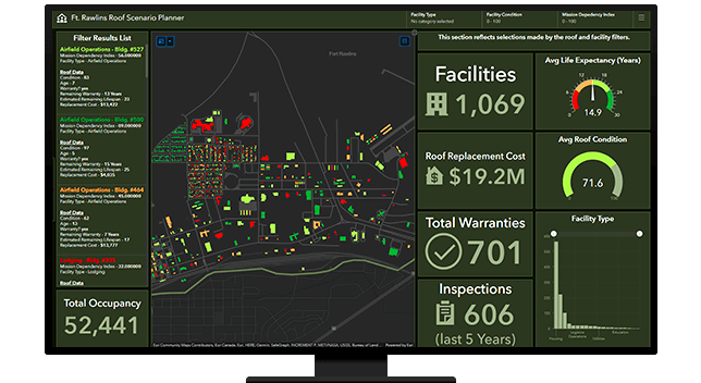
ArcGIS Dashboards
ArcGIS Maps for Unity
Please fill out your details below for us to contact you for the demo.
Write to us at info@esri.in
Talk to us over the phone