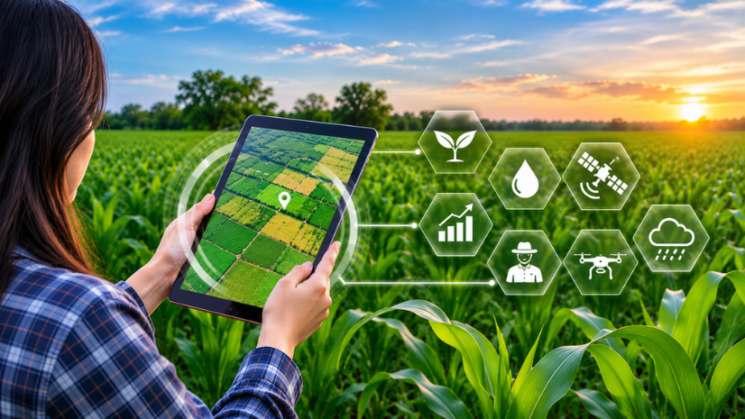
A Geographic Information System (GIS) is technology that captures, analyzes, and maps data tied to location, helping people see patterns that tables and spreadsheets miss. GIS Day 2026 falls on 18 November 2026, and in India it carries extra weight this year. It coincides with Esri India’s 30th year of operations, marking three decades since the company’s establishment in 1996.
GIS Day 2026: A Celebration That Lands on a Milestone Year
Every November, schools, universities, government offices, and businesses around the world open their doors to show what maps and spatial thinking can do. For India’s geospatial community, GIS Day 2026 is both that global celebration and a chance to look back on how far GIS has come since the mid-1990s. The journey runs from expensive computers and slow networks to open data, cloud platforms, and artificial intelligence (AI) working alongside GIS.
The global theme for GIS Day 2026 is GIS: Powering Purpose and Innovation. It celebrates the innovators, problem-solvers, and storytellers who use geospatial technology to make real-world change, and the idea that GIS does far more than make maps.
To mark the occasion, Esri India is inviting organizations, schools, and communities to host their own events and enter the Esri India GIS Day 2026 Celebrate & Win Contest. Events of all sizes are welcome to enter the contest – from a campus map gallery to a district office demo or a short team session.
Where GIS Day Began and Why It Still Matters
GIS Day is an annual, worldwide event that shows how GIS helps people understand and improve the world around them. It takes place on the third Wednesday of November, during Geography Awareness Week.
The first formal GIS Day took place in 1999. Esri president and cofounder Jack Dangermond credits activist Ralph Nader as the person who inspired it. Dangermond and Dr. Roger Tomlinson marked that first GIS Day with students at Murch Elementary School in Washington, DC.
More than 25 years later, the idea matters as much as ever. Agendra Kumar, Managing Director, Esri India, notes that GIS is often still confined to one department or function, even though it is relevant to almost every part of an organization. GIS Day is a chance to close that gap by showing colleagues, students, and neighbors what spatial thinking makes possible.
1996: A Turning Moment for GIS in India
Esri India Technologies Pvt. Ltd. (Esri India) was established in 1996. Looking back on 30 years of Esri India, Kumar describes the 1990s as a turning point for the country. Economic reforms began in 1991, and the Indian Space Research Organisation (ISRO) launched several Earth observation satellites that improved the availability of remote sensing data. Around the same time, government programs in natural resource and water resource management started using satellite-derived information.
In that environment, several GIS companies emerged in 1995 and 1996, including the company that became Esri India, then known as NIIT GIS Limited. The working conditions were very different compared to today. Computing systems were expensive, graphics capabilities were limited, and even a 64 Kbps network connection was considered significant, which made moving large volumes of geographic data difficult.
Three decades on, Esri India serves more than 6,500 organizations and about 1.5 million users, delivering Esri’s ArcGIS, together with its own solutions and services.
“Most organisations will use geospatial intelligence the way they use ERP systems today.”
Agendra Kumar, Managing Director, Esri India
Three Decades, Three Shifts: Better Data, Open Access, and GeoAI
Looking across 30 years, three shifts stand out in how India collects, shares, and uses geospatial data.
Better Earth Observation Data
New ISRO satellites in the 1990s brought better Earth observation data to India, giving government programs the raw material to map land, forests, and water. As computing power, graphics, and networks improved, GIS moved from computer-assisted map production to spatial analysis and then to web-based applications that let organizations share and combine information.
Open Access to Geospatial Data
On 15 February 2021, the Department of Science and Technology (DST), under the Ministry of Science & Technology, announced that rules for geospatial data and maps in India “stand radically liberalised.” Indian companies no longer need prior approvals to collect, create, publish, or update geospatial data and maps within India, and previously restricted geospatial data became freely available.
According to Kumar, the 2021 guidelines made it much easier to acquire, process, and store geospatial data, and permissions for aerial surveys and ground-based data collection became easier and faster. The National Geospatial Policy 2022, notified in December 2022, built on those guidelines with a wider framework for the sector. Encouraged by the 2021 guidelines, Esri India publishes India-specific content through Indo ArcGIS Living Atlas, an evolving collection of ready-to-use geographic content for India.
GeoAI
The third shift is happening now. AI is arriving alongside GIS and changing how organizations work with geospatial data, from how they extract information to how they predict what comes next.
GeoAI and the Next Chapter of GIS in India
GeoAI (geospatial artificial intelligence) brings AI techniques such as machine learning and deep learning into GIS workflows. Instead of analysts tracing every building or field by hand, GeoAI capabilities in ArcGIS can extract features, classify land cover, and detect objects in imagery. Pretrained deep learning models give teams a starting point, so they do not need to build every model from scratch.
In electric utilities, for example, AI can automate the mapping of transmission towers and lines and flag unauthorized structures beneath transmission corridors. Kumar also points to monitoring forests and farmland, detecting unauthorized construction, and analyzing accident-prone locations on transport networks. For a country of India’s scale, that speed changes what is practical to map and monitor.
In 2025, Esri India set up a GIS and AI Competency Center in Noida, backed by a ₹150 crore investment. Kumar describes it as a user-centric capability center, not primarily a research lab, built to help organizations use AI inside their existing GIS workflows. The center has already supported more than 100 users with AI applications, from proof-of-concept projects to production deployments.
AI is also starting to meet GIS from the other direction. Kumar notes that through Model Context Protocol (MCP), people working in ArcGIS can draw on general-purpose AI assistants, while people using those assistants can retrieve relevant information from a GIS database. The next chapter is also about access. On 3 September 2026, Esri India launched GeoSARAL, an indigenous desktop GIS for Linux and Windows built for mapping, visualization, editing, and querying. It works alongside an organization’s existing ArcGIS setup, giving government offices and other users a simple, affordable way into GIS.
How to Celebrate GIS Day 2026 at Your Organization, School, or Community
Celebrations of every size count. Here are seven ideas that work for Indian offices, campuses, and communities:
1) Host a map gallery: Print or display maps your team has made, in the office lobby, a college corridor, or online, and invite people to walk (or browse) through and ask questions.
2) Invite colleagues from other departments: Show finance, procurement, or logistics teams a map built from their own data. A finance team, for instance, can see where debtors are spread out and where payments tend to run late.
3) Run a community mapping exercise: Use ArcGIS Survey123 to have students or volunteers record trees, water points, or streetlights in their village or ward, then map the results together.
4) Take GIS beyond geography students: Give a talk at a college for students of computer science, mechanical engineering, economics, or management. They do not need to become GIS specialists, but they should see how spatial thinking applies in their fields.
5) Explore India-specific data: Walk participants through layers in Indo ArcGIS Living Atlas and build a quick map of your own district or city.
6) Host a hands-on workshop: Let your team showcase a recent GIS project, then give attendees a short exercise to try themselves.
7) Share it online: Post photos, story maps, or a short video of your event using #GISDay and #GISDay2026, or livestream the session for people who cannot attend.
Join the Esri India GIS Day Celebrate & Win Contest
The Esri India GIS Day 2026 Celebrate & Win Contest recognizes the best GIS Day celebrations across India. The top three celebrations win a trophy, and because event scale is not judged, a well-planned school or district office event has as strong a chance as a large one.
Entries are judged on five criteria, which also work as a planning checklist:
Uniqueness of Celebration: Go beyond a standard presentation with a local theme, a hands-on activity, or a format your audience has not seen before.
Awareness Created and Audience Touched: Plan who you want to reach, whether students, colleagues in other departments, or local officials, and design the activity around them.
Activity Vastness: Offer a range of activities, such as a map gallery, a talk, and a field exercise, rather than a single session.
Digital Presence: Share your event online before, during, and after, using #GISDay and #GISDay2026.
Overall Impact: Think about what participants take away, and capture it in photos, numbers, and short feedback.
Celebrations with a positive social impact may earn additional points, so a community mapping exercise or a session with a local school can strengthen your entry.
After your event, fill in the GIS Day report template available on the contest page and email your detailed report to marketing@esri.in. Register your celebration at go.esri.in/gisday today, and submit your report by 30 November 2026.
FAQs
1. What is GIS Day?
GIS Day is an annual, worldwide event that celebrates Geographic Information System technology and shows how it helps solve real-world problems. The first formal GIS Day took place in 1999.
2. When is GIS Day 2026?
GIS Day 2026 falls on Wednesday, 18 November 2026. GIS Day is held every year on the third Wednesday of November, during Geography Awareness Week.
3. How can organizations and schools celebrate GIS Day?
They can host a map gallery, run a community mapping exercise, invite speakers, or hold a hands-on workshop. Sharing the event online with #GISDay helps it reach a wider audience.
4. What is the Esri India GIS Day Celebrate & Win Contest?
It is an Esri India contest that recognizes the best GIS Day 2026 celebrations in India, with a trophy for the top three. Entries are judged on uniqueness, awareness created, activity vastness, digital presence, and overall impact.
5. How do I submit my GIS Day celebration report?
Fill in the GIS Day report template from the Esri India GIS Day contest page after your event. Email the completed report to marketing@esri.in by 30 November 2026.
Written by
Esri India Marketing