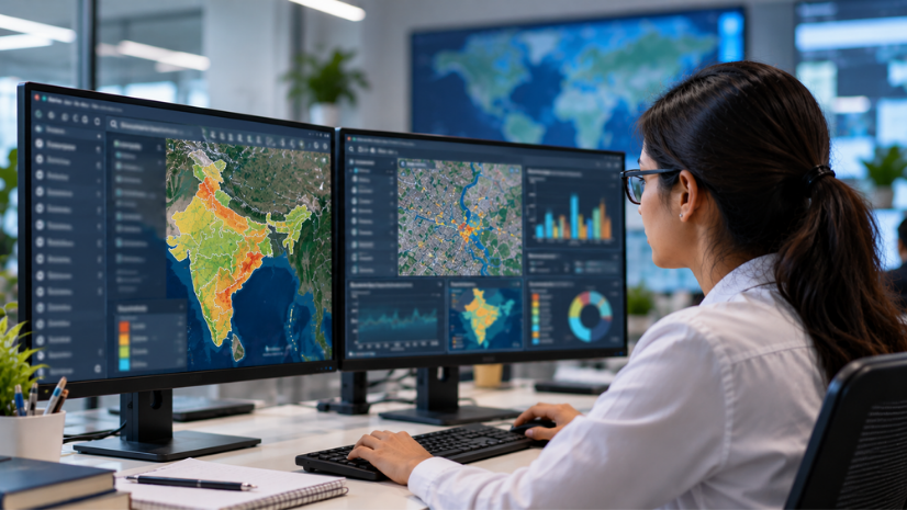
GeoAI in mining uses Geographic Information System (GIS) technology fused with Artificial Intelligence (AI) to map, predict, and manage how water moves through a mine site, from rainfall-runoff to sediment buildup to drainage infrastructure. In India, where mining regulation increasingly ties operational approval to environmental performance, that predictive capability has moved from a nice-to-have to a compliance necessity.
Introduction: Why Mine Water Management Is India’s Next Sustainability Frontier
A mine’s water story rarely stays contained to its own boundary. Sediment washes into nearby streams, culverts clog and redirect runoff into unplanned paths, and a single missed monsoon assessment can turn into a season of remediation costs. For years, Indian mining companies tracked these risks through field surveys that covered a fraction of a site and went stale within months.
That approach no longer holds up against the scale of India’s mining operations or the scrutiny they face. Regulators now expect miners to demonstrate, not just claim, that they are managing water and environmental risk continuously. GeoAI gives mining companies a way to meet that expectation: a single spatial system that combines satellite imagery, hydrological modelling, and historical change detection to show exactly how water behaves across a catchment, not just where it was last surveyed.
What Is GeoAI and Why Does Mine Water Management Need It?
GeoAI applies AI techniques such as deep learning and machine learning to geospatial data, allowing mining teams to extract information from satellite imagery, detect patterns across time, and predict outcomes rather than simply record them. Instead of a mining engineer manually comparing old and new site photos to spot sediment buildup, a GeoAI model can flag the change automatically across an entire catchment.
Mine water management needs this shift because the underlying problem is fundamentally spatial and dynamic. Rainfall-runoff, sediment movement, and drainage infrastructure conditions all change with the seasons and mining activity itself, and a static annual report cannot capture that.
ArcGIS Pro gives analysts the desktop environment to build land-use classification, change detection, and rainfall-runoff models directly from satellite data, while GeoAI capabilities layered on top let teams automate tasks, such as identifying culverts and drainage obstructions, that would otherwise require extensive on-ground inspection.
India’s Regulatory Push for Sustainable Mining: MCDR, Star Ratings, and the SDF
India’s mining sector operates under a tightening regulatory framework that treats sustainable water and environmental management as core to a mining lease, not an optional add-on. The Mines and Minerals (Development and Regulation) Act, 1957 (MMDR Act) provides the statutory basis for mineral conservation, and the Mineral Conservation and Development Rules (MCDR), 2017 give it operational teeth. Chapter V of the MCDR, specifically Rule 35, mandates sustainable mining practices and requires every mining lease holder to monitor and self-report performance against a Star Rating template administered by the Indian Bureau of Mines (IBM).
The Star Rating System, launched by the Ministry of Mines in 2014-15, evaluates mines on four sustainability modules: impact management, progressive closure and restoration, social welfare, and reporting. A five-star rating requires scoring 90 percent or above across these modules, and a seven-star rating, the highest tier, goes only to mines that have held five-star status for five consecutive years and passed a rigorous two-stage evaluation. In July 2025, the Ministry of Mines awarded seven-star ratings for the first time ever under the program to three mines, including Tata Steel’s Noamundi iron ore mine, which had held a five-star rating every year since the awards began in 2016. Ninety-five other mines received five-star ratings that same year.
This Star Rating framework exists to implement the National Mineral Policy 2019’s Sustainable Development Framework (SDF), which set out the broader intent: mining growth in India should not come at the cost of environmental and community wellbeing. For a mining company evaluating GeoAI adoption, the connection is direct. A system that can demonstrate consistent, data-backed impact management makes the difference between qualifying for a higher star rating and falling short of it.
Case Study: Inside Tata Steel’s GeoAI-Powered Water Management at Dimna Catchment
Tata Steel’s Natural Resources Division (NRD) offers the clearest published example of what this shift looks like in practice. Facing inconsistent, time-intensive field-survey methods across its mining catchments near Jamshedpur, the NRD team adopted an integrated ArcGIS Pro and GeoAI framework to understand, predict, and monitor how water and sediment move across the landscape.
The workflow started with building a consistent, high-resolution view of land use and surface conditions using ArcGIS Pro’s land-use and land-cover classification tools, paired with multitemporal change analysis. From there, the team applied ArcSWAT, a third-party hydrological modelling extension, to simulate rainfall-runoff behaviour and anticipate how different rainfall scenarios would affect sediment transport across the Dimna catchment. This shifted the team’s approach from reactive assessment to predictive planning.
The most distinctive part of the workflow addressed a problem field surveys had never solved efficiently: identifying blocked or damaged culverts across a vast mining area. By applying GeoAI-enhanced super-resolution imagery, the NRD team could remotely detect culverts and drainage obstructions with roughly one-metre accuracy, a level of precision that previously required extensive on-ground inspection. The results were measurable. Tata Steel reported a 60 percent reduction in manual mapping effort, along with meaningful cost savings from avoiding unnecessary dredging through more targeted sediment analysis.
Esri India's advanced geospatial and AI-driven tools have transformed how we understand and respond to spatial challenges. The ability to visualize, analyze, and act on high-resolution data has significantly improved our decision-making, operational efficiency, and long-term planning.
The ArcGIS Pro Workflow: From Satellite Imagery to Predictive Water Models
Understanding the landscape first
Every predictive water model starts with an accurate picture of current surface conditions. Analysts use ArcGIS Pro to classify land use and land cover across a mining catchment, then run multitemporal change detection to see how surface conditions have shifted over recent years. This foundational step turns what used to be a slow, field-survey-dependent exercise into a repeatable desktop workflow.
Predicting water behaviour
Once the surface picture is clear, the focus moves to how water actually moves across that terrain. ArcSWAT-driven rainfall-runoff modelling lets analysts simulate different rainfall scenarios and anticipate sediment transport and catchment health before the monsoon arrives, rather than assessing the damage afterward.
Identifying infrastructure risk remotely
Drainage infrastructure like culverts plays an outsized role in managing runoff, and GeoAI’s super-resolution imagery tools can detect blockages and obstructions to roughly one-metre accuracy without requiring a field team to physically inspect every site. This remote capability meaningfully reduces both the time and the safety risk involved in infrastructure monitoring.
Scaling with trusted reference data
Indo ArcGIS Living Atlas gives mining teams ready access to authoritative land-cover datasets and satellite imagery, which removes the delay of sourcing and preparing base data every time a team wants to extend its analysis to a new mining area.
Beyond Tata Steel: Where Else GeoAI Can Support Mine Water Management in India
Tata Steel currently stands as the only mining company with a published Esri India case study specifically covering GeoAI-driven water management, so any broader adoption picture across other Indian mining companies should be understood as capability rather than confirmed deployment. That said, India’s coal sector already demonstrates a related and equally compelling pattern: treating mine water as a community resource rather than only an operational risk.
Neyveli Lignite Corporation India Limited (NLCIL) supplies mine water to the Chennai Metro Water Supply Scheme through a 200-kilometre pipeline, part of a broader effort across coal and lignite public sector undertakings that supplied roughly 18,513 lakh kilolitres (LKL) of mine water for community use over five years through March 2024, reaching around 1,055 villages in coal-bearing states. This kind of large-scale water routing and distribution is a strong candidate for spatial mapping and modeling, whether that means optimizing pipeline routes, monitoring supply consistency, or tracking which villages depend on which source.
Compliance adds another avenue for extending this capability beyond a single case study. The Central Ground Water Authority (CGWA), operating under the Environment (Protection) Act, 1986, requires mining projects that intersect the water table for dewatering to install piezometers for continuous groundwater level monitoring, with additional technical scrutiny in coastal areas to guard against seawater ingress. Mapping piezometer networks and modeling drawdown spatially turns this compliance requirement into structured, auditable data rather than a periodic paperwork exercise, a workflow well suited to the GeoAI-based mapping tools already used in the natural resources and mining sector.
Mining companies exploring where else this capability applies across exploration, mine planning, and environmental compliance can review natural resources and mining solutions built specifically for India’s regulatory and terrain context.
Challenges and the Road Ahead
Data quality and consistency remain a foundational hurdle
GeoAI models are only as reliable as the imagery and ground-truth data feeding them, and satellite resolution, cloud cover, and seasonal variation can all affect how confidently a model detects sediment change or a blocked culvert. Mining companies adopting these tools need to budget time for field validation alongside the automated workflow, at least until a model has proven itself across a full seasonal cycle at a given site.
In-house geospatial skills are still scarce
Building and maintaining rainfall-runoff models or fine-tuning deep learning tools for culvert detection requires a blend of hydrology and GIS expertise that most mining teams have not traditionally needed to keep on staff. Companies that invest early in training their own geospatial analysts, rather than treating this as a one-time consulting engagement, tend to get more durable value from their GeoAI investment.
Regulatory reporting still runs on templates built for an earlier era
While the Star Rating System already scores mines on impact management, the self-assessment template does not yet require submission of the kind of granular spatial evidence that GeoAI can generate. Mining companies that build this capability now will be well positioned as reporting standards evolve to expect more verifiable, data-backed disclosures.
Scaling beyond a flagship site takes deliberate investment
A workflow proven at one catchment does not automatically transfer to another with different terrain, rainfall patterns, or drainage infrastructure. Companies moving from a single successful pilot to broader adoption across multiple mining leases need to plan for the customization each new site’s hydrology will require.
Every unmonitored culvert, every unmapped sediment shift, and every village depending on a mine’s water supply represents a decision that used to be made with incomplete information. As India’s mining sector faces closer scrutiny on both compliance and community impact, the companies that can show, with spatial evidence, exactly how they manage water will be the ones that keep their operations running through the next monsoon and the next regulatory review alike.
FAQs
1.What is GeoAI in mining?
GeoAI in mining is the application of artificial intelligence techniques, including deep learning and machine learning, to geospatial data from a mine site. It allows mining teams to automatically detect changes, predict water behavior, and identify infrastructure risks across a catchment rather than relying on manual field surveys.
2.How does GIS help manage water in mining operations?
GIS lets mining teams layer land-use data, rainfall-runoff models, and historical satellite imagery to understand how water and sediment move across a catchment over time. This turns water management from a reactive, field-survey-based process into a predictive one that can flag risks before the monsoon season begins.
3.What is the Star Rating System for mines in India?
The Star Rating System is a Ministry of Mines framework, launched in 2014-15 and administered by the Indian Bureau of Mines, that scores mining leases on impact management, closure and restoration, social welfare, and reporting. Mines must achieve at least a three-star rating within a set period, and higher ratings, up to seven stars, recognize sustained, verified performance over several years.
4.Which ArcGIS products were used in Tata Steel’s water management project?
Tata Steel’s Natural Resources Division used ArcGIS Pro for land-use classification and change detection, along with GeoAI capabilities for super-resolution imagery analysis and culvert detection. The team also used the third-party ArcSWAT extension for rainfall-runoff modeling and Indo ArcGIS Living Atlas for authoritative reference data.
5.What are the biggest challenges in adopting GeoAI for mine water management?
The main challenges are data quality and consistency, since satellite imagery and seasonal variation affect model reliability, and a shortage of in-house staff who understand both hydrology and geospatial analysis. Scaling a proven workflow from one mining site to another with different terrain and rainfall patterns also requires deliberate customization rather than a simple copy-paste rollout.
Written by
Esri India Marketing