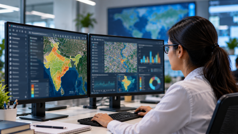
From Static Maps to Living Systems
What if a city could see itself not only as it exists today, but as it existed yesterday and as it might evolve tomorrow?
A geospatial digital twin makes this possible.
A geospatial digital twin is more than a 3D model. It is a living, spatially enabled system that integrates real-world infrastructure, land use, environmental conditions, and population dynamics into a unified digital environment. It brings together historical data, real-time feeds, advanced analytics, and scenario planning into one authoritative platform for decision-making.
For Urban Infrastructure Service Provider (UISP) and local governments, this represents a fundamental shift; from reactive governance to predictive and data-driven administration.
Why Geospatial Technology Is the Foundation
Every decision a UISPs or governments makes is tied to location.
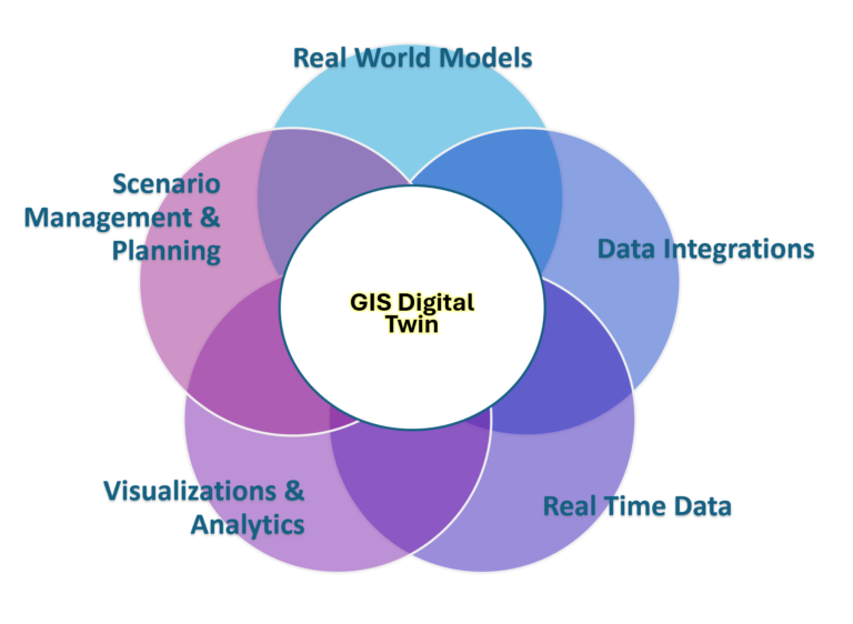
Whether it is urban expansion, infrastructure investment, environmental monitoring, agricultural planning, or citizen services, geography provides the common operating picture. A geospatial digital twin aggregates diverse datasets and reveals how they interact spatially, offering leaders clarity that traditional siloed systems cannot provide.
The result is an intelligent edge: decisions are no longer based on isolated reports but on contextual, location-aware insights.
A Phased Approach to Building an Urban-Level Digital Twin
Creating a digital twin for an entire captive city may appear overwhelming. However, when approached in structured phases, it becomes both achievable and scalable.
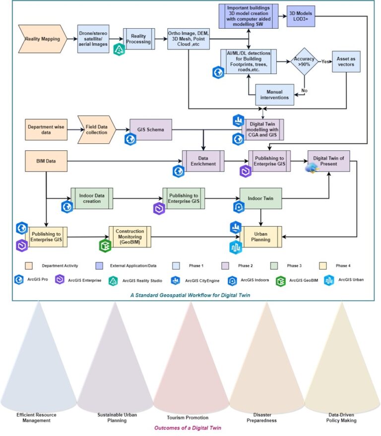
Phase 1: Reality Mapping — Capturing the Physical World
Every digital twin begins with accurate reality capture.
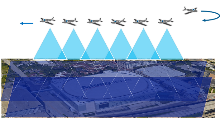
High-resolution drone surveys form the backbone of this phase, enabling detailed representation of the built and natural environment. Through structured aerial data acquisition and advanced processing engines within modern Esri platforms, UISP can generate:
- 3D meshes
- Digital Elevation Models (DEM)
- High-density point clouds
- Orthomosaic imagery
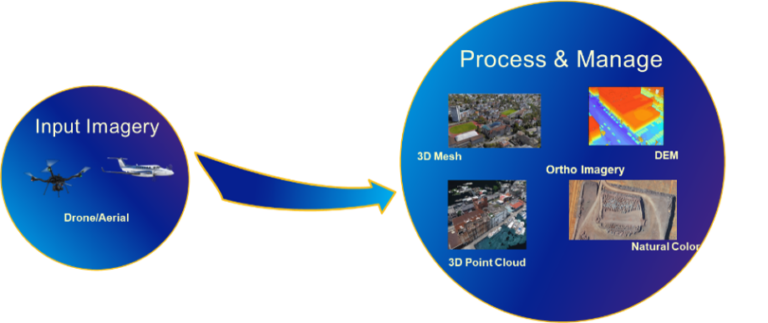
Beyond visualization, AI-powered tools can automatically extract features such as buildings, trees, and roads, accelerating the transition from raw imagery to structured intelligence.
This phase transforms the physical landscape into a measurable and analysable digital asset.
Phase 2: Integrating Data into an Operational Digital Twin
Once reality capturing is completed, the next step is transformation from static 3D outputs to an interactive enterprise system.
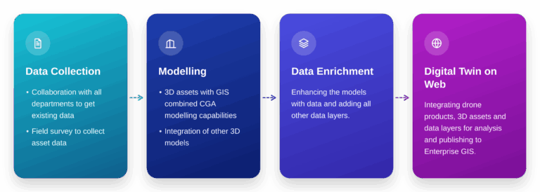
By integrating spatial datasets into an enterprise GIS environment, departments can:
- Create 3D monitoring dashboards
- Deploy web and mobile applications
- Enable operational oversight across agencies
- Facilitate stakeholder collaboration
The digital twin becomes accessible not just to GIS specialists, but to planners, administrators, engineers, and even citizens.
Advanced visualization through immersive technologies further enhances stakeholder engagement, allowing decision-makers to experience development scenarios before implementation.
This phase converts data into operational intelligence.
Phase 3: Extending the Twin Indoors
A city does not end at its building footprint.
Indoor GIS enables the creation of highly detailed digital replicas of critical buildings such as hospitals, government offices, and heritage sites. With indoor positioning technologies, users can:
- Navigate facilities in real time
- Optimize space allocation
- Improve visitor experience
- Support emergency response
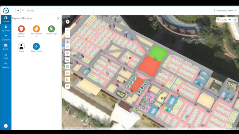
For historical landmarks, indoor twins open opportunities for immersive tourism and virtual exploration. For administrative facilities, they streamline operations and enhance service delivery.
The digital twin now becomes multi-dimensional—above ground, underground, and inside buildings.
Phase 4: The Planning Twin — Designing the Future
Once the present is digitally represented, UISPs can begin shaping the future.
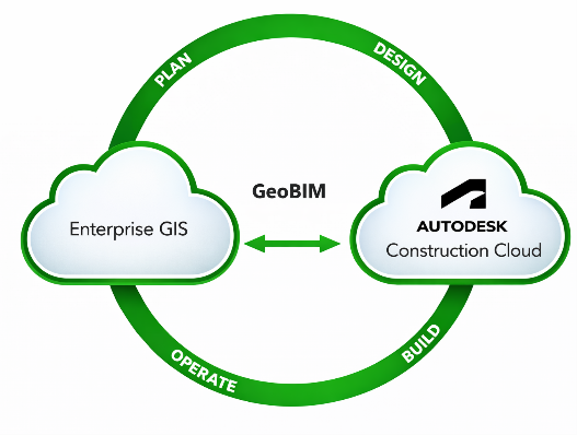
Construction Management Integration
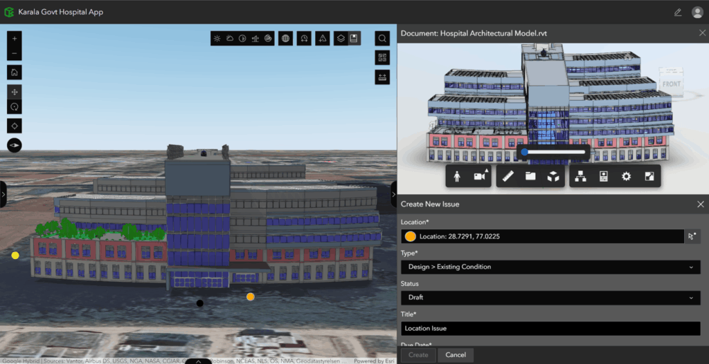
By integrating Building Information Modelling (BIM) data into the geospatial environment, construction projects gain spatial context. Engineering models can be visualized alongside environmental conditions, infrastructure networks, and regulatory frameworks.
This enables:
- Improved interdepartmental coordination
- Real-time construction monitoring
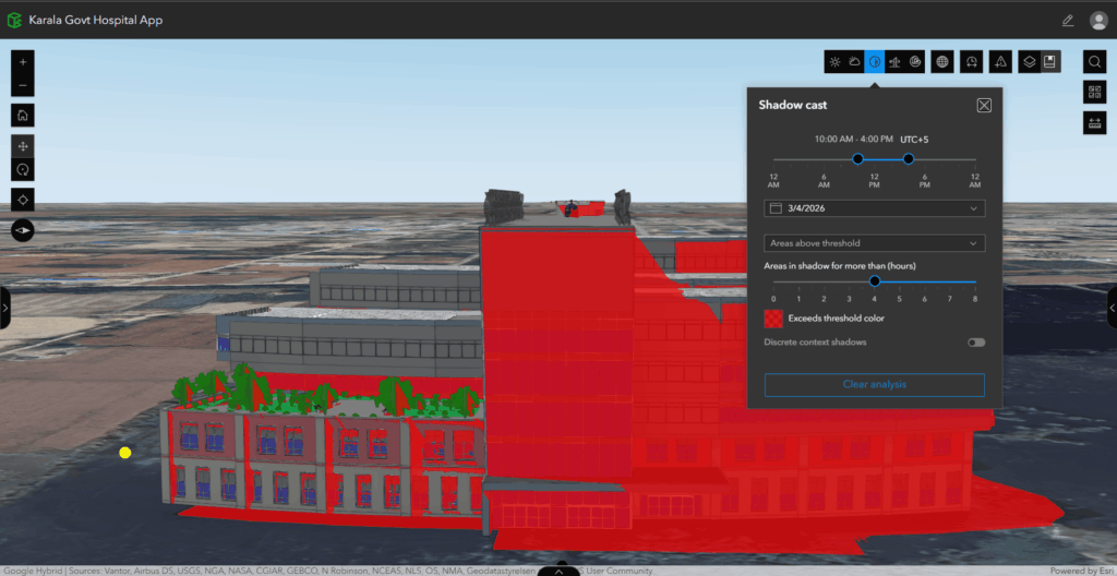
- Environmental impact simulations
- Centralized review of engineering documentation
Construction becomes transparent, collaborative, and geographically aware.
-
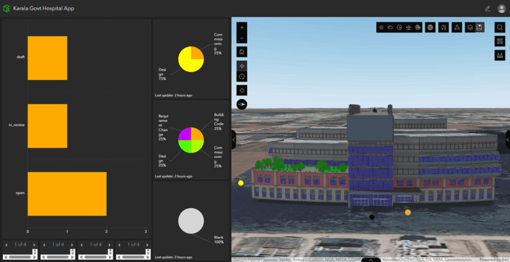
1. Issues Dashboard within ArcGIS GeoBIM
Urban Planning and Redevelopment
Perhaps the most transformative capability of a digital twin lies in scenario-based urban planning.
Planning authorities can:
- Define zoning regulations and land-use constraints
- Model redevelopment scenarios
- Simulate demolition and reconstruction
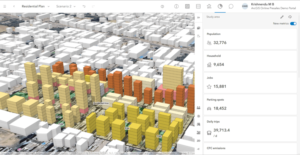
- Generate performance indicators in real time
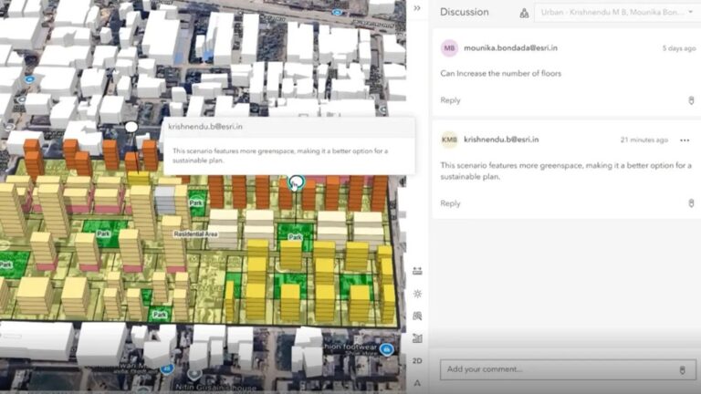
Dashboards can dynamically reflect projected impacts such as job creation, parking demand, water requirements, carbon emissions, and waste generation.
Planners can compare multiple scenarios, collaborate with stakeholders, and invite public feedback directly within the platform.
ArcGIS Urban shifts urban planning from static master plans to interactive, data-driven scenario modelling. Further, ArcGIS CityEngine can be used to create detailed 3D environments with building facades, streetscapes, and landscaping, helping planners and stakeholders visualize proposed developments and understand their design impact before implementation.
-
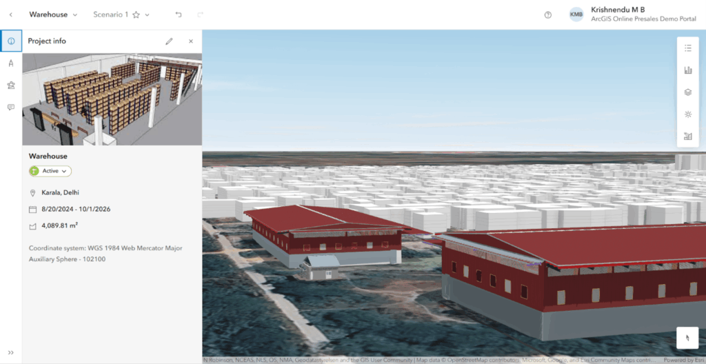
1. Projects in ArcGIS Urban for short term projects
Strategic Benefits of a Captive City Digital Twin
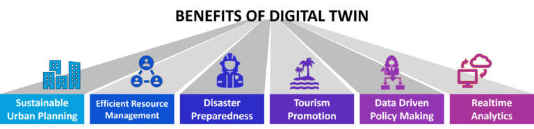
A digital twin is not only a visual representation of a city. It becomes a decision support system that strengthens governance, improves planning, and builds long term resilience. When implemented thoughtfully, it delivers value across infrastructure, heritage conservation, disaster preparedness, tourism, education, and public participation.
While the concept is highly relevant for captive or industrial cities, the same approach can be equally valuable for state governments and Urban Local Bodies (ULBs) responsible for planning, managing, and monitoring urban infrastructure at larger scales.
Moving Toward Intelligent Cities
A geospatial digital twin is not merely a visualization tool. It is a strategic governance platform.
As states and cities face increasing pressure from rapid urbanization, climate change, infrastructure demands, and rising citizen expectations, digital twins offer a scalable path toward resilience and sustainability.
The future of governance is not static. It is spatial, intelligent, collaborative, and predictive.
And the journey begins with location intelligence!

Krishnendu M B is a geospatial professional specialized in developing scalable GIS solutions that address real-world challenges.