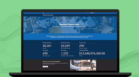
Equitable Property Value Initiative
A configuration of ArcGIS Hub that provides a direct access point for all stakeholders to attain authoritative parcel data and services online.

Improve public trust and confidence with public-facing technology
Give the public usable, authoritative assessment data in maps and apps so citizens can find answers to common questions. Delivering online self-service data, maps, and apps reduces customer visits and telephone calls while increasing transparency.
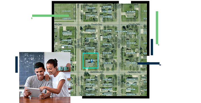
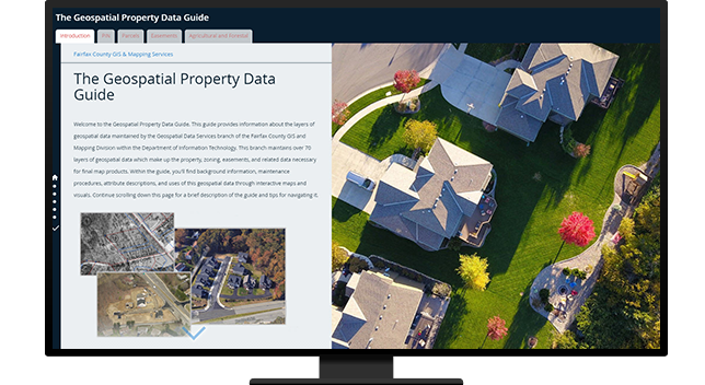
Data is critical to decision making for citizens and taxpayers. Whether buying a house or opening a new business, authoritative information is essential. Esri India’s SaaS open data capabilities provide your community with the authoritative data they need to make better decisions and accomplish their goals.
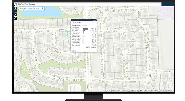
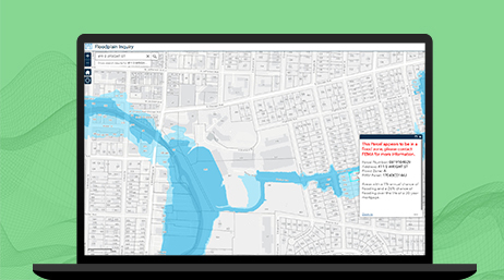
Choose from a variety of pre-configured apps to locate property in the flood plain, discover comparable sales, and publish assessed values and property tax allocation. Or, configure your own apps to deliver information to specific communities like planners, real estate professionals, developers, and surveyors.
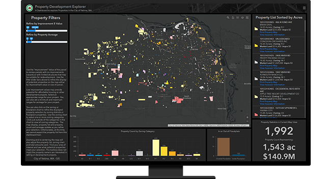
Defending appeals costs local governments significant resources. With GIS you can improve public trust and confidence and better defend values with maps and easy-to-use information products. Story maps, web maps, and apps provide an effective way to communicate complex analysis with taxpayers.
Equitable Property Value Initiative
ArcGIS Hub
ArcGIS StoryMaps
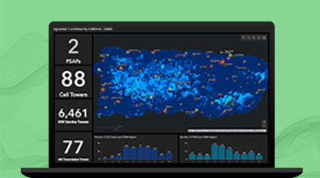
ArcGIS Operations Dashboard
Engage the Public Solutions
Please fill out your details below for us to contact you for the demo.
Write to us at info@esri.in
Talk to us over the phone