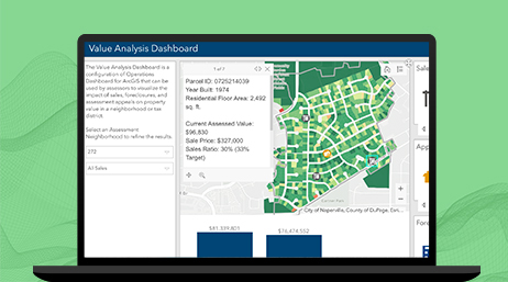
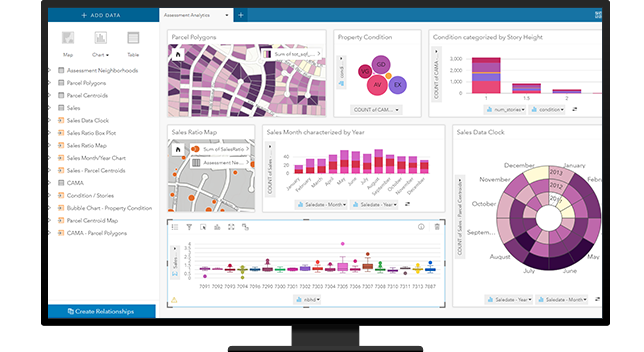
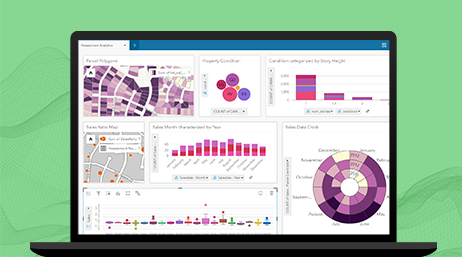
Parcel Value Analysis
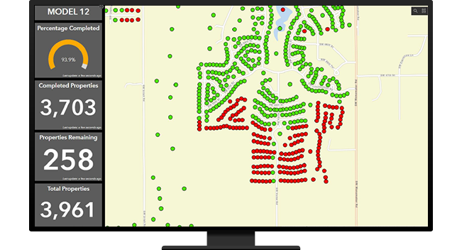
Assessors can use this dashboard to visualize the impact of sales, foreclosures, and assessment appeals on property value in a neighborhood.

Accurately determine and visualize property values with GIS
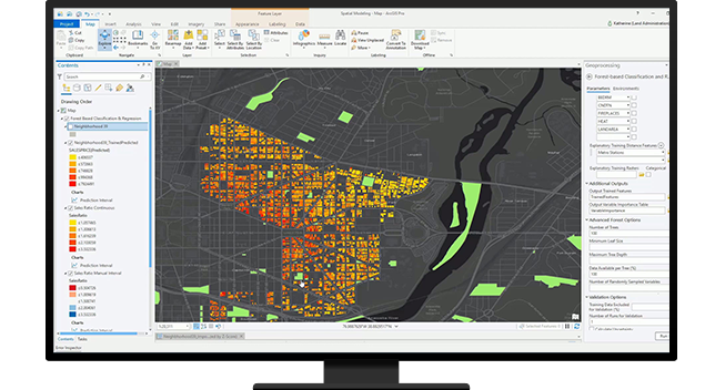
Improve your valuations and analysis with spatial statistics. ArcGIS spatial analytical capabilities include geographic weighted regression, ordinary least squares, forest-based classification, artificial intelligence, and machine learning to support your existing and new models.
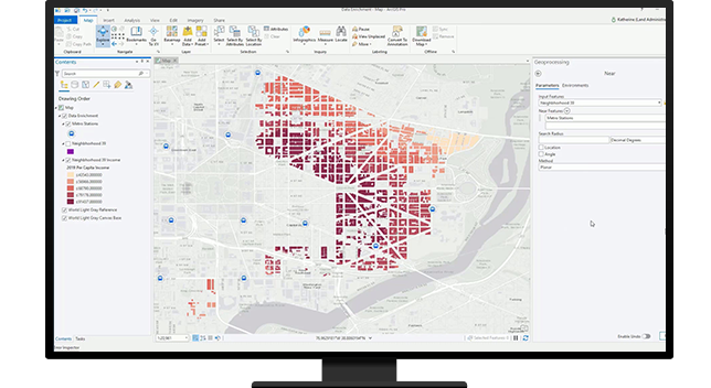
Use location to augment your property characteristics data with geoenrichment. With ArcGIS GeoEnrichment Service you can append additional property characteristics to your data, improving data quality, analysis, and valuations that are defendable, fair, and equitable.
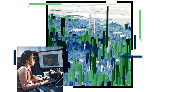
Use ArcGIS mapping capabilities to easily visualize trends and patterns in your valuation data. Understand how location affects value. Use charts, graphs, and maps that work together to deliver insight and improve your data by detecting errors and outliers.
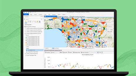
Maximizing productivity for field personnel is centered around location. Esri India's location technology enables local government to locate staff, assign work, and route staff throughout the day. With a user-friendly solution that requires little to no training, staff can now reduce errors, boost productivity, and save their organization money.
Parcel Value Analysis
ArcGIS Pro
ArcGIS Spatial Analyst
ArcGIS Geostatistical Analyst
ArcGIS Insights

Workforce for ArcGIS
Please fill out your details below for us to contact you for the demo.
Write to us at info@esri.in
Talk to us over the phone