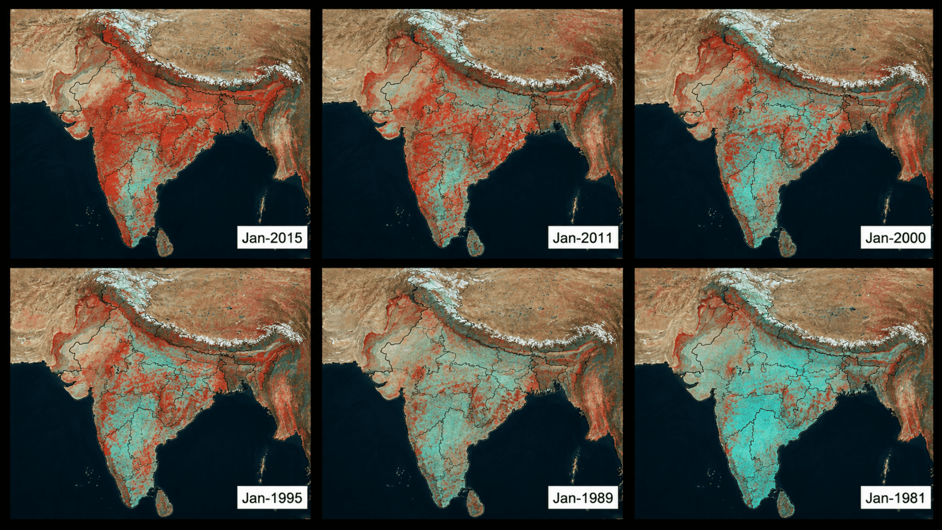
Esri India Marketing | May 12, 2026 Change Detection Using Satellite Imagery: How India Is Tracking Urban Sprawl
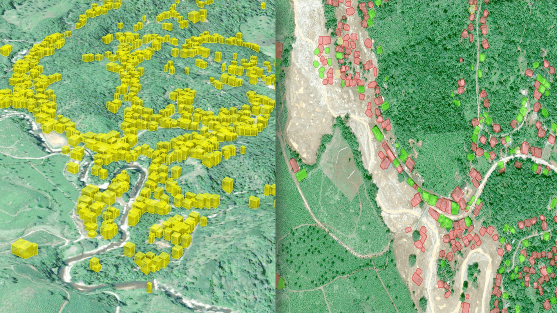
Esri India Pre Sales | March 31, 2026 A New Era of Crop Mapping via Remote Sensing Foundation Models in ArcGIS Pro