Policy making and effective governance are critical for a developing nation. Adding spatial components makes designing policy, implementation and monitoring far more effective and efficient. Outcome of such endeavour is improvement in service delivery.
Ministry of Housing and Urban Affairs (MoHUA), Government of India actively uses spatial data for urban governance. With the vision of encouraging open data and collaboration, MoHUA, envision and built India Urban Observatory (IUO) using Esri’s revolutionary ArcGIS Hub.
ArcGIS Hub serves as a platform to provide access to datasets and applications. It can be utilised as platform over which to different stakeholders can collaborate to create spatial maps and applications. Hubs can also be used for citizen engagement by creating public centric initiatives.
Below framework has been used to create the IUO on ArcGIS Hub
")
The Key Features of the India Urban Observatory are as follows:
- Data Stories of urban India highlighting use of GIS analytical and visualization. Urban stories are built around urban issues like patterns of urbanization in the country, demographic distribution, and urban planning & development.
- Comparing the urbanization scenarios globally, nationally, state wise and city wise through GIS enabled dashboards.
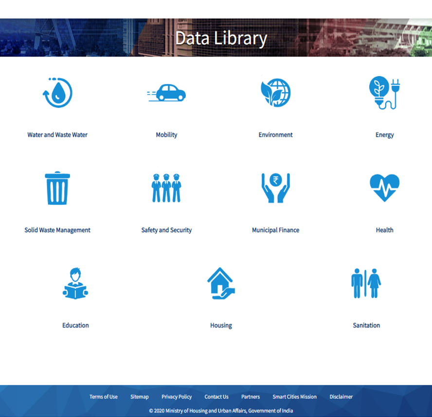
- Data library for exploring geospatial data.
- Map viewer for creating maps using data.
- Initiatives for public engagement.
National, State and City Insights
Nationally different critical parameters like Air Quality, liveable cities, planning preparedness of cities etc. These national comparisons help to identify the problem areas and helps driving actions to support the areas which are lagging. Similarly, there are state-wide comparison theme which have been designed on women safety, aerosol etc. These GIS visualization of the data helps in taking actions in the unsafe area, by respective state government.
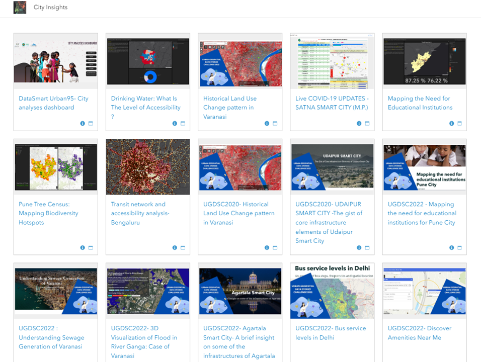
City Insights provides different GIS based dashboards to bring about urban analytics like drinking water accessibility in Indian cities, changing landuse patterns of city (Varanasi) and mapping bio diversity of Pune city.
The IUO is also a repository of open data, providing both spatial data, non-spatial data, documents etc. This data may be explored, downloaded in different formats, can be utilised for building applications and undertaking research. Unique point on the data is that these datasets can be downloaded either in the form of .csv, .kml, shapefile and in GeoJSON formats.
IUO also supports a Map Viewer, whereby different layers of information may be added, overlaid and thematically analysed. Map Viewer helps to create and explore a wide range of maps in ArcGIS Online. Using Map Viewer, the users can create interactive web maps that can be shared as well. Map Viewer includes two vertical toolbars—the Contents (dark) toolbar and the Settings (light) toolbar. Contents tool bar helps to manage and view the map contents and work with the map. While Settings toolbar helps to access options for configuring and interacting with map layers and other map components.
-
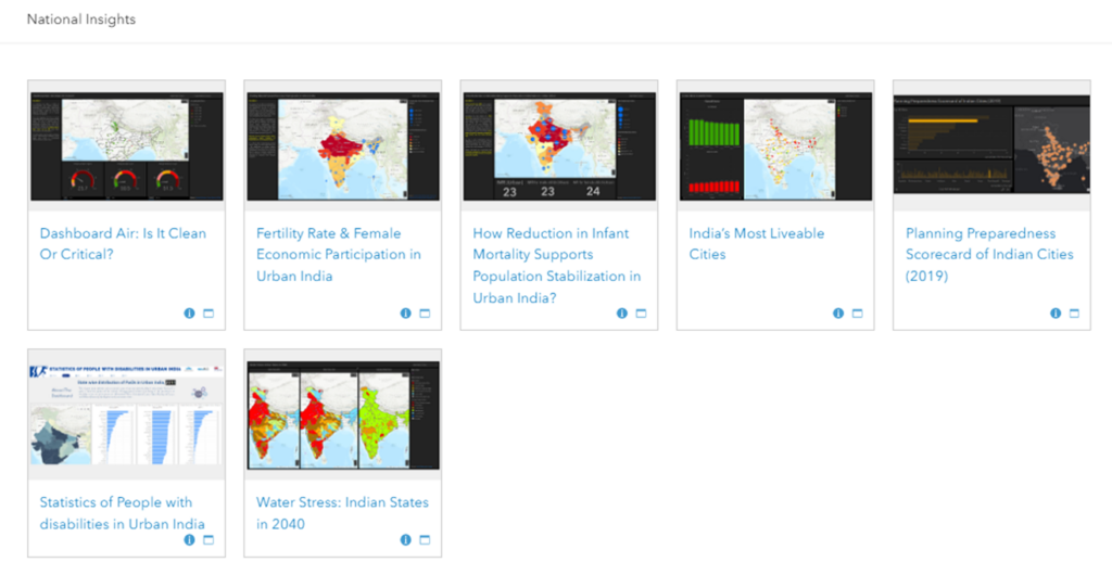
Figure 2 : National Insights
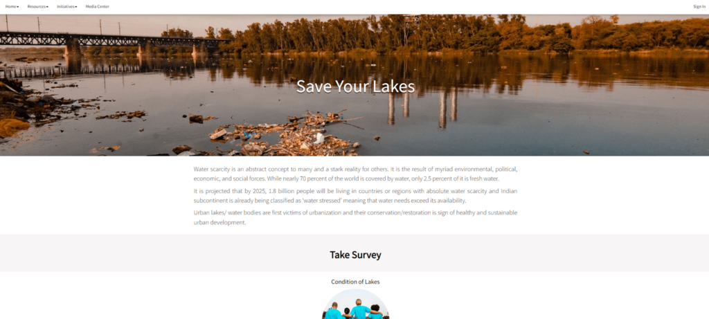
IUO also hosts initiatives. An initiative bundles content—such as apps, datasets, sites, and pages—around a project, topic, or goal. As of now IUO runs a “Save the lake” initiative for the cities to map their lakes and wetlands in the city. Such initiative provides opportunity for cities to engage with citizens, environment protection groups, NGO etc.
IUO thus serves not only as geo-spatial hub but also as a lab to conduct urban research, collaborate with citizens and highlight the success urban stories. IUO in coming years intends to focus on the following aspects:
- Bringing all the urban mission programs at one location.
- Creating a platform to connect cities to states to national governance.
- A platform collaborating the urban research on various aspects of cities.
- Churning the data generated from different open sources, departments, city data officers, and crowd sourced data.
- Create platforms to connect city services through data such as public digital data, apps, social media data, and sensors data.
- Providing an insight into how the data analytics can be integrated in planning, policy response and the challenges faced by the city.
- Enhancing citizen participation in decision making for improving transparency, accountability there by giving citizens a voice in planning and development of the city.
-
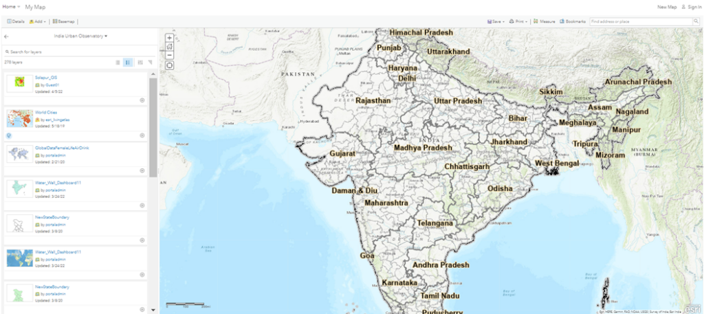
Figure 5
Conclusion:
IUO is one of its kind in entire India. Similar geo-hubs can be developed by the state and cities for making data and applications accessible to everyone at any time. This would bring forwards the co-creation and collaboration that is the need of the hour for solving complex urban problems. It would also serve as example of transparent systems there by reinforcing the best practices adopted by cities in solving urban issues.

As the Urban Presales Head, I design GIS solutions for Urban Planning Development and Management.