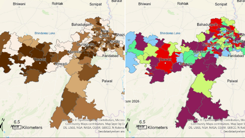
India’s Shift Towards Smarter Logistics
India’s logistics sector is going through a major shift. Over the last few years, the country has invested heavily in highways, dedicated freight corridors, ports, logistics parks, and digital infrastructure. These investments are already showing results. According to the shared report, India’s logistics cost has reduced to 10–10.7% of GDP in FY2026, compared with 13–14% nearly a decade ago. India’s Logistics Performance Index ranking has also improved from 54th in 2014 to 38th in 2023.
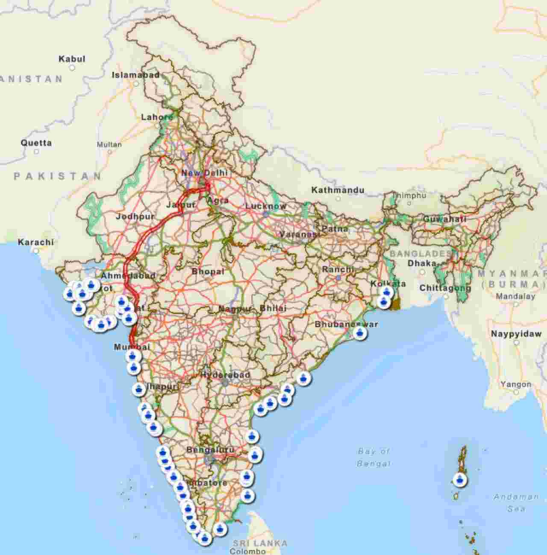
A key initiative under PM GatiShakti to strengthen this logistics network is the Dedicated Freight Corridor. It separates freight movement from passenger traffic, making goods transport faster, more reliable, and higher in capacity. Double-stack containers and electrified freight routes further improve this advantage by increasing carrying capacity, reducing long-haul truck movement, lowering road congestion, reducing diesel dependency, and supporting cleaner logistics. For sectors such as automotive, FMCG, e-commerce, cement, steel, food grains, and industrial goods, this creates a stronger balance between cost, reliability, and sustainability.
Challenges of Fragmented Logistics Planning
Despite this progress, logistics companies still face several practical challenges when decisions are made without a strong location-based view. Routes may be planned using separate systems or manual judgment, without clearly seeing roads, rail corridors, ports, terminals, warehouses, customer locations, and bottlenecks together. This can lead to inefficient route selection, weak first-mile and last-mile planning, delayed response during disruptions, and higher operating cost. A route may look suitable on paper, but the nearest terminal, rail yard, or port may not have enough capacity on that day. Without GIS, teams often have data, but they do not have a connected view of where assets are, how routes are performing, where delays may occur, and which movement option is most practical.
Connecting Logistics Assets Through GIS
The next stage of logistics transformation is about making all these assets work together as one connected system. This is where GIS-based solutions play a major role. With Esri technology, ArcGIS helps to convert infrastructure into operational intelligence.
Over the years, ArcGIS has been widely adopted by both government and commercial organizations to solve location-based challenges. Governments have used it for urban planning, infrastructure development, transportation, disaster response, utilities, and public service delivery. At the same time, businesses across logistics, manufacturing, retail, real estate, energy, and telecom have used ArcGIS to understand markets, optimize networks, manage assets, and improve operations.
In logistics, ArcGIS can represent the entire network as a connected system of roads, rail corridors, ports, rail yards, warehouses, logistics parks, and transfer points. This helps planners to compare road-only, rail-based, maritime-based, and multimodal movement. They can evaluate distance, travel time, cost, emissions, and operational feasibility. Instead of only asking, “Which route is shortest?”, the system can answer a more practical question: “Which route is actually workable today?”
That difference matters because ArcGIS also allows organizations to develop custom networks based on their own logistics reality, such as plants, warehouses, nearest ICDs, private sidings, and custom freight rail speeds.
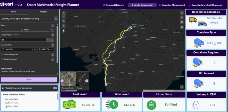
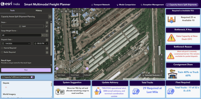
For example, a company may want to move 1,800 tonnes of cargo. If one 20-foot container carries 20 tonnes, the shipment requires 90 TEU. But if the rail yard has capacity for only 10 TEU on the selected date, the full shipment cannot move by rail. A capacity-aware planning system can recommend how much consignment can move by rail and how much should move by road. It can also calculate the required trucks for first & last mile delivery, show the bottleneck on the map, and explain the recommendation in simple business language.
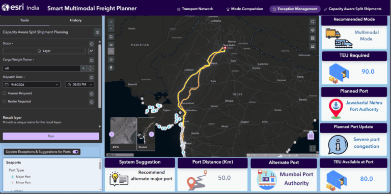
The same capability can support port disruption planning. When a planned port is congested or unavailable, teams should not have to manually check multiple systems to find alternatives. ArcGIS-based solution can identify nearby suitable ports, check connectivity, consider available capacity, and recommend the best alternate gateway. This can help to reduce delays and improve cargo evacuation planning. For government agencies, this kind of system can support infrastructure planning and policy decisions. It can show where multimodal logistics parks are needed, which industrial clusters have weak rail connectivity, where first & last mile gaps exist, which corridors are underutilized, and where road congestion can be reduced by shifting suitable freight to rail.
For industries, the same system can support daily logistics decisions. Automotive companies can use it for plant-to-port movement and export planning. FMCG and e-commerce companies can shift long-haul movement to rail where feasible while keeping trucks for first & last mile delivery. Cement, steel, and mineral companies can use it for bulk freight movement and terminal capacity planning from their own plants. Agriculture and food-grain supply chains can use it to manage seasonal cargo movement from production areas to markets, warehouses, or ports.
This shows that the value is not limited to one department or one industry. Any organization that moves goods across a large network can benefit from stronger location intelligence.
From Disconnected Systems to Connected Logistics Intelligence
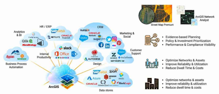
The real strength of ArcGIS is, that it can work as the common location layer between different systems such as ERP, TMS, WMS, port systems, railway systems, IoT feeds, and field operations. Each system may hold one part of the logistics picture. ArcGIS brings these parts together on a map.
The business value is clear. GIS-based route and mode selection can help to reduce logistics cost, while capacity visibility can reduce delays. Alternate planning improves resilience during disruptions, and stronger first-mile and last-mile analysis makes logistics parks and terminals more effective. Emission visibility also supports cleaner and more sustainable freight movement.
The future of logistics is not only about moving goods from one place to another. It is about moving them through the right mode, through the right route, at the right time, with the right capacity, and with the least possible cost and impact.
India has built the infrastructure for a modern logistics network. With ArcGIS, that network can become smarter, more connected, and more efficient.

Tanisha Jaiswal, Assistant Manager – Pre-Sales, focuses on understanding client needs and delivering tailored solutions to drive business growth.