Organizations today rely heavily on location intelligence for routing, field mobility, logistics planning, asset management, emergency response, and citizen services. As these workflows become operational and enterprise-critical, the quality and reliability of the underlying street data become just as important as the GIS platform itself.
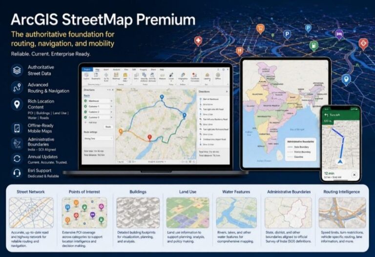
This is where ArcGIS StreetMap Premium plays a transformative role.
StreetMap Premium (SMP) is Esri’s authoritative, enterprise-ready street data product designed for advanced routing, geocoding, network analysis, and offline mobility workflows across ArcGIS applications. It provides organizations with a production-ready foundation for reliable mapping and navigation workflows in both connected and disconnected environments.
Esri India further enhances value of StreetMap Premium through India-specific administrative boundary alignment and support for national geospatial compliance requirements.
What is ArcGIS StreetMap Premium?
ArcGIS StreetMap Premium is a ready-to-use street data and routing solution that integrates seamlessly with the ArcGIS ecosystem, including:
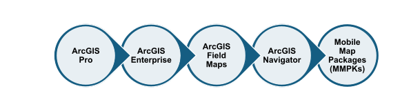
Unlike datasets that require extensive preparation and normalization before operational use, StreetMap Premium is designed to work out of the box for enterprise GIS workflows.
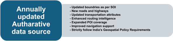
Key Features of StreetMap Premium




Why Organizations Choose ArcGIS StreetMap Premium
Organizations adopting enterprise GIS increasingly require datasets that are:
- Reliable
- Scalable
- Consistent
- Operationally ready
- Compliant with regional requirements
- Integrated with enterprise workflows
StreetMap Premium addresses these needs by combining authoritative street content, advanced routing intelligence, offline mobility support, and seamless ArcGIS integration into a single enterprise solution.
It helps organizations move from basic mapping toward production-grade location intelligence capable of supporting mission-critical operations.
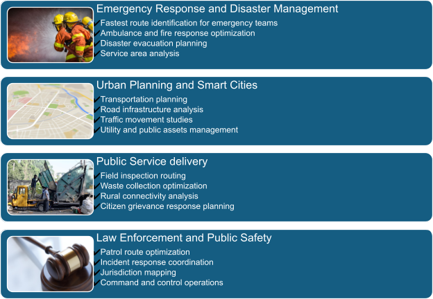
Government Use Cases
Government organizations increasingly depend on location intelligence for citizen services and operational planning. StreetMap Premium supports a wide range of public sector workflows.
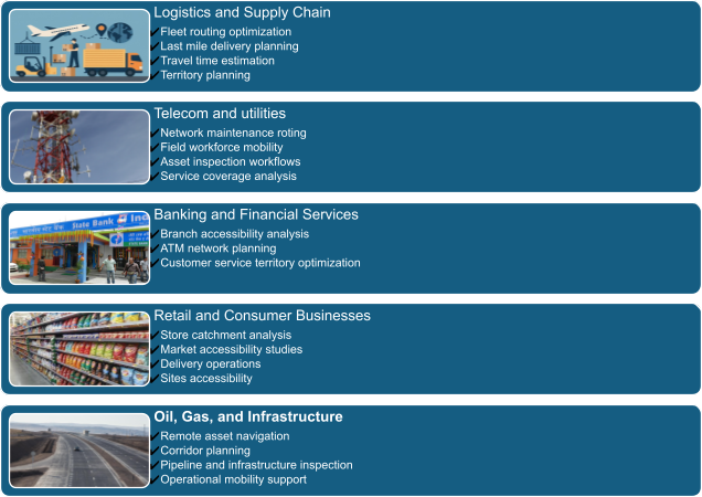
Non-Government and Enterprise Use Cases
StreetMap Premium also delivers strong value across commercial and enterprise sectors.
Conclusion
As routing and mobility workflows become central to enterprise operations, the importance of trusted street data continues to grow.
ArcGIS StreetMap Premium provides organizations with a reliable, scalable, and enterprise-ready foundation for routing, navigation, geocoding, and offline GIS workflows. From government agencies and smart cities to logistics providers and utilities, SMP enables organizations to confidently deploy operational GIS solutions across desktop, enterprise, and field environments.
With authoritative data, advanced navigation intelligence, India-specific enhancements, and seamless ArcGIS integration, StreetMap Premium empowers organizations to build smarter, faster, and more reliable location-driven operations.
Connect with us to explore how StreetMap Premium can support your routing, geocoding, navigation, and enterprise mapping initiatives with the reliability and expertise needed for operational success.

Roushan Kumar is a Senior Product Lead at Esri India, managing Indo ArcGIS StreetMap Premium, ArcGIS Business Analyst, and the Esri Raster and Vector Basemaps Data Pack, enabling organizations to build reliable routing, location intelligence, and data-driven GIS solutions.