Understanding subsurface geology is a critical part of mining exploration and resource evaluation. Exploration drilling provides valuable information about lithology, mineralization, and geological structures beneath the ground surface. Borehole logs capture these observations at specific drilling locations and form the foundation for geological interpretation.
However, borehole data represents information collected only at discrete points. When interpreted using traditional tables or two-dimensional maps, it can be difficult to understand how geological materials are distributed between boreholes or how these materials vary across an exploration area.
Geographic Information System (GIS) provide a powerful way to integrate drilling data with other spatial datasets and visualize subsurface geology. Using ArcGIS Pro, borehole datasets can be analyzed using geostatistical methods and visualized in three dimensions. This article demonstrates how borehole data can be transformed into a voxel-based subsurface model using Empirical Bayesian Kriging and multidimensional NetCDF datasets.
Workflow Overview
The following workflow demonstrates how borehole data can be transformed into a volumetric subsurface model:
- Import borehole data and convert intervals into 3D points
- Generate a geostatistical layer using Empirical Bayesian Kriging
- Analyze lithology variation with depth
- Convert the geostatistical output into NetCDF format
- Create a multidimensional voxel layer
- Visualize subsurface geological materials in 3D
This workflow allows mining professionals to move from discrete borehole observations to a continuous 3D representation of subsurface geology.
Preparing Borehole Data for 3D Analysis
Borehole datasets generally contain information such as:
- Borehole coordinates (X, Y)
- Surface elevation
- Depth intervals
- Lithology or Material Classification
Initially, boreholes appear as point features on a map. However, each borehole represents geological information collected along a vertical column beneath the surface.
By assigning Z-values representing depth or elevation, borehole records can be visualized as 3D points in a Local Scene within ArcGIS Pro. This enables geologists to explore how geological materials vary vertically.
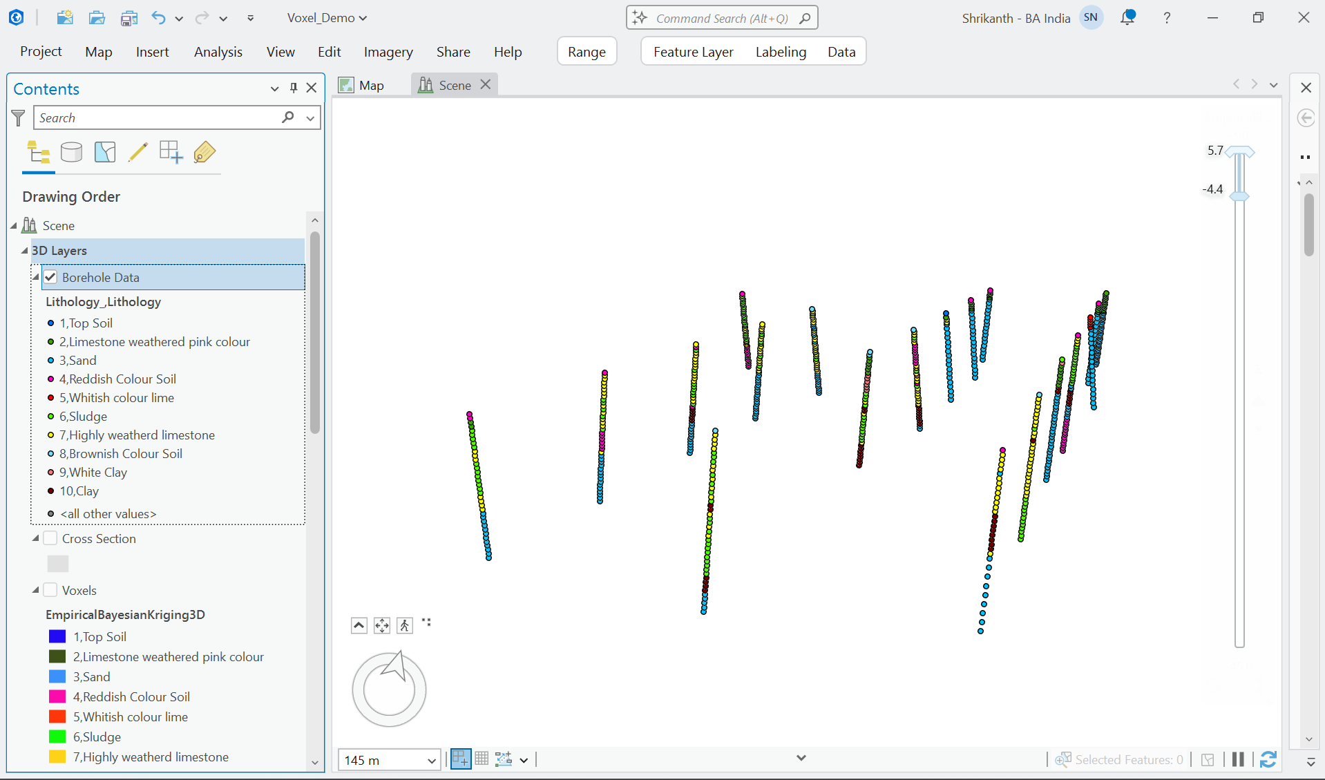
a) Borehole intervals visualized as 3D points in ArcGIS Pro
This initial visualization provides insight into subsurface conditions before further geostatistical analysis is performed.
Estimating Subsurface Distribution Using Empirical Bayesian Kriging
Borehole drilling provides information only at specific locations. To understand geological conditions between boreholes, spatial interpolation techniques are required.
ArcGIS Pro provides Empirical Bayesian Kriging (EBK) through the Geostatistical Analyst extension. EBK evaluates spatial relationships in the borehole dataset and generates a continuous geostatistical layer representing predicted lithology distribution.
Unlike traditional kriging approaches, EBK automatically accounts for uncertainty by repeatedly simulating semivariograms. This makes it particularly useful when dealing with limited or unevenly distributed datasets.
Geostatistical modeling enables users to:
- Estimate values in unsampled areas
- Identify spatial trends in geological data
- Generate predictive subsurface models
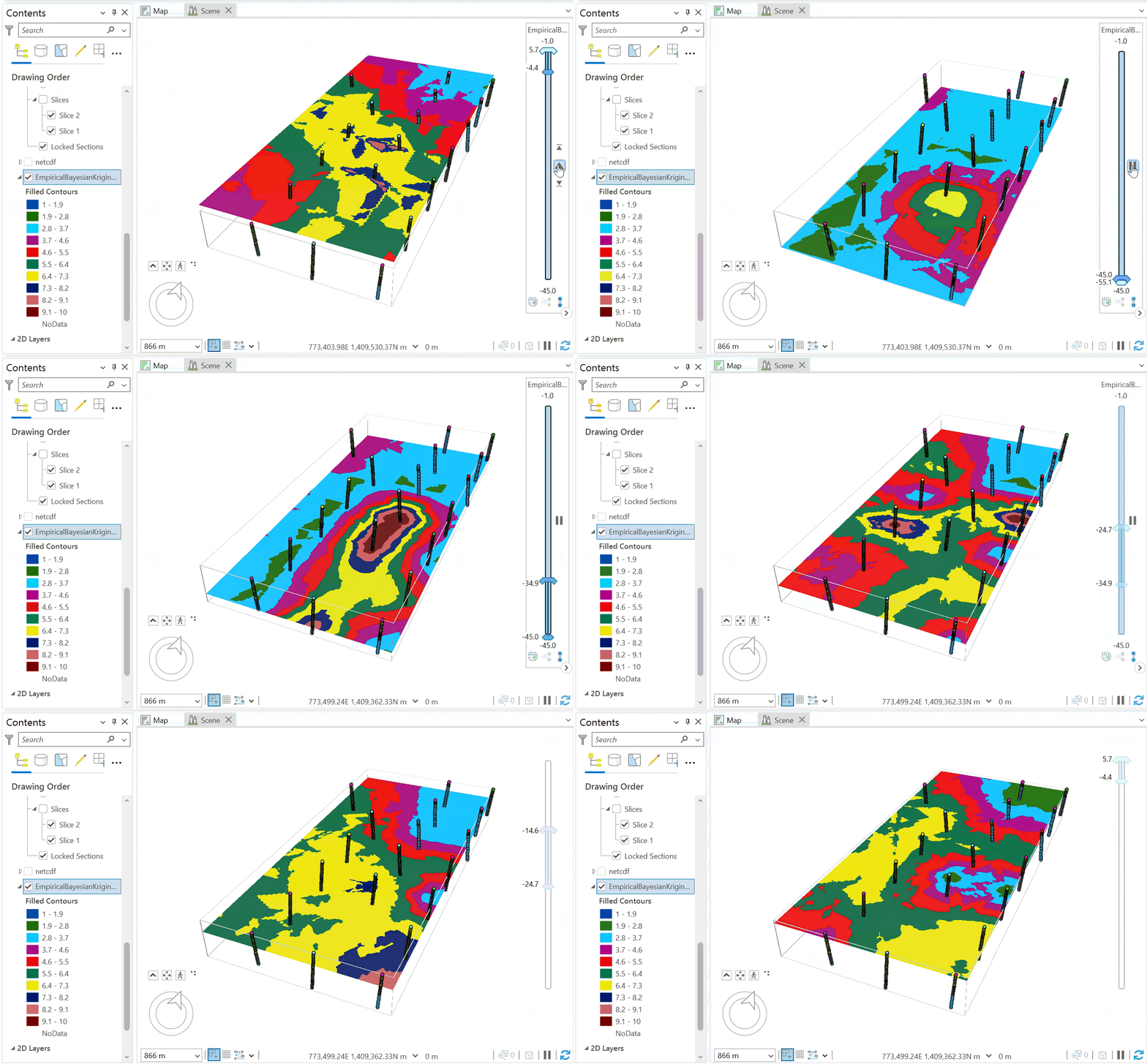
b) Geostatistical layer generated using Empirical Bayesian Kriging.
This step converts discrete borehole measurements into a continuous geological model, improving understanding of subsurface variability.
Exploring Geological Variation with Depth
Once the geostatistical layer is created, it can be explored across different depth levels. This allows geologists to analyze how geological materials change vertically across the deposit.
Depth-based exploration helps identify:
- transitions between lithological units
- potential mineralized zones
- ore and waste boundaries
- structural geological trends
Understanding these variations supports improved geological interpretation and exploration decision-making.
Converting Geostatistical Results to NetCDF
To manage the subsurface dataset across three spatial dimensions, the geostatistical output can be converted into NetCDF format.
NetCDF is a multidimensional scientific data format that stores information across X, Y, and Z dimensions. It is widely used in geoscience workflows because it efficiently handles large volumetric datasets.
Another advantage of NetCDF is interoperability. As an open data format, NetCDF datasets can be shared across multiple geological and mining platforms, enabling collaboration between GIS specialists, geologists, and mine planners.
Creating a Multidimensional Voxel Model
Once the dataset is stored in NetCDF format, it can be used to generate a multidimensional voxel layer in ArcGIS Pro.
Voxel layers divide the subsurface into small 3D grid cells, where each cell stores a value representing a geological property such as lithology.
This concept is similar to block models commonly used in mining software, where underground materials are represented using volumetric blocks.
Voxel layers allow users to:
- visualize geological formations in 3D
- rotate and explore the subsurface model
- slice through the dataset to examine internal structures
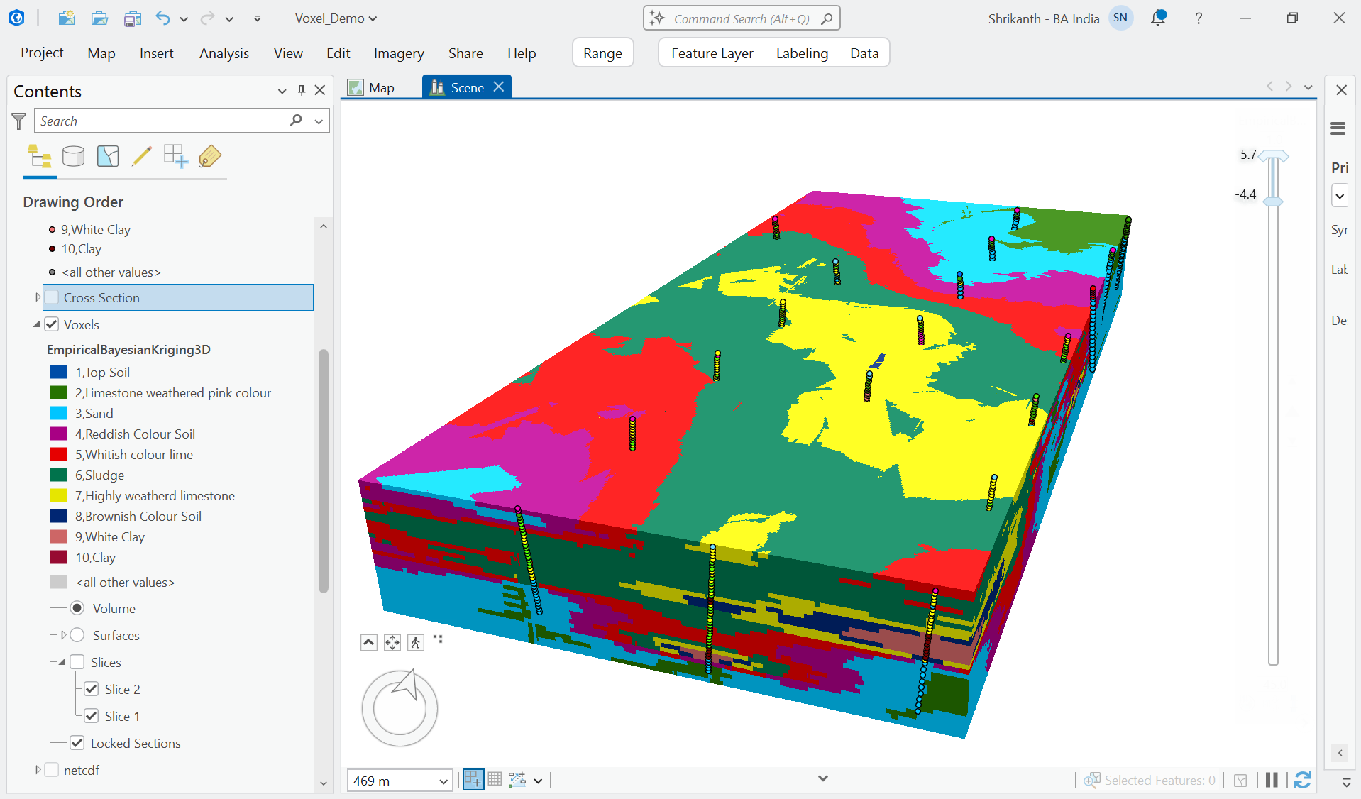
c) Multidimensional voxel layer representing subsurface lithology.

d) Voxel model showing only sand layers after filtering lithology types.
This interactive visualization provides a powerful way to interpret geological structures and material distribution.
Supporting Modern Mining Workflows
The integration of GIS and geostatistical modeling provides several advantages for mining workflows:
- Improved visualization of subsurface geology
- Better interpretation of borehole datasets
- Enhanced understanding of material distribution
- Support for exploration and resource analysis
These capabilities enable mining organizations to move beyond static datasets and develop interactive, data-driven geological models.
Conclusion
Subsurface modeling plays a critical role in mineral exploration and mine planning. By integrating borehole datasets with geostatistical analysis and multidimensional visualization, ArcGIS Pro enables mining professionals to build detailed 3D geological models.
Transforming borehole data into voxel-based subsurface models provides deeper insights into underground material distribution and supports better exploration decisions.
As mining operations continue to adopt data-driven technologies, GIS platforms like ArcGIS will remain essential tools for transforming geological data into actionable insights.

Shrikanth is a GIS Analyst at Esri India, focused on helping organizations solve real world challenges using GIS, Spatial Analysis and ArcGIS technologies.