
Indoor GIS for Smarter Infrastructure Management
July 19, 2023 | 11 am IST onwards
Indoor GIS for Smarter Infrastructure Management
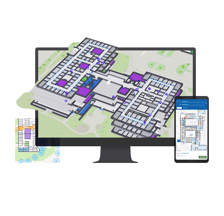
ArcGIS Indoors offers a solution for organizations to revolutionize indoor spaces using the power of GIS technology. By providing detailed indoor mapping, real-time positioning, space utilization analysis, indoor routing, and facilities management capabilities, ArcGIS Indoors empowers facilities managers, architects, and professionals across industries like retail, healthcare, hospitality, and transportation.
Key Takeaways
- Indoor Mapping and Visualization: ArcGIS Indoors enables the creation of detailed indoor maps that accurately represent the physical layout of buildings.
- Indoor Positioning System (IPS): With IPS integration, ArcGIS Indoors allows users to track and locate assets, people, and equipment in real-time within indoor environments.
- Space Utilization and Analysis: ArcGIS Indoors provides tools to analyze and optimize space utilization within indoor environments.
- Indoor Routing and Navigation: The solution offers indoor routing capabilities, allowing users to find the shortest or most efficient paths between different locations within buildings.
- Facilities Management: ArcGIS Indoors facilitates the management of building infrastructure and assets.
- Indoor Analytics: The solution enables the analysis of data collected within indoor spaces.
Who should attend?
Facilities managers, building operators, architects, urban planners, and professionals in industries such as retail, healthcare, hospitality, and transportation who are involved in managing and optimizing indoor spaces.
ArcGIS Indoors enables organizations to optimize indoor environments, improve operational efficiency, and deliver exceptional user experiences. Make the most of your indoor spaces with ArcGIS Indoors and leverage data-driven insights for smarter decision-making.
Speaker

Roma Malik,
Esri India