
Sustainable Development
Better understand the earth’s complex systems with location intelligence
SUCCESS STORY
Shrinking the Distance to Food Aid
USAID used predictive analysis tools to optimize food distribution sites, minimizing the distances women and children travel to receive aid.
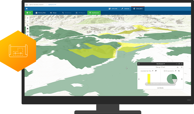
Plan effectively
ArcGIS workflows maximize the impact of projects by optimizing the distribution of resources. Get insight about where activities can be focused to best reach targets outlined in global Sustainable Development Goals.
Measure impact
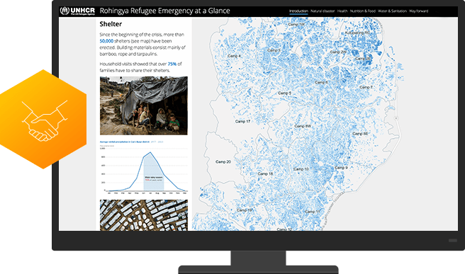
A location intelligence platform precisely measures results so you can justify expenditures and secure future funding. Take advantage of analytics that precisely assess program effectiveness and enable you to share it with all stakeholders via dashboards and map-based reports.

Strengthen partnerships
ArcGIS is as a collaboration hub that facilitates partner/client interaction. Leverage easy-to-configure apps, interactive maps, and authoritative data to engage grantees, beneficiaries, donors, and the public.
Request a demo
Please fill out your details below for us to contact you for the demo.
Get in touch with us
Email Us
Write to us at info@esri.in
Call Us
Talk to us over the phone