This webinar will explore how AI ML can be utilized for Automated feature identification from Satellite or DRONE data. It will also explore how AI-ML technology can collect information from videos and how multi-criteria-based AI models can be created and tested with real incidents and how it an be utilized at other locations.
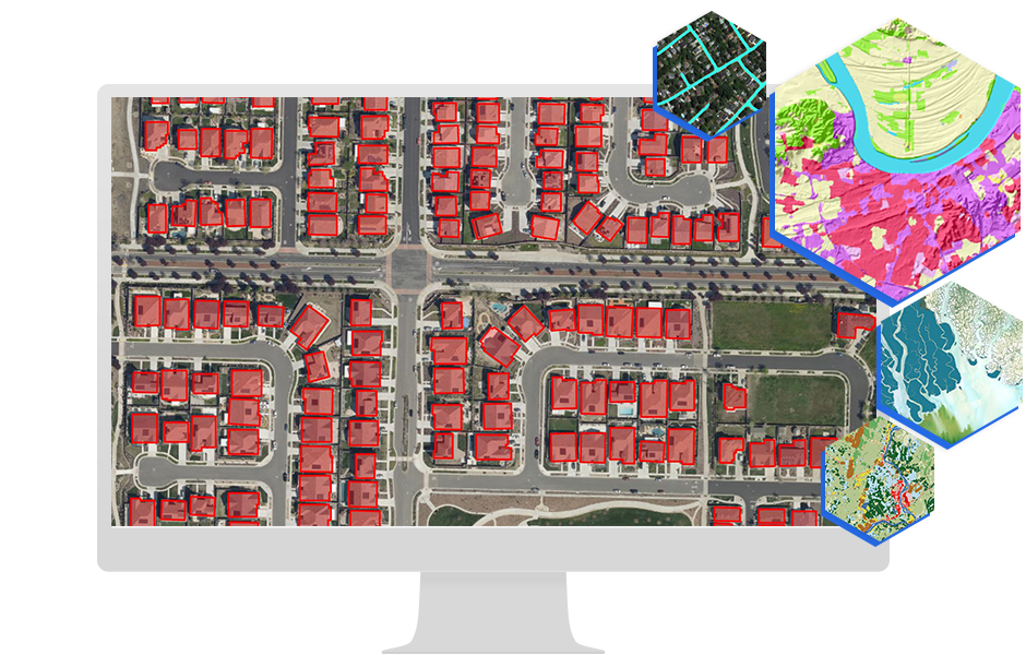
View Details: AI-ML in ArcGIS helps ULBs make smarter, faster planning and governance decisions by automating analysis and predicting future needs. GeoAI can detect unassessed properties, illegal constructions and land-use violations from imagery, while machine learning supports better planning of water supply, waste routes, traffic and disaster response. It can also predict road and asset deterioration, identify service gaps and improve citizen service delivery through automated grievance analysis and hotspot detection. Integrated into ArcGIS dashboards, these tools help ULBs shift from reactive to proactive, data-driven governance.