Cover Story
GIS Mapping a Better Future
GIS provides a platform to store, manage, and analyze geospatial data to help make informed decisions in a variety of fields.

GIS IN EDUCATION
Table of contents
GIS helps architects and urban designers by providing detailed geographic and spatial data, crucial for largescale projects. It aids in identifying spaces with specific attributes, enabling informed decision-making and efficient resource use. Keeping this in mind, the National Institute of Technology, Raipur offers Remote Sensing and GIS courses to senior undergraduates and postgraduates. We unfold the details through a discussion with Dr. Vivek Agnihotri, Assistant Professor, Department of Architecture and Planning, NIT, Raipur.

As technological advancements continue to permeate the architectural landscape, the utilization of tools like Building Information Modelling (BIM) and Geographic Information Systems (GIS) has become indispensable, particularly for larger projects. By analyzing spatial relationships and patterns, GIS aids in the optimization of urban design, contributing to sustainable and resilient urban environments. One of the most significant advantages of GIS is its ability to overlay various data layers, such as zoning information, demographic data, transportation networks, and environmental factors. This multi-layered analysis enables architects to develop comprehensive design solutions that address diverse aspects of urban planning. For instance, GIS can highlight areas prone to flooding, ensuring that infrastructure is designed to mitigate potential risks. It can also identify underutilized spaces that can be transformed into vibrant public areas, enhancing the overall quality of urban life. As urbanization continues to surge, the demand for architects who possess a robust understanding of GIS is growing. Emerging architects must equip themselves with GIS skills to remain competitive in the industry. Embracing this technology will empower them to create innovative, data-driven solutions that shape the future of our cities.
At the National Institute of Technology Raipur, the Department of Architecture and Planning offers Remote Sensing and GIS courses for both senior undergraduate and postgraduate students. These courses combine theoretical knowledge with practical, hands-on tutorials, providing a comprehensive learning experience.
Yes, there has been a noticeable change in the way architecture students approach urban problems today. This shift can be attributed to several factors, including advancements in technology, increased awareness of sustainability, and a greater emphasis on interdisciplinary collaboration. Students today are more conscious of the environmental impact of their designs and strive to create buildings and spaces that promote ecological balance. This includes incorporating green building practices, such as using renewable materials, optimizing energy efficiency, and enhancing water conservation.
Additionally, students are increasingly considering the social and economic aspects of sustainability, ensuring that their designs contribute to the well-being of communities. Interdisciplinary collaboration is another significant change in the way architecture students approach urban problems. Modern urban issues are complex and multifaceted, requiring input from various disciplines such as engineering, urban planning, sociology, and environmental science. Students are now more open to collaborating with professionals from these fields, leading to more holistic and integrated design solutions. This collaborative approach not only broadens their perspective but also fosters innovation and creativity. Moreover, architecture education is evolving to address contemporary urban challenges. Curricula are being updated to include topics such as disaster resilience, climate adaptation, and smart city planning. These changes ensure that students are well-prepared to tackle the pressing issues facing our cities today. In summary, architecture students are adopting a more innovative, sustainable, and collaborative approach to urban problems. This transformation is driven by technological advancements, heightened awareness of sustainability, and interdisciplinary collaboration, enabling them to develop solutions that are responsive to the complexities of modern urban environments.
Equipping architecture students with knowledge of advanced technologies like Artificial Intelligence (AI) and Machine Learning (ML) is crucial for shaping the future of architectural design. As the world becomes increasingly interconnected and technology-driven, the architecture profession must evolve to meet the demands of contemporary society. AI and ML are transformative technologies that offer significant advantages in architectural design and planning. AI can automate repetitive tasks, such as drafting and data analysis, allowing architects to focus on more creative and strategic aspects of their work. For example, AI-powered tools can generate multiple design options based on specific parameters, enabling architects to explore a wider range of possibilities and make more informed decisions. Machine Learning, a subset of AI, excels at identifying patterns and making predictions based on large datasets. In architecture, ML can analyze historical data, environmental factors, and user preferences to optimize building performance and sustainability. For instance, ML algorithms can predict energy consumption patterns, helping architects design energy-efficient buildings that reduce environmental impact. Furthermore, AI and ML can enhance the accuracy and efficiency of urban planning. By analyzing vast amounts of spatial data, these technologies can identify optimal locations for new developments, assess the impact of proposed projects on traffic and infrastructure, and suggest sustainable solutions for urban growth. This data-driven approach ensures that architectural designs are not only aesthetically pleasing but also functional and contextually appropriate. Integrating AI and ML into architectural education prepares students to navigate the complexities of the modern built environment. By mastering these technologies, future architects will be better equipped to tackle pressing challenges such as climate change, urbanization, and resource management. Additionally, proficiency in AI and ML will enable architects to stay competitive in an increasingly technology-driven industry.
In summary, imparting knowledge of advanced technologies like AI and ML to architecture students is essential for fostering innovation and creating better architectural marvels. These technologies empower architects to design smarter, more sustainable, and resilient structures that meet the needs of the future.

To download the PDF version of this article, click the button below.
GIS provides a platform to store, manage, and analyze geospatial data to help make informed decisions in a variety of fields.
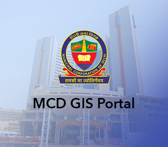
The MCD GIS citizen portal is a step towards better governance taken by the Municipal Corporation of Delhi to allow the citizens of Delhi to avail various services through an easy-to-use interface along with geo-referential data.

In the heart of Rajasthan, R-CAT (Rajasthan Centre of Advanced Technology) emerges as a beacon of innovation and knowledge. Established by the Government of Rajasthan, it’s not just an institute- it’s a gateway to the future.

Suez Group has been active in the Indian water and wastewater market since 1978 and established an Indian subsidiary in 1986. Suez uses Esri products to enable comprehensive study and planning through GIS mapping, field surveys, and door-to-door surveys.