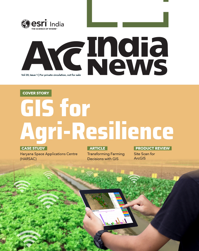
Cover Story
GIS Mapping a Better Future
GIS provides a platform to store, manage, and analyze geospatial data to help make informed decisions in a variety of fields.

Cover Story
Table of contents
In an age defined by complexity—climate disruptions, geopolitical tension, urban sprawl, digital fragmentation—what the world needs more than ever is a common language of understanding. One that transcends borders and disciplines. One that does not just ask what or why, but also where. That language is GIS—Geographic Information Systems.
Once considered a niche technical domain, GIS has evolved into the connective tissue of the 21st century, linking data with geography, people with policy, and the digital with the physical. From climate models to traffic patterns, from deforestation in the Amazon to flood risks in Chennai, GIS enables us to see the world not just as isolated problems but as an intricate, interrelated system. In doing so, it offers clarity, coordination, and ultimately, solutions.

At its core, GIS answers the most fundamental of questions: Where?
Where is the need greatest? Where are we vulnerable? Where are we growing? Where are the patterns forming? These spatial questions form the bedrock of modern decision-making. But GIS does more than just locate. It connects. It explains. It predicts.
In urban planning, GIS enables planners to manage urbanization more effectively across multiple sectors, including land use, transportation, housing, development, and the environment. Each stage of urban planning, ranging from setting objectives to implementation and monitoring, benefits from GIS tools that support data analysis, modeling, and scenario evaluation. Technologies like ArcGIS Urban allow planners and administrators to visualize demographic needs, assess housing plans, and collaborate through web-based 3D applications.
GIS helps store and analyze physical, social, and economic data, aiding in site feasibility studies and tracking land changes over time. It also facilitates citizen engagement, encouraging community input to create smarter, more livable cities. Esri’s smart city solutions are empowering professionals to design impactful plans that enhance the overall quality of life.
Infrastructure forms the backbone of a city. In infrastructure development, GIS is playing a pivotal role. Smart infrastructure projects today rely heavily on advanced technologies, such as GIS, BIM, and Digital Twins, to enhance planning, execution, and efficiency. Large infrastructure projects often face cost overruns of 20–60% but integrating GIS and BIM can yield up to 13% in cost savings. GIS supports site selection, environmental assessment, and infrastructure alignment by offering spatial context, helping teams plan projects such as roads, railways, and airports with minimal ecological impact. ArcGIS supports the full AEC lifecycle. Its tools offer intelligent mapping, GeoDesign capabilities, real-time visualization, and data sharing to boost operational transparency, collaboration, and cost-effectiveness.
In utilities, GIS helps in gaining better situational awareness along with actionable intelligence for informed decisions. More than 90% of utility enterprises have a context of location associated, which can be easily harnessed for higher efficiency. Making it easier, faster, and cheaper than ever, ArcGIS is providing an opportunity for utilities to proactively interact with every asset and consumer. ArcGIS Utility Solutions are making access to contextualized information easier than ever before, helping utility CXOs address their priorities more effectively, strengthen their ability to stay agile in changing times, and grow sustainably.
Effective Disaster management is a necessary component of resilient urban and rural spaces. GIS empowers administrators to enhance disaster preparedness and build more resilient living environments. It aids in enhancing preparedness, response, and recovery through spatial intelligence. Integrated into regional development planning, GIS enables better risk modeling, early warning systems, and informed decision-making. It helps identify vulnerable areas, directs relief efforts, and improves situational awareness, ultimately leading to faster, more targeted responses and efficient recovery. ArcGIS supports the full disaster management lifecycle with powerful tools for mapping, remote sensing, and data visualization. Indo ArcGIS offers tailored disaster management solutions that help with real-time resource planning and disaster mitigation efforts, making disaster response more effective and community-centric.
India is primarily an agricultural economy, with agriculture serving as the livelihood source for nearly half of the country’s population. It is the backbone of rural India, contributing significantly to food security, employment, and national GDP. In agriculture, GIS enables precision farming by linking soil, weather, and crop data into actionable insights. It is playing a transformative role in modern agriculture by bringing precision, efficiency, and sustainability to farming practices. By integrating spatial data on soil health, crop performance, weather conditions, water availability, and topography, GIS allows farmers and agribusinesses to make informed, sitespecific decisions. Precision agriculture, powered by GIS, enables optimized planting, targeted irrigation, and efficient use of fertilizers and pesticides, resulting in higher yields and reduced environmental impact.
GIS also supports real-time crop monitoring using satellite imagery, drones, and remote sensors to detect stress factors like disease, pests, or nutrient deficiencies early, allowing for timely interventions. On a broader scale, GIS helps policymakers and researchers assess food security risks, plan for climate change impacts, and improve agricultural supply chains. By visualizing complex relationships between natural resources, human activity, and market dynamics, GIS empowers the agricultural sector to adapt, innovate, and ensure sustainable food production for a growing global population.
GIS forms a core component of Business Growth as well. It empowers businesses to make more informed decisions by providing actionable insights derived from spatial data analysis. By leveraging GIS technology, businesses can gain a competitive edge, optimize their operations, and achieve their strategic objectives more effectively.
For instance, in retail, GIS reveals purchasing behavior patterns, optimizes supply chains, and forecasts demand. GIS is revolutionizing the retail sector by enabling businesses to harness the power of location intelligence for more precise decision-making across site selection, customer targeting, supply chain optimization, and competitive analysis. By integrating demographic data, consumer behavior patterns, traffic flows, and competitor locations, GIS allows retailers to identify optimal store locations, predict market demand, and fine-tune marketing strategies based on localized insights. GIS-based spatial analysis helps companies segment customers geographically, personalize promotions, and even adapt product offerings to the preferences of specific neighborhoods or regions.
On the operational side, GIS enhances supply chain efficiency by optimizing delivery routes, managing inventory distribution, and anticipating potential disruptions. As e-commerce grows, GIS also supports last-mile delivery planning, enabling faster and more cost-effective service. By connecting consumer data to geography, GIS empowers retailers to understand not just who their customers are, but where and how they engage, driving smarter, location-informed business strategies that strengthen competitiveness in a rapidly evolving retail landscape.
GIS is also becoming a core technology of quick commerce. Since the core promise of quick commerce is ultra-fast delivery, it is essential to have highly accurate, real-time insights on traffic conditions, road closures, route optimization, and weather disruptions to ensure timely fulfilment. GIS brings automation to enable this level of dynamic, data-driven decision-making. With tools like ArcGIS, quick-commerce companies can dynamically optimize logistics, minimize delivery times, and swiftly adapt to changing conditions such as traffic congestion, weather disruptions, or unexpected delays. This real-time spatial intelligence not only enhances operational efficiency but also ensures a consistent, highquality customer experience.
In manufacturing, GIS is increasingly becoming a strategic enabler, offering the agility and intelligence manufacturers need to enhance customer experience and streamline operations. With the growing demand for data-driven decision-making and automation, GIS facilitates coordinated planning across the entire value chain, resulting in improved efficiency, reduced costs, and better risk mitigation.
Esri’s location intelligence solutions empower manufacturers to visualize and analyze data with spatial context, leading to smarter decisions in areas such as market analysis, sales territory optimization, field service management, and supply chain operations. Advanced tools, such as ArcGIS Business Analyst and ArcGIS Knowledge, enable manufacturers to innovate across customer service, asset management, and logistics, ultimately driving greater operational resilience and a competitive advantage.
In the Banking and Financial Services sector, the adoption of GIS is rapidly expanding, driven by the need for enhanced market intelligence, operational continuity, and regulatory compliance. GIS enables banks to go beyond traditional data analysis by leveraging geospatial visualization to interpret complex market dynamics, customer behavior, and service accessibility.
From identifying optimal branch locations to mapping market potential, GIS supports strategic decisions in sales, marketing, and service delivery. As the sector adapts to decentralized business models and explores new growth in emerging markets, the demand for advanced spatial analytics is growing. Esri’s GIS solutions transform geographic data into actionable insights, helping financial institutions enhance their analytical capabilities, refine business strategies, and stay competitive in a fast-evolving global market.
Behind all of these use cases is a unifying force: a spatial framework that turns chaos into context.
GIS today serves as a powerful common thread that integrates everything, everywhere—across geographies, domains, and data types. It is not just a mapping tool, but a dynamic system that brings together disparate datasets—spatial and non-spatial—to reveal patterns, relationships, and insights that were previously inaccessible. Whether it’s linking satellite imagery with cadastral data, integrating IoT feeds with utility networks, or merging socio-economic datasets with administrative boundaries, GIS acts as the connective tissue that enables holistic decision-making. Its ability to break down silos, harmonize information, and present a unified, location-intelligent view makes GIS indispensable for smart governance, resilient infrastructure, environmental sustainability, and inclusive development.
As a unifying platform, GIS integrates scientific knowledge from various disciplines. It serves as a bridge that connects diverse scientific domains, enabling a holistic understanding of our world. At its core, GIS is grounded in geography, but it intersects with countless disciplines—from climatology and ecology to sociology and economics. Scientific disciplines often function in silos, but GIS provides a universal spatial language that harmonizes them. GIS allows biologists, sociologists, epidemiologists, and geologists to analyze their research in spatial context.
Sociologists use GIS to map and analyze demographic, economic, political, or cultural data from various sources and scales. They also use GIS to examine how human activities affect the environment and vice versa, such as urbanization, migration, climate change, or natural hazards.
An environmentalist uses GIS to investigate the physical processes and characteristics of the Earth and its systems. For example, they can use GIS to measure and model topography, hydrology, geology, ecology, or meteorology. They can also use GIS to monitor and assess the impacts of natural or human-induced changes on the environment, such as land cover, biodiversity, water quality, or carbon emissions. Biology, ecology, geology – we can explore the natural world using GIS. Tracking migratory patterns, monitoring biodiversity, and analyzing geological formations, GIS helps scientists uncover nature’s secrets. GIS is a great tool to visualize the environmental process, hydrologic process, impacts, and results.
GIS can also be used to map and visualize historical events, movements, or places, such as wars, migrations, or landmarks. It can also be used to analyze and interpret the spatial aspects of literary works, artistic expressions, or philosophical ideas, such as themes, symbols, or perspectives. By using GIS, we can enrich our cultural awareness, appreciation, and communication about human experience and its diversity. GIS adds a data perspective to social issues. It should be heralded as a tool used to achieve social objectives, such as equality, distribution of resources, such as healthcare and education facilities. Earth Observation techniques, such as time series analysis, give historians the power to visually and interactively understand events such as migration and changes in settlement patterns. The ability of GIS tools to work in any context is unparalleled.
By integrating GIS with computer science, students can learn programming languages and tools for spatial analysis. For example, GIS can be used to develop web-based mapping applications and spatial algorithms. It enables the integration of spatial data with other data sources, such as remote sensing and social media data. GIS empowers computer scientists to solve spatial problems using computational techniques, contributing to advancements in spatial data management, machine learning, and artificial intelligence. The integration of ML and AI enhances spatial decision making.
GIS integrates data and content from multiple sources, creating a comprehensive view of information. By harmonizing disparate datasets, GIS enables a more complete understanding of complex issues and facilitates data-driven decision-making. GIS integrates these varied datasets by georeferencing them, allowing users to visualize and analyze disparate information layers within a unified spatial framework.
We live in a world of data excess. But data is valuable only when contextualized. GIS platforms like ArcGIS act as fusion engines, integrating fragmented data from satellites, sensors, surveys, and social media into a coherent spatial narrative. ArcGIS can harmonize structured (databases), semi-structured (Excel), and unstructured data (text, imagery). It supports both raster and vector formats and incorporates real-time data streams from IoT devices.
GIS can seamlessly combine high-resolution imagery, realtime traffic feeds, weather data, demographic statistics, environmental measurements, and infrastructure maps — transforming complex, multi-dimensional data into coherent, actionable insights. ArcGIS enables integration of data with external enterprise systems such as ERP, CRM, SCADA, and BIM, ensuring that both operational and analytical data are accessible through location-aware dashboards and applications.
With support for open standards, APIs, and interoperability with cloud, AI, and big data platforms, GIS has evolved into an enterprise-grade system of systems. It creates a unified data environment. It allows organizations to break down data silos, foster cross-disciplinary collaboration, and generate a comprehensive spatial understanding that supports better planning, faster decision-making, and more effective problem-solving.

Mining entails careful planning and periodic assessment of the area during the entire lifecycle of the project. A geospatial application enables Adani Natural Resources to get diverse information on a single platform, thereby gaining deep insights.
The GIS application aptly manages the challenges of receiving different datasets from different stakeholders, the complexity of having information in different formats and datasets in different coordinate systems. This integration has led to better decision making at all levels.
Advanced technology involving drones, 2D & and 3D models, and integrating non-SAP sources has brought visibility to land use. The technological prowess is being enhanced as a part of Adani Mining’s vision of being the leading mining company with the ethos of a responsible miner.
In today’s data-driven enterprises, GIS plays a pivotal role in integrating and streamlining diverse business workflows and processes across sectors. Traditionally, many organizations managed spatial and non-spatial data separately, resulting in data silos, inefficiencies, and delays. GIS eliminates these silos by acting as a common platform that brings together data, systems, and processes, enabling seamless collaboration and more informed decision-making. GIS enables:

Cross-Departmental Collaboration: For large organizations, various departments—operations, maintenance, planning, customer service, compliance—often operate in silos. GIS serves as an enterprise-wide platform where workflows intersect. For example, a utility company’s field operations team can update asset conditions in real-time via GIS-enabled mobile apps, which instantly informs maintenance scheduling, regulatory reporting, and customer communication processes.
Real-Time Monitoring and Decision Support: By integrating GIS with real-time data streams (e.g., IoT sensors, weather data, traffic feeds), organizations can monitor operations live. This real-time situational awareness supports quick decision-making, early warning systems, and adaptive management. For example, in supply chain logistics, GISintegrated dashboards allow managers to proactively adjust delivery routes based on current conditions.
Automation of Business Processes: GIS enables automation of routine tasks such as route optimization, resource allocation, incident response, asset inspections, and reporting. Workflows can be designed to trigger specific actions based on spatial data—for instance, automatically dispatching repair crews when a sensor detects pipeline leakage, or rerouting deliveries based on real-time traffic data.
Regulatory Compliance and Reporting: Many industries face complex regulatory requirements that involve spatial data (e.g., environmental constraints, zoning laws, safety zones). GIS simplifies compliance by integrating regulatory frameworks into operational workflows, automatically flagging violations, generating compliance reports, and maintaining audit trails.
Improved Customer Engagement: GIS-powered portals and applications can offer customers self-service options—viewing service outages, tracking service requests, or providing feedback via interactive maps. This integration enhances transparency and improves customer satisfaction.
GIS streamlines workflows and business processes by integrating spatial data into decision-making processes. It optimizes operations by providing a spatial context that enhances efficiency and effectiveness.

GIS delivers geographic experiences to data-driven decisionmaking, immersing the audience and enabling collaboration and communication. It is profoundly reshaping human actions and experiences by bringing the power of location intelligence into daily decision-making at both individual and collective levels. By integrating diverse data sources—environmental, demographic, behavioral, and infrastructural—into dynamic spatial models, GIS enables people to better understand the world around them and make more informed choices.
For individuals, GIS applications like navigation systems, fitness trackers, and location-based services enhance daily experiences by optimizing routes, suggesting destinations, or monitoring personal activities in real time. On a larger scale, city planners use GIS to design smarter, more livable urban environments by analyzing traffic patterns, public services, green spaces, and social demographics, thereby directly influencing how people live, move, and interact within their communities.
In fields like disaster response, public health, and climate adaptation, GIS allows decision-makers to proactively manage risks, allocate resources more efficiently, and protect vulnerable populations, ultimately saving lives and minimizing disruption. Furthermore, by visualizing how actions in one place impact distant or marginalized communities—such as the downstream effects of deforestation, urban sprawl, or pollution—GIS fosters greater social responsibility and collective awareness. In essence, GIS is not just a technology for analyzing spatial data; it is a powerful tool that connects people to place, aligns actions with consequences, and helps shape more resilient, equitable, and sustainable experiences for societies at large.

GIS integrates analytics by combining spatial data with advanced analytical tools to derive actionable insights from complex datasets. At its core, GIS allows users to visualize relationships, patterns, and trends that are inherently geographical, but its true power lies in integrating multiple analytical methods—spatial, statistical, temporal, and predictive—within a unified platform. Through spatial analysis, GIS can calculate distances, identify optimal locations, assess suitability, and model spatial interactions between features such as population density, land use, and infrastructure networks.

The integration of Geographic Information Systems (GIS) and Artificial Intelligence (AI) is revolutionizing the way we understand, analyze, and act upon spatial data. By combining the spatial processing power of GIS with the predictive and learning capabilities of AI, we can unlock deeper insights from geospatial datasets—ranging from satellite imagery and sensor data to demographic patterns and infrastructure networks. AI-driven algorithms can automate feature extraction, detect anomalies, predict future trends, and optimize decision-making processes across domains such as urban planning, agriculture, disaster response, and environmental management. This synergy not only enhances the accuracy and efficiency of spatial analysis but also enables real-time, intelligent geospatial solutions that were previously unattainable. As this integration advances, it paves the way for smarter cities, more resilient ecosystems, and data-driven governance.
When fused with real-time data streams, GIS supports dynamic monitoring and predictive analytics, enabling organizationsand forecast future trends with high accuracy.
The platform’s interoperability with statistical tools like R and Python further extends its analytical depth, allowing complex models to be directly integrated into spatial workflows. By converging location intelligence with advanced analytics, ArcGIS empowers organizations to make data-driven, locationbased decisions that drive operational efficiency, strategic planning, and sustainable development.
ArcGIS integrates analytics by embedding powerful spatial, statistical, and predictive tools within a single comprehensive platform. It allows users to analyze complex geospatial data, uncover patterns, and visualize relationships that are not apparent in traditional tabular datasets. Through its extensive suite of spatial analysis tools—such as proximity analysis, network analysis, suitability modeling, and hotspot detection— ArcGIS enables users to perform in-depth assessments across diverse sectors.
ArcGIS Business Analyst is a unique solution that has the potential to greatly enhance the efficacy of government departments by offering precise insights into spatial and demographic factors. Using the solution, government agencies can make data-driven decisions, optimize resource distribution, and customize efforts to achieve more effective outcomes in public safety, economic development, community assessments, city development, and more. They can make a greater impact on the lives of the citizens using the available data as the developmental efforts become more targeted and reach the maximum number of beneficiaries.
Using Business Analyst, the need for users to collect, clean, and verify data is eliminated as Esri, in collaboration with MBR (Michael Bauer Research), provides the latest datasets built into the software. Important parameters such as age-sex distribution, consumer segmentation, spending habits, purchasing power, etc., are available for the user to browse and add to their workflow as required. In the solution, the analysis extent can be set to 8 different geography levels: States, Districts, Parliamentary Constituencies, Subdistricts, Assembly Constituencies, Pincode, Villages & Wards. Business Analyst also provides location data for a wide range of POIs – hospitals, police stations, ATMs, petrol stations, as well as a variety of businesses such as restaurants, malls, etc. The simple task-based structure within the BA toolbox gives users a step-by-step methodology for creating a suitability map while also allowing the flexibility to add, remove, change, and reset weightages of parameters dynamically.
The GIS-based solution, powered by ArcGIS Business Analyst, offers a robust approach to optimizing the revenue potential of West Bengal’s Excise Department. By integrating demographic, economic, and various spatial data, the proposed workflows address key challenges and opportunities in Spirits revenue management. Spirit revenue management for the excise department involves overseeing the collection of taxes and duties on alcoholic beverages, specifically spirits, in a way that ensures compliance, minimizes fraud, and maximizes revenue generation. It requires accurate tracking of production, distribution, and sales through systems that monitor and enforce legal standards.
The GIS-based solution enables the Excise Department to overcome the following challenges:

In a world where cities are becoming smarter, industries are becoming more digital, and ecosystems are more threatened, the need for integrated, location-aware decision-making has reached a critical juncture. GIS is emerging as the keystone technology in this transformation. It is enabling organizations to visualize complexity, align cross-sectoral goals, and make informed, spatially contextualized decisions.
GIS connects data, disciplines, devices, and people. It allows city planners to simulate urban development, climate scientists to monitor environmental change, epidemiologists to track disease spread, and businesses to optimize customer engagement—all within the same spatial framework. GIS does not just integrate systems; it integrates understanding. GIS is used to connect various aspects of our world, from personal devices to large-scale infrastructure, creating a seamless and interconnected experience. By getting seamlessly integrated with other technologies like IoT, AI, and machine learning, GIS unlocks new possibilities for problem-solving and decision-making. Real-time sensor data, predictive analytics, and automated insights are turning static maps into dynamic decision platforms. This convergence is enabling smarter energy grids, precision agriculture, earlywarning systems, and responsive public services—directly improving quality of life and ensuring sustainability.
At its core, GIS connects people, processes, and places. It democratizes access to information, fosters collaboration across disciplines, and promotes transparency and accountability in governance. In doing so, GIS is not just solving problems—it is empowering communities. By integrating everything, everywhere, GIS is seamlessly bridging gaps across data, disciplines, and decisions to build a smarter, more sustainable world for everyone.
To download the PDF version of this article, click the button below.
GIS provides a platform to store, manage, and analyze geospatial data to help make informed decisions in a variety of fields.
The MCD GIS citizen portal is a step towards better governance taken by the Municipal Corporation of Delhi to allow the citizens of Delhi to avail various services through an easy-to-use interface along with geo-referential data.

In the heart of Rajasthan, R-CAT (Rajasthan Centre of Advanced Technology) emerges as a beacon of innovation and knowledge. Established by the Government of Rajasthan, it’s not just an institute- it’s a gateway to the future.

Suez Group has been active in the Indian water and wastewater market since 1978 and established an Indian subsidiary in 1986. Suez uses Esri products to enable comprehensive study and planning through GIS mapping, field surveys, and door-to-door surveys.