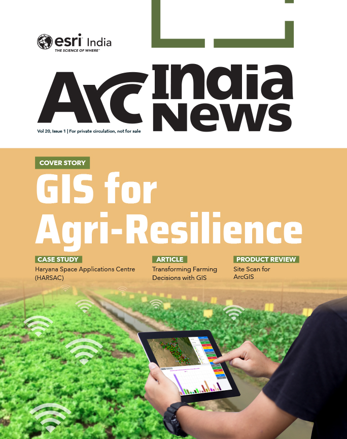
Cover Story
GIS Mapping a Better Future
GIS provides a platform to store, manage, and analyze geospatial data to help make informed decisions in a variety of fields.

Cover Story
Building Smarter, Resilient, and Sustainable Infrastructure with Geo-Intelligence
Table of contents
As India makes a larger presence in the global landscape, infrastructure development stands as one of the nation’s defining imperatives. With over 1.4 billion people and an expanding economy growing at around 7% annually, the demand for efficient, resilient, and sustainable infrastructure has never been more pressing. The government’s ambitious infrastructure investments highlight the nation’s recognition that roads, ports, and railways are the backbone of economic growth.
However, rapid urbanization, increasing environmental risks, and the complexity of modern engineering projects demand an equally sophisticated technological response. This is where Geographic Information Systems (GIS) stands out as a transformative technology that integrates geography, data, and design to build infrastructure that is not only efficient but intelligent.
GIS offers comprehensive insights into existing infrastructure, topographical features, and environmental constraints, enabling planners and engineers to identify optimal locations for new projects and improve existing ones. Spatial analysis tools within GIS allow professionals to assess terrain, accessibility, population density, and environmental impacts, thereby supporting data-driven and informed decision making. Tools such as ArcGIS Urban, ArcGIS Indoors, ArcGIS CityEngine, and ArcGIS Reality provide spatial intelligence at every level, from strategic planning to operational execution, ensuring that decisions are informed, collaborative, and grounded in real-world context.
GIS plays a transformative role in all stages of an AEC project, right from planning to maintenance.
Planning: In the planning phase, GIS aids site selection and feasibility analysis. By integrating demographic data, terrain, and land-use maps, planners can pinpoint optimal locations for highways, airports, and industrial corridors while minimizing environmental disruption.
GIS empowers stakeholders by providing a spatial perspective on complex datasets, facilitating evidence-based planning and policy formulation. Through scenario modelling and predictive analytics, planners can assess the potential outcomes of different development strategies, select cost-effective options, and promote sustainable growth. This proactive approach minimizes risks and ensures that infrastructure initiatives align with long-term development objectives.
Designing: During the design phase, GIS supports the visualization of engineering concepts in a spatial context. Integration with BIM brings even greater precision. By linking 3D building models with real-world coordinates, design teams gain insight into accessibility, utilities, and community impacts. Digital Twins take the precision to new levels.
ArcGIS is foundational for any digital twin. It connects different types of data and systems to create a single view that can be accessed throughout the complete project life cycle. It enhances data capture and integration, enables better real-time visualization, provides advanced analysis and automation for future predictions, and facilitates information sharing and collaboration.
Building: On-site construction benefits from real-time GIS dashboards and drone mapping. Supervisors can compare design models with as-built models, detect deviations early, and ensure safety compliance, thereby reducing rework and delays.
Operation and Maintenance: Following construction, GIS becomes a dynamic system for asset management. By integrating spatial and asset data, organizations can monitor COVER STORY LRMs, and publish and share linear referenced data services. the condition, performance, and lifespan of infrastructure assets. This integration enables proactive maintenance, optimized resource allocation, and extended asset lifecycles. GIS-based asset management systems enhance operational efficiency, reduce costs, and support informed decision making throughout an asset’s life.
GIS offers a comprehensive solution for the infrastructure sector by creating a System of Record, a System of Engagement, and a System of Insight. It builds a connected platform that integrates data across departments and external agencies. It brings together asset inventories, maintenance records, safety data, and environmental information into a single, unified environment. GIS supports both day-to-day operations and long-term planning by enabling the comparison of project scenarios, prioritizing needs, and optimizing investments based on measurable outcomes.
Accurate, up-to-date land information is foundational for efficient planning, land acquisition, environmental compliance, and sustainable construction. Land Information Systems (LIS) provide an integrated, authoritative view of land parcels, ownership, encumbrances, and terrain conditions. GIS adds powerful spatial analytics, visualization, and decision-support capabilities to a LIS. Together, they streamline corridor planning, reduce project delays, optimize alignment selection, and help mitigate risks related to land disputes or environmental sensitivity.
By enabling transparent data sharing among government agencies, developers, and communities, LIS and GIS play a transformative role in accelerating infrastructure delivery and ensuring that India’s road and port networks are built smarter, faster, and more sustainably.
GIS aids in unifying existing Department of Transportation (DOT) systems through a centralized Linear Referencing System (LRS), enabling data fusion and sharing across business units. It helps in planning, managing, and maintaining roadway LRS networks, author maps that fuse data from different LRMs, and publish and share linear referenced data services.
GIS enables informed decision-making through accurate data analysis, improving efficiency in project planning and prioritization. GIS promotes cost-effective asset management by optimizing life-cycle costs and enabling proactive maintenance. It enhances coordination between agencies and stakeholders by serving as a shared information hub. Finally, GIS improves public engagement and transparency, allowing citizens to visualize how transportation investments support safety, mobility, and environmental sustainability. GIS has emerged as an essential technology for the future of roads and highways management. By integrating spatial data with performance metrics, it empowers transportation agencies to move from reactive maintenance to proactive, data-driven planning. Through better coordination, smarter investments, and clearer communication, GIS helps agencies achieve their strategic goals efficiently while meeting the growing demands of public accountability and sustainable infrastructure management.
GIS has emerged as an essential technology for the future of roads and highways management. By integrating spatial data with performance metrics, it empowers transportation agencies to move from reactive maintenance to proactive, data-driven planning. Through better coordination, smarter investments, and clearer communication, GIS helps agencies achieve their strategic goals efficiently while meeting the growing demands of public accountability and sustainable infrastructure management.
In the railway and public transport sectors, GIS facilitates route optimization, track maintenance, and service scheduling. It is an extremely powerful technology that can help shape various operational requirements and asset management of the Railways. The sector can use geo-enablement projects for asset management, decision-making and planning, disaster management and rescue operations, monitoring and alert systems, real-time tracking and prediction, or forecasts. Integration of GIS with ticketing and passenger information systems allows transit authorities to improve service reliability, enhance passenger experience, and boost ridership. Furthermore, GIS plays a critical role in designing multimodal transportation hubs that efficiently integrate multiple transit modes.
GIS streamlines the coordination and management of diverse facilities/assets, maximizing operational efficiency. It serves as a robust foundation for enhanced port facility management by integrating information for informed decision-making regarding limited port area allocations. A web-based GIS application or dashboard facilitates real-time monitoring of real estate leases and relevant leasehold details within organizational levels, facilitating better decision-making.
Effective Disaster management is a necessary component of resilient urban and rural spaces. GIS empowers administrators to enhance disaster preparedness and build more resilient living environments. It aids in enhancing preparedness, response, and recovery through spatial intelligence. Integrated into regional development planning, GIS enables better risk modeling, early warning systems, and informed decision-making. It helps identify vulnerable areas, directs relief efforts, and improves situational awareness, ultimately leading to faster, more targeted responses and efficient recovery. ArcGIS supports the full disaster management lifecycle with powerful tools for mapping, remote sensing, and data visualization. Indo ArcGIS offers tailored disaster management solutions that help with real-time resource planning and disaster mitigation efforts, making disaster response more effective and community-centric.
GIS maps utilities like water networks, gas pipelines, and cable networks, integrating them with on-site facility photos and asset databases. This setup enables comprehensive monitoring and visualization through GIS-based dashboards or web applications.
Efficient port operations demand precise coordination of activities like ship traffic control, berth scheduling, utility provisioning, and container management. Location-based information management solutions enhance efficiency through modeling, analysis, and visualization tools. GIS technology maps and displays vessel locations, aiding traffic control and safety management. Vessels can be color-coded by cargo type, with detailed berth information including vessel type, name, arrival times, and ownership. This data supports tariff calculations, billing, and reporting. Real-time integration with sensors and IoT devices enables predictive and proactive planning of port operations.
In the case of airports, GIS improves operational awareness by providing real-time dashboards that display gate status, aircraft positions, and resource availability. Operators can quickly detect conflicts, optimize gate assignments, and maintain smooth passenger and aircraft flows, even during disruptions. This spatially integrated view enhances decision-making, reduces delays, and boosts overall efficiency and revenue.
ArcGIS can help port operators navigate regulatory requirements and mitigate risks associated with environmental impact, safety hazards, and security threats. By integrating regulatory data layers and conducting spatial risk assessments, decision-makers can ensure compliance with regulations and implement appropriate risk mitigation measures. Location based information management and visualization capabilities give you useful tools for environmental management. GIS technology can be used to create a comprehensive view of hazardous materials location and its storage and analyze the potential impact of chemical, oil, or gas spills in the marine environment. A 3D visualization of the port facilities or underwater features can also be created. With the help of bathymetric data, the channel depth can be determined for known areas, which will lead to proper dredging operations and underwater obstructions for safer navigation. Integrating sensor technology into port operations can indeed play a crucial role in monitoring and managing pollutants in the sea, as well as in maintaining the health of flora and fauna. Here’s how sensor integration can contribute to this process for maintaining water quality, Marine life monitoring, Early Warning Systems, and more.
GIS enables smarter capital investment by providing a comprehensive spatial view of airport assets, operations, and development needs. Integrated mapping of pavements, utilities, terminals, and airfield components helps identify asset conditions, maintenance histories, and life-cycle priorities so funds are allocated where they deliver the greatest value. GIS also supports data-driven justification for expansions by analyzing operational bottlenecks such as runway occupancy, taxiway conflicts, and gate congestion. Environmental and regulatory layers—noise, wildlife, flood risk—allow planners to select development sites that minimize impacts and costly delays. Scenario modeling helps compare growth options and align projects with demand forecasts and resilience goals, ensuring capital improvements are both cost-effective and strategically aligned.
GIS-enabled indoor mapping improves airport operations and passenger experience through detailed digital maps of terminals, gates, retail areas, and operational spaces.
These maps support precise routing for travelers and staff, showing distances, travel times, and vertical navigation across multiple floors. Integrated sensor data enables real-time crowd monitoring, dynamic wayfinding, and congestion management. For staff, indoor GIS streamlines maintenance, inspections, and emergency response, turning complex indoor spaces into intuitive, navigable environments that boost efficiency and confidence.
GIS supports airport noise analysis by integrating flight paths, terrain, land use, and population data to map noise contours and assess community impacts. Analysts can compare noise exposure with residential zones, schools, and sensitive sites, and evaluate the effects of changes in runway use, schedules, or aircraft types. GIS helps prioritize mitigation strategies such as insulation programs or land-use changes and provides clear visualizations for stakeholder communication, making noise management more transparent and evidence-based.
Most ports have significant technology investments and management systems housing critical data. However, these data are often siloed within departments, hindering effective decision-making. GIS offers a solution by integrating existing data systems. With nearly all port data having a spatial component, GIS acts as a bridge between disparate datasets, enhancing data utilization. The focus is not on developing new, complex systems but on maximizing the accessibility of existing data. By creating open APIs that integrate data from various port management systems, including real-time updates, GIS enables centralized data access based on user credentials. This integration brings heightened control to a complex operational environment, fostering more informed decision-making.
Adani Enterprises Limited is using a GIS-based web Effective Planning and Management of Ports using ArcGIS Adani Enterprises Limited is using a GIS-based web application as a centralized control ‘Land Information System’ that acts as a repository of land assets and resources. The Land & Estate department of the company has created a GIS-based system that facilitates master planning and management of multiple ports.
An infrastructural marvel, the mega port at Mundra is a major economic gateway that caters to the northern hinterland of India with multimodal connectivity. The department has incorporated a major project of Mundra Master Planning & and its Development using GIS systems.
GIS has played a crucial role in planning the development of a very important Port, an industrial Hub, and the supporting social and physical infrastructure.
The data was collated, processed, and developed using ArcGIS software, and the solution was deployed using the Portal for ArcGIS technology which helped the organization to analyze the current operation and development situation of the port, industrial hub, and social infrastructure and make decisions about the existing deficiency and expansion, needs of improvements and future development with their management support.
The integration of GIS with Building Information Modelling (BIM) has emerged as a transformative approach in the infrastructure industry, bridging the gap between building design and spatial analysis to facilitate more informed decision-making, collaboration, and project outcomes. It involves converging building information with geographic data, creating a comprehensive and integrated digital twin of the built environment, encompassing both the indoor and outdoor aspects of infrastructure and building projects.
The integration also leads to substantial cost savings. By combining BIM with GIS, project teams can identify and address issues during the planning phase by creating detailed 3D representations of infrastructure projects. This proactive approach, supported by GIS, minimizes expensive rework, material wastage, and resource inefficiencies. Utilizing IoT sensors for monitoring equipment performance and maintenance, alongside GIS analysis, further contributes to cost savings. The early detection of equipment issues, facilitated by GIS, enables preventive maintenance, eliminating the need for costly breakdown repairs. Additionally, optimizing resource allocation through real-time data, made possible by GIS, can lead to reductions in energy and resource costs, ultimately enhancing overall business profits.
ArcGIS GeoBIM enables organizations to provide rich geospatial context to architecture, engineering, construction, and facility management projects. By bringing GIS and BIM data together, ArcGIS GeoBIM allows users to incorporate and use data from multiple systems, access project data from a common experience, explore GIS and BIM data side by side, collaborate and share information with stakeholders, and minimize costly data conversions. Using AEC Project Delivery, users can extend internal GIS content and context to resources outside of the organization. This allows them to collaborate and share information directly with stakeholders
The concept of Digital Twins is evolving rapidly in infrastructure to create digital replicas of physical assets, systems, or processes, visualize, analyze, optimize, and simulate scenarios, improve decision-making, enhance operational efficiency, and drive innovation with sustainable & resilient solutions. ArcGIS CityEngine is an advanced 3D modeling software used for creating massive, interactive, and immersive urban environments based on real-world GIS data with the potential to showcase a fictional city of the past, present, or future.
The convergence of GIS, BIM, and Digital Twins is a transformative leap toward building intelligent infrastructure ecosystems. ArcGIS is foundational for any digital twin.
It connects different types of data and systems to create a single view that can be accessed throughout the complete project life cycle. It enhances data capture and integration, enables better real-time visualization, provides advanced analysis and automation for future predictions, and facilitates information sharing and collaboration.
Taking things to the next level, Artificial Intelligence is revolutionizing the infrastructure industry by enabling smarter, data-informed decision-making across the entire infrastructure lifecycle. By analyzing vast amounts of spatial, environmental, and operational data, AI algorithms can identify patterns, forecast outcomes, and predict potential issues before they occur. In the AEC context, this means anticipating construction delays, optimizing resource allocation, predicting equipment failures, and improving design efficiency.
When combined with GIS, predictive analytics enhances spatial understanding, allowing engineers and planners to visualize risk zones, forecast infrastructure performance, and model future urban growth scenarios.
For instance, AI can predict which areas are prone to flooding, structural deterioration, or energy inefficiency, enabling proactive maintenance and resilient design strategies. Ultimately, AI-driven predictive analytics transforms GIS and AEC workflows from reactive problem-solving to proactive planning—reducing costs, improving safety, and promoting sustainability in the built environment.
As the discussion unfolds, GIS is revolutionizing the way we plan, construct, and manage infrastructure. The geographic approach fosters understanding, promotes collaboration, and enables data-driven decision-making, inspiring us to take decisive action. Across sectors, from transportation and utilities to urban planning and disaster management, GIS is fostering efficiency, sustainability, and resilience. By leveraging the power of GIS, we are shaping the infrastructure of tomorrow, paving the way for a more sustainable future. As the infrastructure industry leverages the next generation of tech, GIS integrated with advanced technologies like AI, IoT, and Cloud Computing will be an integral component of the revolution, and we will continue to witness exciting developments in the realm of smart infrastructure.

To download the PDF version of this article, click the button below.
GIS provides a platform to store, manage, and analyze geospatial data to help make informed decisions in a variety of fields.
The MCD GIS citizen portal is a step towards better governance taken by the Municipal Corporation of Delhi to allow the citizens of Delhi to avail various services through an easy-to-use interface along with geo-referential data.

In the heart of Rajasthan, R-CAT (Rajasthan Centre of Advanced Technology) emerges as a beacon of innovation and knowledge. Established by the Government of Rajasthan, it’s not just an institute- it’s a gateway to the future.

Suez Group has been active in the Indian water and wastewater market since 1978 and established an Indian subsidiary in 1986. Suez uses Esri products to enable comprehensive study and planning through GIS mapping, field surveys, and door-to-door surveys.