Geoprocessing
Work with your data using tools to automatically analyze, edit, transform, and manage your geospatial data.

Use state-of-the-art tools, such as smart mapping, multi-attribute symbology, and flexible labeling and annotation options to create the world’s more stunning maps.
ArcGIS Pro features a project-based workflow, where you can work with multiple displays and layouts simultaneously in 2D and 3D.
Create multiple layouts in your projects using templates for industry standard and custom sizes and incorporates dynamic functionality, such as charts, tables, and legends.
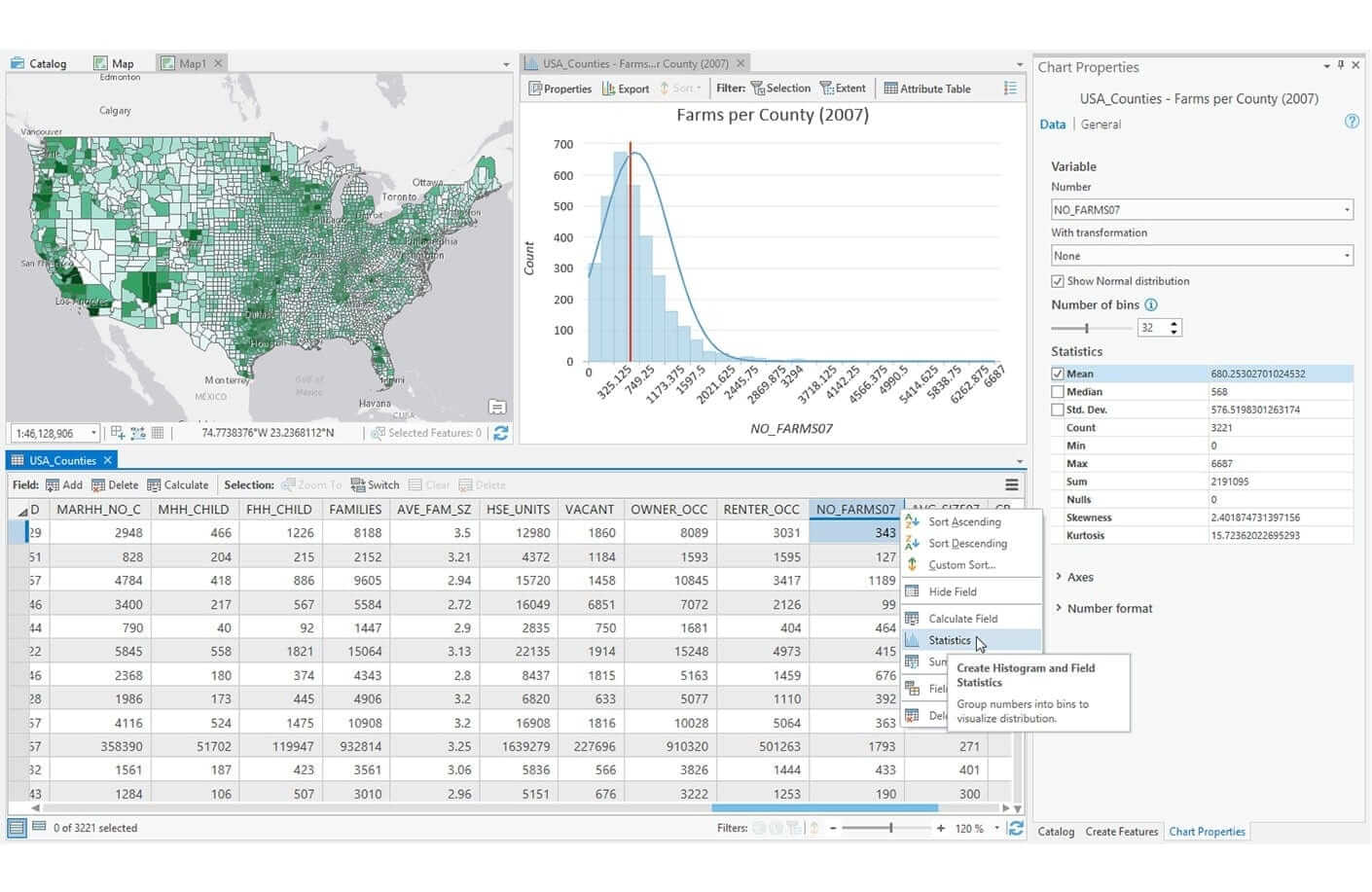
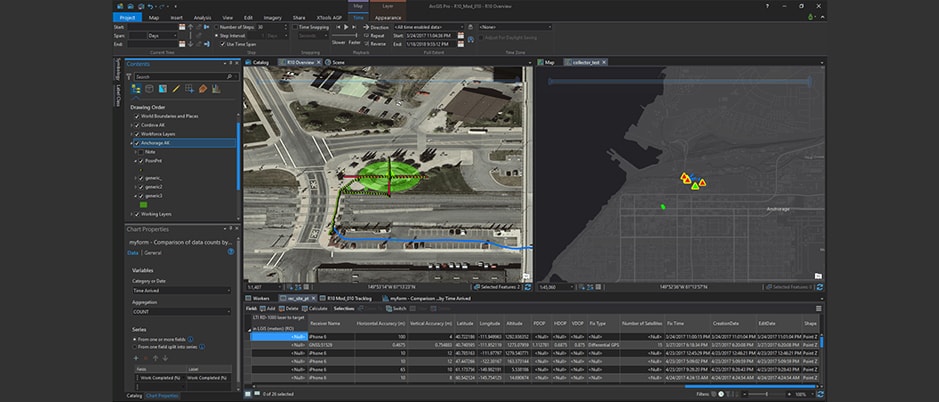
Build dynamic maps, charts, and tables for use in powerful and informative dashboards.
ArcGIS Pro includes wizards and validation tools for sharing your maps for print, as interactive web maps, and optimized for ArcGIS Apps and custom applications.
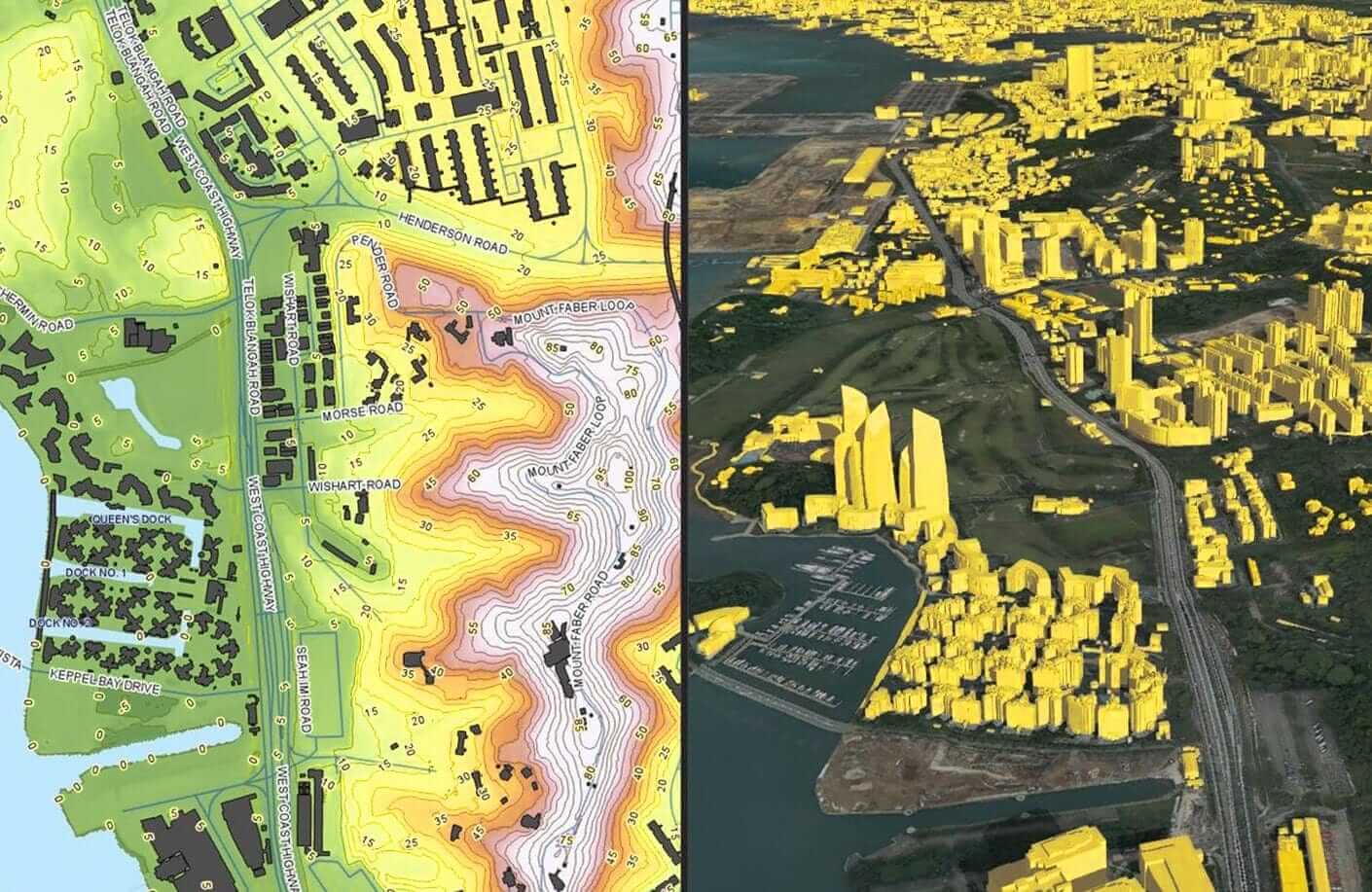
Simply getting your data onto a map puts it into context and reveals new insight and understanding.
Answers to many questions often require an understanding of spatial relationships such as proximity, coincidence, intersection, overlap, visibility, and accessibility.
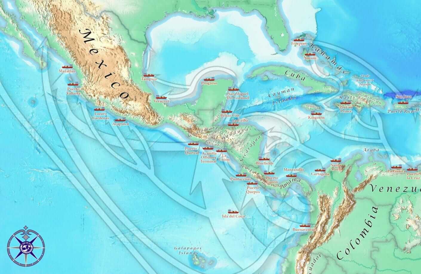
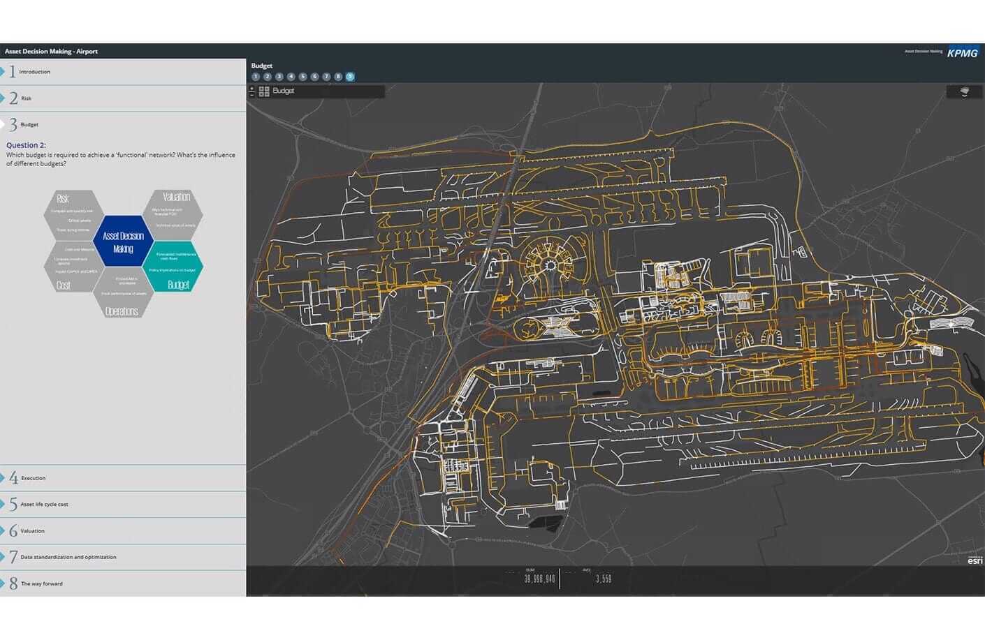
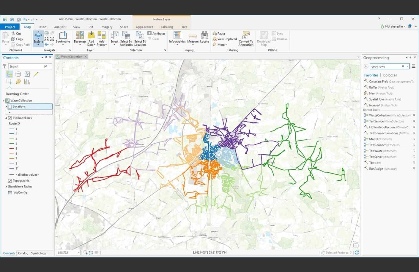
Use GIS for site selection based on empirical data. Optimize routing by including your own custom network data (private roads) and restrictions for weight, turns, or cargo.
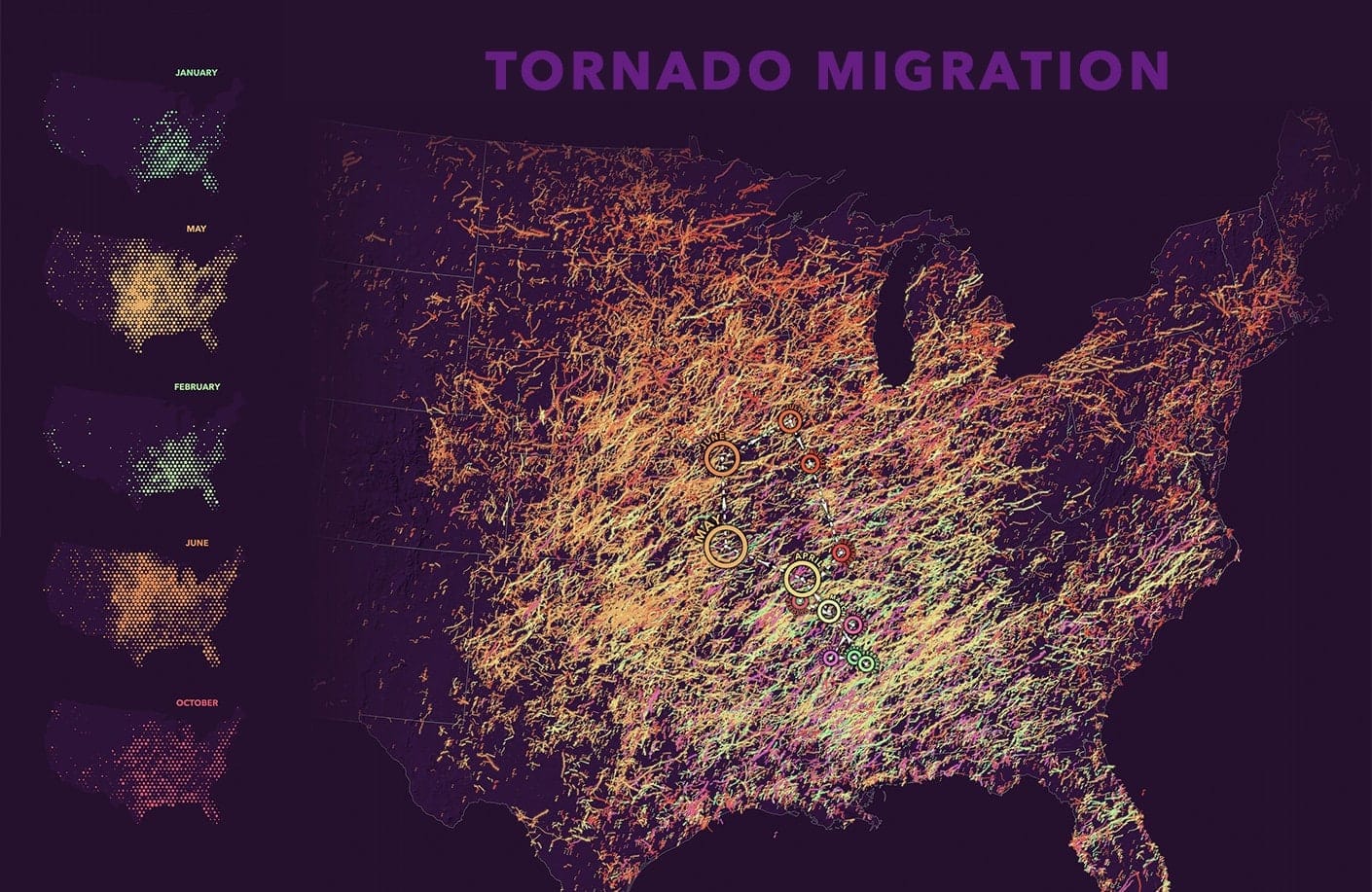
Find hot spots and outliers or natural data clusters when you use data to detect, quantify, and analyze changes in patterns over time.

Spatial analysis lets you use powerful modeling techniques to make predictions and better understand our world.

Improve the efficiency and accuracy of your tasks, workflows, and analysis with automation tools.

Ensure data integrity and accuracy with a complete set of tools for storing, editing, evaluating, and managing all kinds of spatial data.
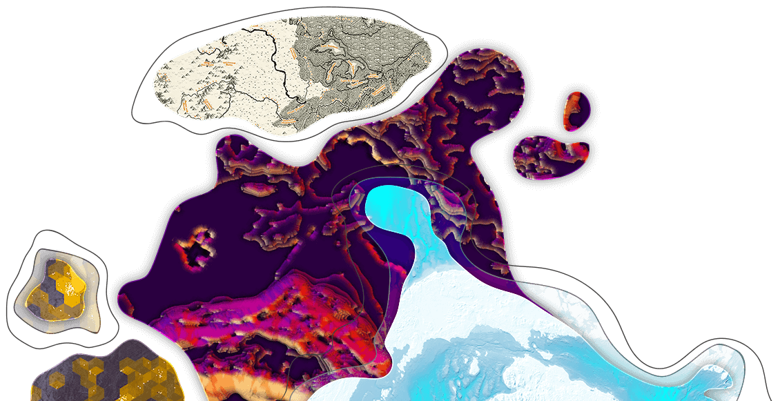
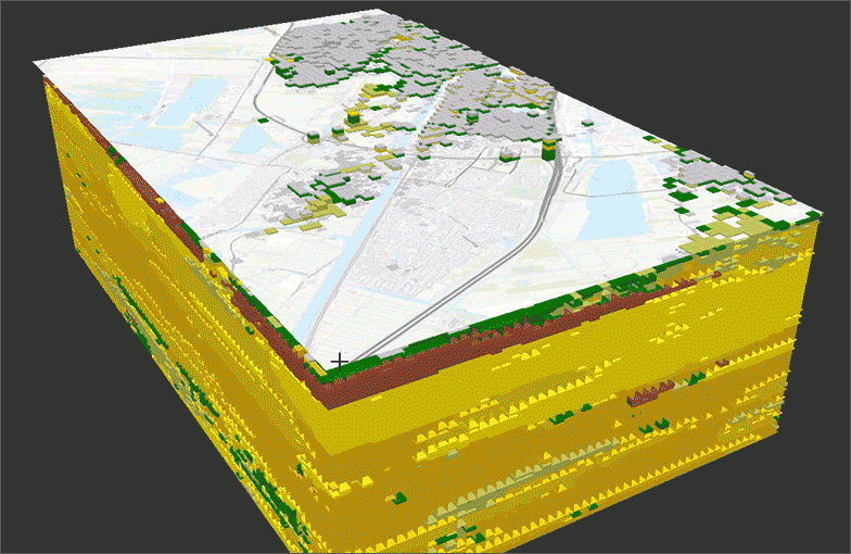
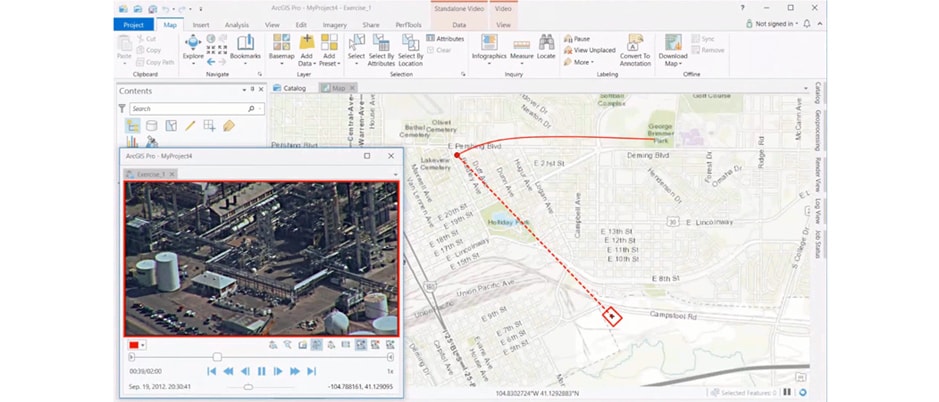
Drones, satellites, aerial, video, lidar, and more, ArcGIS Pro provides powerful tools to manage and analyze imagery.
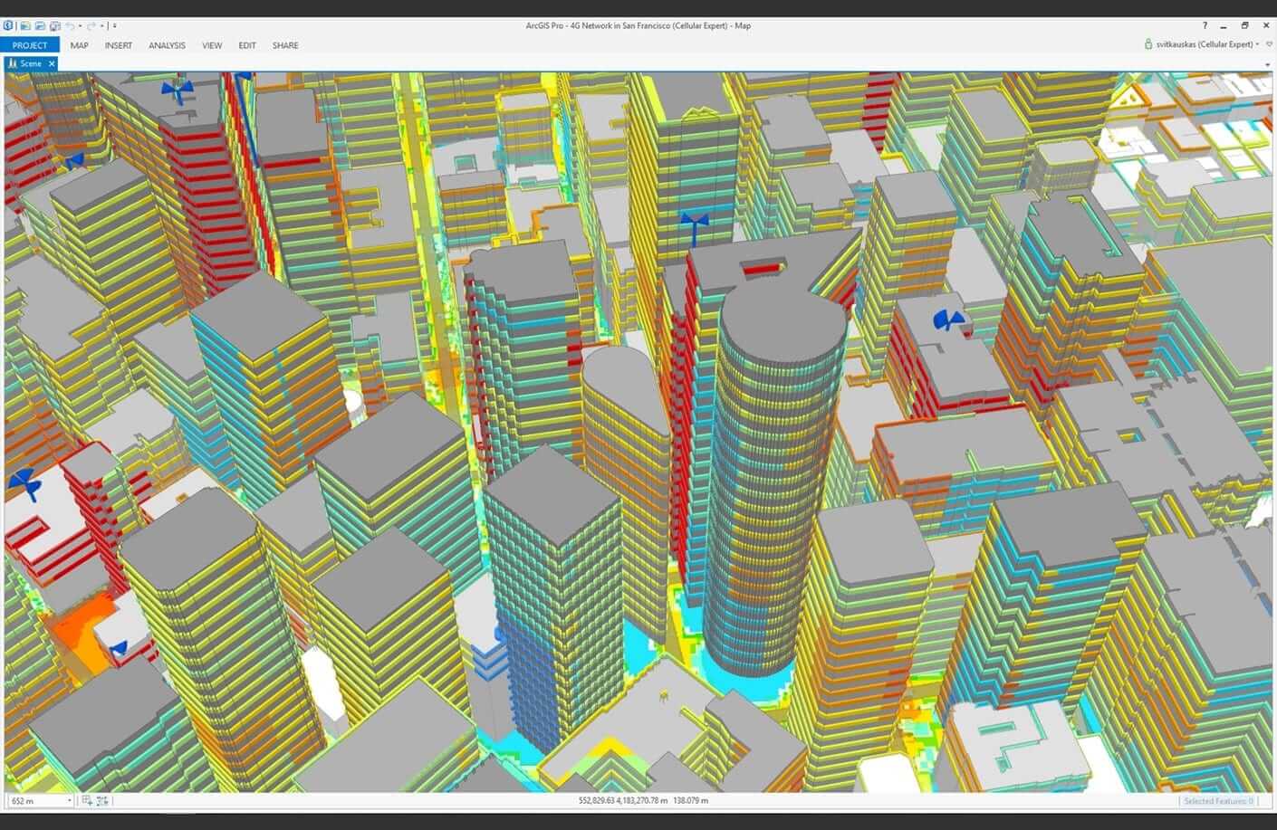
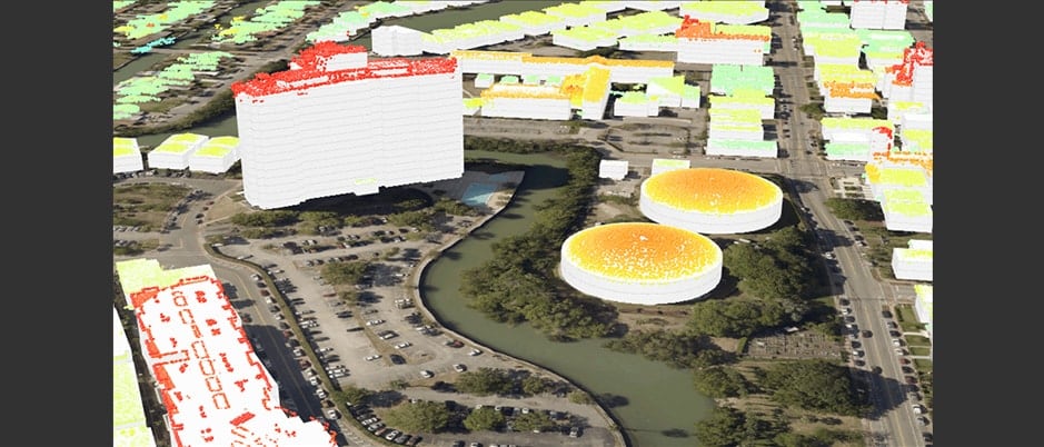
Blend IoT data, GIS-driven location intelligence, and AI-powered algorithms and deep learning models to drive insight and make smarter decisions.
Deploy ArcGIS Pro across your organization using tools that are secure and scalable.
Get answers for your product, industry or technical inquiries
Share your details with us
Talk over the phone