ArcGIS Infographics Add-in Get facts and demographics about areas with clean, clear infographics. Learn more
ArcGIS Editor for OpenStreetMap (download) Contribute to the OpenStreetMap project using the ArcGIS editing environment. Learn more
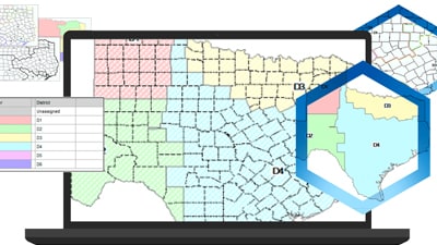
Districting for ArcGIS (download) Redraw political boundaries, define districts, set up territories, and analyze results. Learn more
Esri S-57 Viewer (download) Visualize S-57 data in compliance with S-52 standards and specifications. Learn more
Free Geoportal Add-ons (download) Catalog geospatial resources within an enterprise regardless of location or type. Learn more
ArcGIS Enhanced Feature Search Extension Provide enhanced searching of attributes in ArcMap. Download now