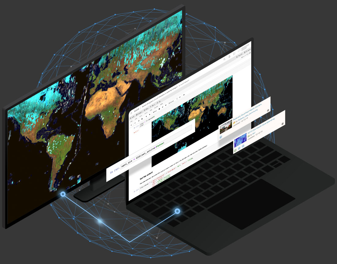
ArcGIS Notebooks
Spatial analysis meets data science
Break away from siloed analysis workflows
Explore the collaborative spatial data science workbench designed for data scientists and GIS professionals.
What can you do with ArcGIS Notebooks?
- Data Engineering
- Spatial Analysis
- Machine Learning and AI
- Automation
- Collaboration
- Data Storytelling
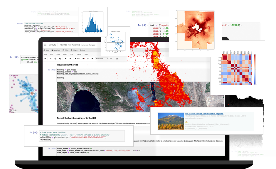
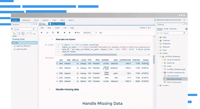
Enhance your data engineering
Prep your data using spatial and open-source libraries to isolate an area of interest and identify anomalies. Add context with curated location data.
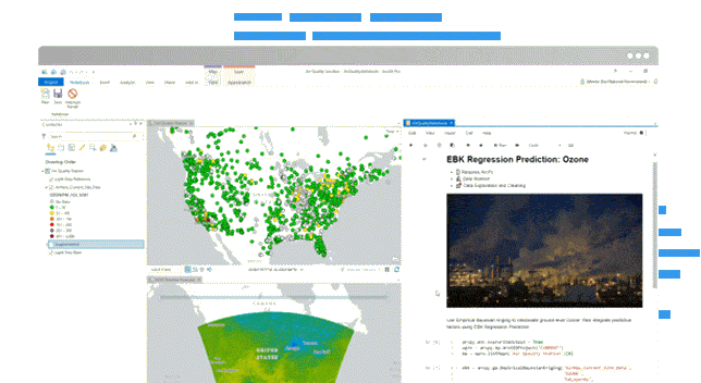
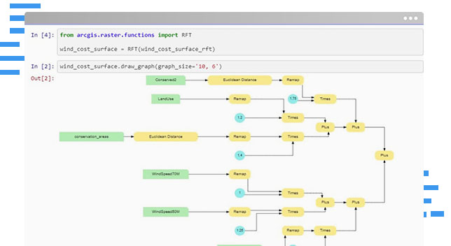
Optimize your analyses with location
Go beyond proximity with advanced analytics. Arrive at statistically significant results with spatial algorithms and open-source Python libraries.
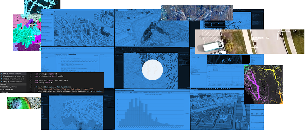
Predict with spatial artificial intelligence
Train and perform inference on models using built-in tools with machine learning and deep learning frameworks to solve complex spatial problems.

Find efficiencies and reduce errors
Leverage the built-in ArcGIS Python Libraries to automate and schedule repetitive administrative tasks in your Web GIS.
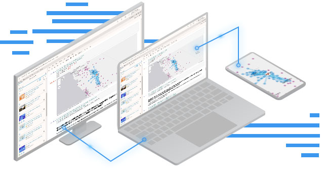
Reproducible research across teams
Explain your analyses by combining Python with interactive visuals and descriptions. Share a workspace that is familiar to other data scientists.
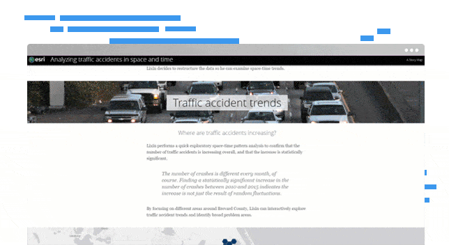
Build information products that inspire
Share results via visually stunning maps and intuitive apps that drive action and help infuse AI into real-world problem solving.
How does it work?
Add data
Access your data and contextualize it with datasets, built by the ArcGIS community and Esri’s team of cartographers, demographers and statisticians.
Visualize
Dynamically create beautiful maps and visualizations that tell a story. Explore data distributions, find patterns, and view results in 2D and 3D.
Analyze
Combine industry-leading spatial analytics from ArcGIS with open source Python libraries to solve complex problems and build precise models.
Share
Make your models accessible and easy to find, increasing transparency and efficiency. Better collaborate with other analysts and data scientists.
Contact us to get started
Join our growing list of interested users and organizations.
Get in touch with us
Product Information
Get answers for your product, industry or technical inquiries
Contact Us
Share your details with us
Give us a call
Talk over the phone