

ArcGIS Excalibur
Integrated image exploitation
Web-based image exploitation workflow for timely geospatial intelligence
Transforming analyst workflows
- Search and discover
- Work remotely
- Organize projects
- Exploit and analyze
- Export and share
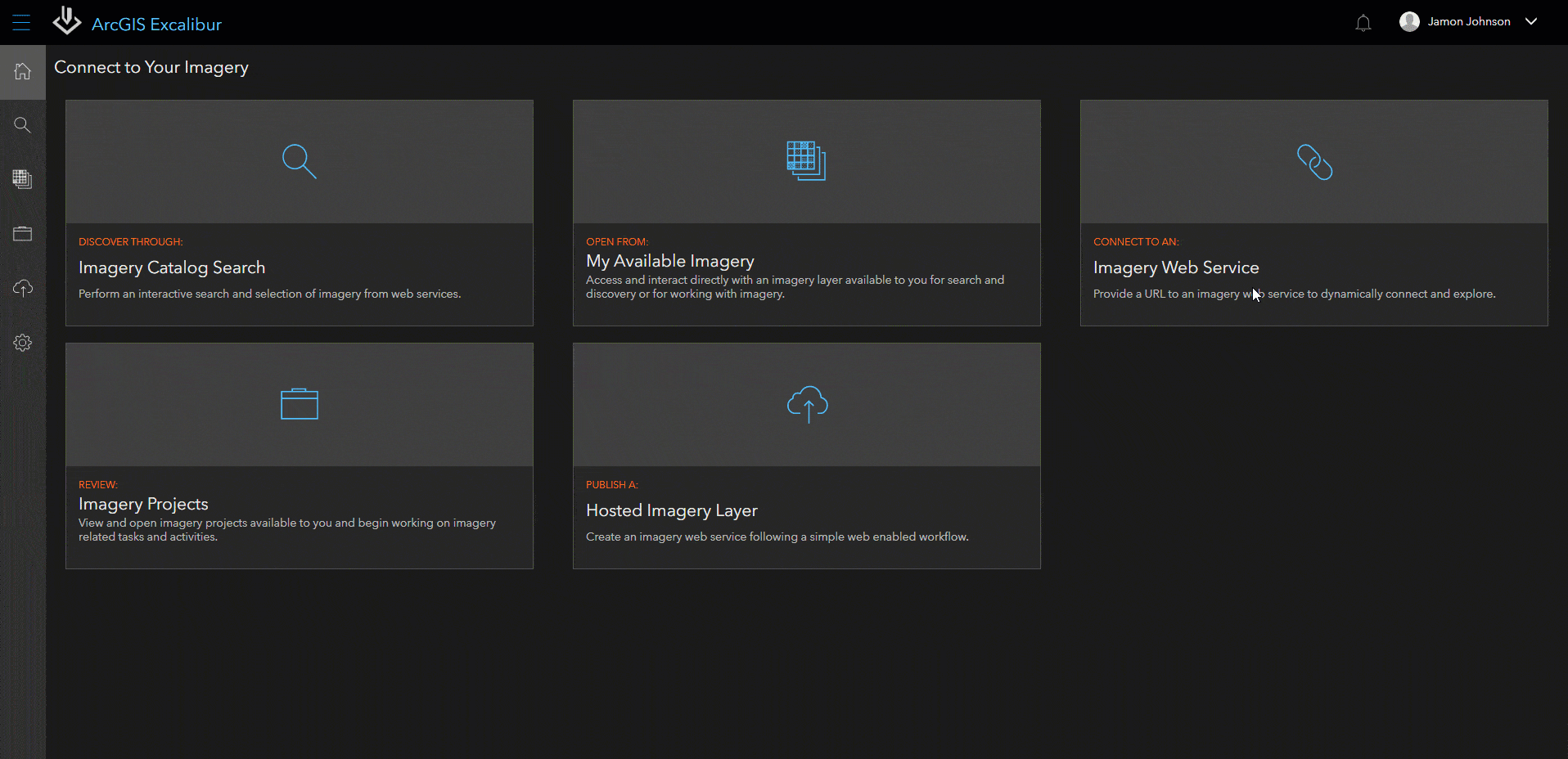
Search and discover
Access imagery in seconds from web-enabled image services, then open it from the search results. Save and quickly get back to search queries. Filter searches by date, cloud cover, and name, or input a service URL for faster access.

Work remotely
You can access imagery over the web from anywhere with Open Geospatial Consortium standard Web Map Service (WMS) and Web Map Tile Service (WMTS). Increase collaboration in the field with remote inspection, analysis, and discovery workflows.
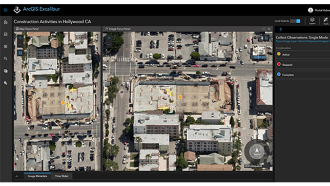
Organize projects
Perform image exploitation more efficiently using imagery projects. Imagery projects organize the images, tools, and instructions needed to complete an exploitation task. Add observation layers to a project and include a web map with geospatial reference layers to help provide context.
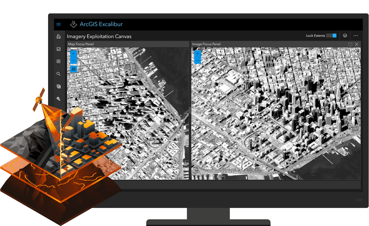
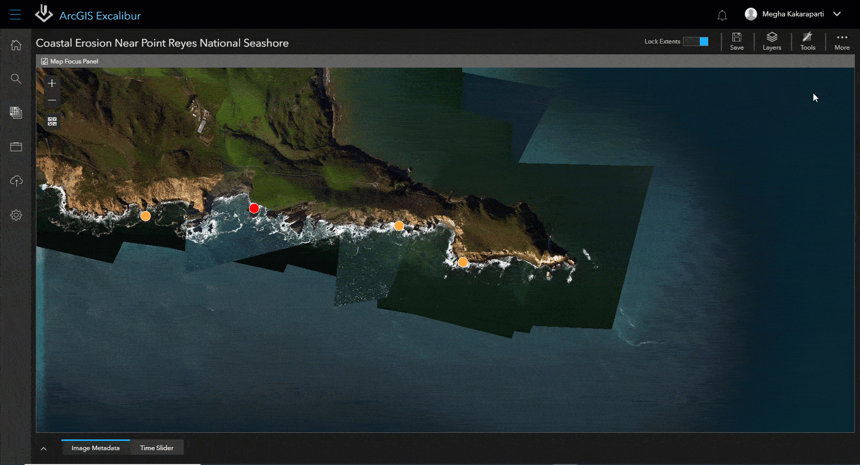
Exploit and analyze
Prepare reports with annotated images and extracted information from image observations. Save time by adding geoenriched observation layers or detect change with automated pixel-based comparison. Make multiple edits simultaneously and improve productivity.
Export and share
Add value to briefings with exported images. Then, share them with key stakeholders to help make informed decisions based on data and insights from images. Bring other ArcGIS apps and solutions into play to create image observation reports, dashboards, interactive briefing materials, and dynamic analysis layers.

How it works
Access imagery
Perform an interactive search of available imagery, set search settings, preview imagery, view image metadata, and queue images for further use.
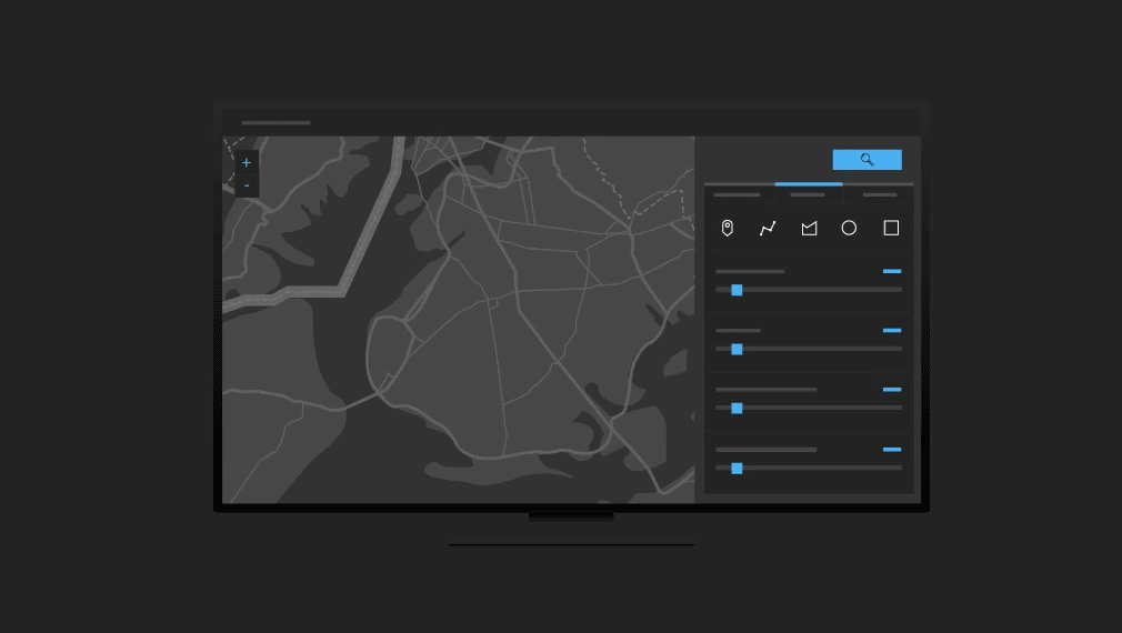
Perform imagery exploitation
Users can create markups, measurements, and apply image enhancements or predefined image renderers on oblique or orthorectified imagery.
Share results
Create imagery observation reports and interactive briefing products, monitor product metrics, or share your analysis as dynamic imagery layers.

Comprehensive imagery platform
Together, the products in this platform provide a complete integrated image exploitation solution.
ArcGIS Image Server
The foundation to process, analyze, and share massive collections of imagery and rasters.
ArcGIS Enterprise
Get started with ArcGIS Enterprise, the industry-leading geospatial platform.
ArcGIS Dashboards
Add imagery layers to your dashboard to show your information at a glance, designed for those who need it.
Contact us to get started
Join our growing list of interested users and organizations.
Get in touch with us
Product Information
Get answers for your product, industry or technical inquiries
Contact Us
Share your details with us
Give us a call
Talk over the phone