
Master Planning Whitepaper
GIS: A proven pathway to city's Master Planning
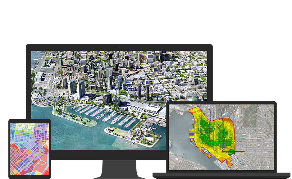
Geospatial technology gives you the location-based intelligence and spatial analysis, you need to build and maintain various necessary amenities in cities. For decades, governments and organizations around the world have relied on GIS. Now more than ever, GIS is mission critical. There are endless opportunities to apply GIS in nearly every discipline in Government—from law enforcement and public works to citizen engagement and infrastructure management. Additionally, the applications in ArcGIS for State Government and ArcGIS for Local Government can help policymakers and executives in government make decisions that are more informed. With the advancements in GIS, the utilization of hard copy maps is limited to the field work and field verification of data. The digital GIS environment can be used for spatial and attribute data analysis and GIS based master plan formulation.
For Master Planning, the key considerations of using GIS are:
- GIS based master plan is plan in practice.
- Each phase of plan can be made on live environment.
- Satellite & Drone images can be used to update the master plans anytime.
- GIS supports analyzing spatial demands and to create master plans.
- Multilayers spatial data and overlaying them provides a more scientific approach in planning.
- GIS offer alternate scenarios in planning.
- GIS offers “What if” planning.
- GIS supports modeling every sub objective of a plan.
- Web GIS supports people’s involvement in planning.
- GIS enables standardization.
- Mobile app supports quick GIS surveys for preparing Master Plan.