Case Study
Tata Steel Utilities and Infrastructure Services Limited Optimizing Urban Services with Enterprise GIS
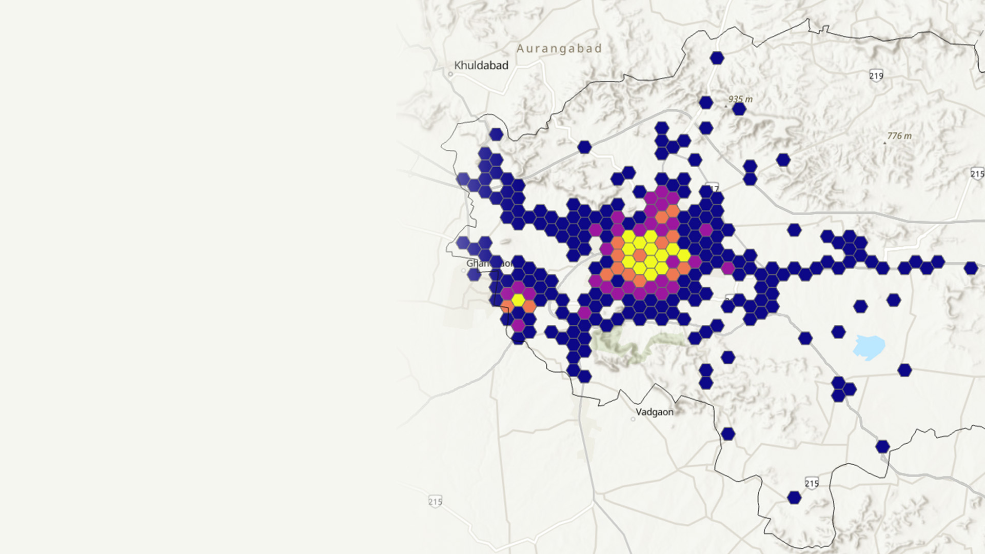
Tata Steel UISL’s journey with Geographic Information Systems (GIS) began with utilizing GIS in a CAD (Computer-Aided Design) format.

Case Study
Tata Steel UISL’s journey with Geographic Information Systems (GIS) began with utilizing GIS in a CAD (Computer-Aided Design) format.
Revenue-generating opportunities continue to grow in manufacturing. With a focus on customers' needs, companies can leverage location intelligence to enhance strategic plans, drive growth, optimize service capacity, and increase market share. Your supply chain can be your competitive advantage.
Plan for growth with precise local market insights. Location intelligence enables you and your dealer network to drive market dominance and create more engaging customer relationships.
Increase customer loyalty and improve retention of your service team with data-driven territory planning, geographic alignment, and contract execution.
Manage service levels and reliability by visualizing assets and anticipating disruptions. Location-based business intelligence provides unique visibility into your global supply network.
Build a nimble, responsive supply chain using location-based business intelligence. GIS provides risk awareness to support capital planning and manufacturing operations across a global network.
Successful organizations use location intelligence to capture market share more quickly, reduce operational cost, mitigate risks, and minimize disruptions in the supply network.
Please share your details below, and our team will get in touch with you!
Write to us at info@esri.in
Talk to us over the phone