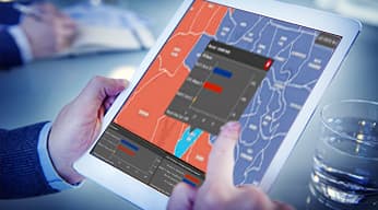
Skip to Content
gis for election by Esri India

Elections

Transform your election planning & operations with GIS

Empower the democratic process with GIS. With integrated maps, analytics, and app configurations, you can guide early voting, locate election day polling places, share real-time election results, find your elected officials, develop redistricting plans, and manage campaigns.

How Location Intelligence Drives Elections

With GIS, agencies can create information products and support every aspect of the elections process, from planning, to Election Day operations, to citizen engagement.

Previous
Next

Specialized Apps

Previous
Next

Find out how Esri India can help your organization

Get started

Connect with Esri India