
Registrations are closed
Encroachment Detection: A Key Factor in Infrastructure Protection
November 26, 2025 | 11 am IST onwards
Overview
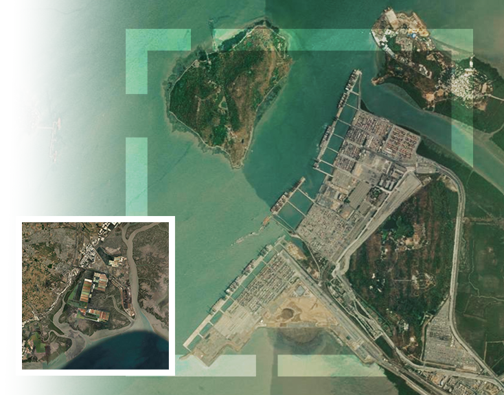
Managing and protecting government land assets at scale is a complex challenge. With unauthorized land-use changes on the rise, departments need a powerful, real-time solution that integrates cutting-edge geospatial technology, artificial intelligence, and cloud infrastructure.
Join us to explore how the geospatial technology can be leveraged for encroachment along with Esri India’s Managed Cloud Solution. This solution combines high-resolution satellite imagery, AI/ML-powered change detection, and field validation via an integrated Mobile App to establish a fully digitized, port level asset protection system.
Key Takeaways
- Real-time detection of unauthorized land-use changes and encroachments
- Interactive Dashboards with a robust decision support system (DSS)
- Construction Monitoring, Project Planning, Construction and Maintenance
- Creation of a dynamic, real-time digital inventory of ports land assets
- Hosted on Esri India Managed Cloud for performance, security, and peace of mind
Who Should Attend
- Port Authorities
- Maritime Boards
- GIS and IT Professionals
- Decision Makers in Infrastructure
- Policymakers and Regulators
- AEC Sector Professionals: Project Owners, Contractors, Architects, Engineers
- Geospatial Consultants and System Integrators
Speakers

Ashish Dhawan
Senior Industry Manager,
Esri India

Ashish Kumar Pal
Senior Project Manager,
Esri India

Ujjval Bajaj
Engineer - EIC,
Esri India
Agenda
| Timing | Session |
| 11:00 am – 11:05 am | Introduction by Ashish Dhawan |
| 11:05 am – 11:35 am | Encroachment Detection: A Key Factor in Infrastructure Protection by Ashish Kumar Pal |
| 11:35 am – 11:50 am | Esri India Managed Cloud Services by Ujjval Bajaj |
| 11:50 am – 12:00 pm | Closing Remarks and Q&A |