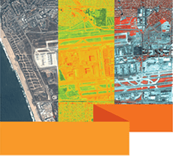
ENVI & SARScape
ENVI image analysis and processing software is beneficial for everyone from entry level analysts to domain experts. It contains many easy-to-use tools that don’t require advanced training and education in remote sensing to get actionable results. ENVI offers intuitive data visualization, processing, and analysis. ENVI includes a comprehensive suite of data analysis tools used to extract information quickly and easily from imagery. These tools are exposed as discrete processing tasks as well as workflows that guide you through the processing steps to ensure accurate preparation, and include calibration, pre-processing, atmospheric correction, pan sharpening, orthorectification and co-registration. From there, ENVI analytics can be used to detect changes and anomalies, measure and extract features, model topographic characteristics and much more.
Unlike passive optical sensors that can only operate in daylight, synthetic aperture radar (SAR) systems are active sensors, which provide their own energy source, allowing them to collect data day or night, through clouds and in most weather conditions. To make SAR data more user friendly, L3Harris has introduced ENVI SARscape, an analysis module that integrates multiple processing functions and algorithms into simplified, and in some cases, automated workflows. As with the other ENVI modules, ENVI SARscape puts powerful capabilities into the hands of analysts to extract meaningful results quickly and easily from SAR data sets.
Key Takeaways
Learn how you can transform satellite data into meaningful information using ENVI:
- Use one solution to work with all your data types
- Customize ENVI to meet unique needs
- Advanced feature interpretation and measurements from imagery
- Perform highly specialised tasks that require advanced image analysis, such as extracting features, correcting for atmospheric conditions, and orthorectifying images
- Simplifying information extraction from SAR data
Who Should Attend?
Remote Sensing and GIS professionals, Managers, Educators, Research scholars, Conservators, Engineers and Executives associated with Climate Change, Environment & Conservation of Natural Resources like Forests, Biodiversity, Minerals, Water, Agriculture, Soils etc. from across nation and invited guests sharing a passion for nature and its conservation for a better world.
Speaker

Manjusha Singh, Esri India

