Registrations are closed
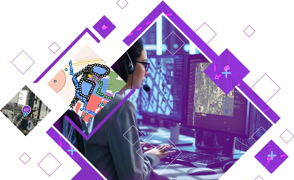
Enhance Real-Time Coordination with ArcGIS Mission
July 24, 2025 | 11 am IST onwards
Overview
In today’s dynamic environment, organizations must be prepared to respond rapidly and efficiently to both planned and unplanned events. From natural disasters and public health crises to large-scale public gatherings, the need for real-time situational awareness and seamless coordination is more critical than ever.
Recent events have highlighted the growing complexity of planning for and managing large crowds—whether at political rallies, religious festivals, protests, or sporting events. These situations demand a high level of preparedness and flexibility. Crowd management has emerged as a significant challenge, requiring tools that can adapt to shifting scenarios, ensure public safety, and maintain law and order.
ArcGIS Mission is a comprehensive tactical operations solution designed to meet these evolving challenges. It enables command centres and field teams to collaborate through a shared operational view, real-time personnel tracking, secure in-app communication, and mission planning tools. As events unfold, teams can respond dynamically making informed decisions, updating plans on the go, and maintaining full awareness of personnel, crowd movements, and critical resources.
This webinar will demonstrate how ArcGIS Mission helps public and private sector organizations streamline field operations, manage large-scale events more effectively, and enhance overall mission readiness. Whether you're responsible for citywide event coordination, emergency response, or law enforcement operations, ArcGIS Mission empowers your teams with the tools they need for real-time decision-making and operational success.
Key Takeaways
- Maintain a real-time operational picture across all field and command teams
- Plan, execute, and monitor missions dynamically, even under rapidly changing conditions
- Track personnel and assets live using map-based situational awareness
- Communicate instantly via secure chat, maps, and media sharing
- Capture mission data for post-event analysis and future preparedness
Join us to explore how ArcGIS Mission can strengthen your operational capabilities and transform how your teams coordinate, communicate, and respond on the ground.
Who should attend?
People involved in security, public safety, emergency response, disaster management, and operations teams from both public and private sectors.
Speaker

Kritika Katoch,
Esri India