March 26, 2026 | 11 am IST
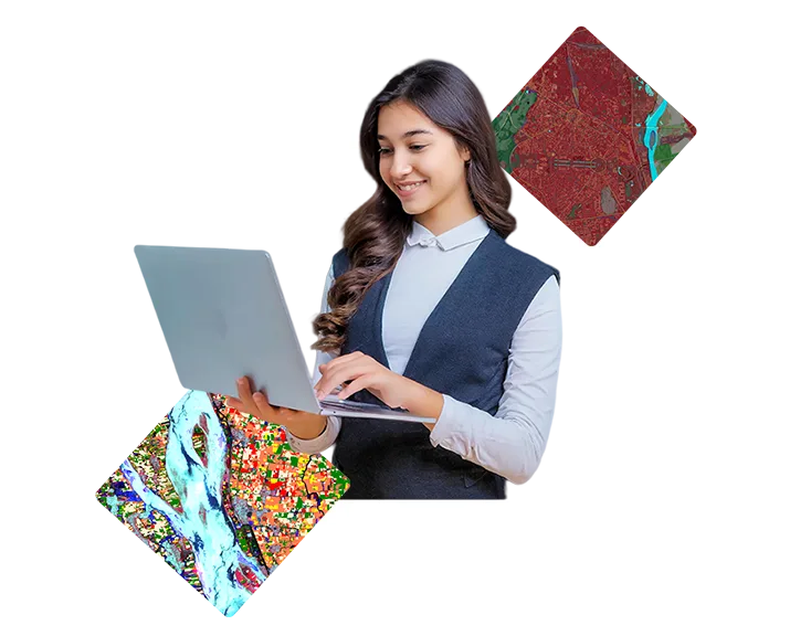
Esri Academy – Harness World-Class Training Courses Freely
Esri Academy is the official learning platform of Esri, a global leader in Geographic Information Systems (GIS).
Esri India GeoVision webinar series is your go-to-destination to learn about the latest industry trends, product updates, and technology developments impacting the world of GIS.
Esri Academy is the official learning platform of Esri, a global leader in Geographic Information Systems (GIS).
Join us to discover how you can safeguard your data and deliver secure, reliable geospatial services across your organization.
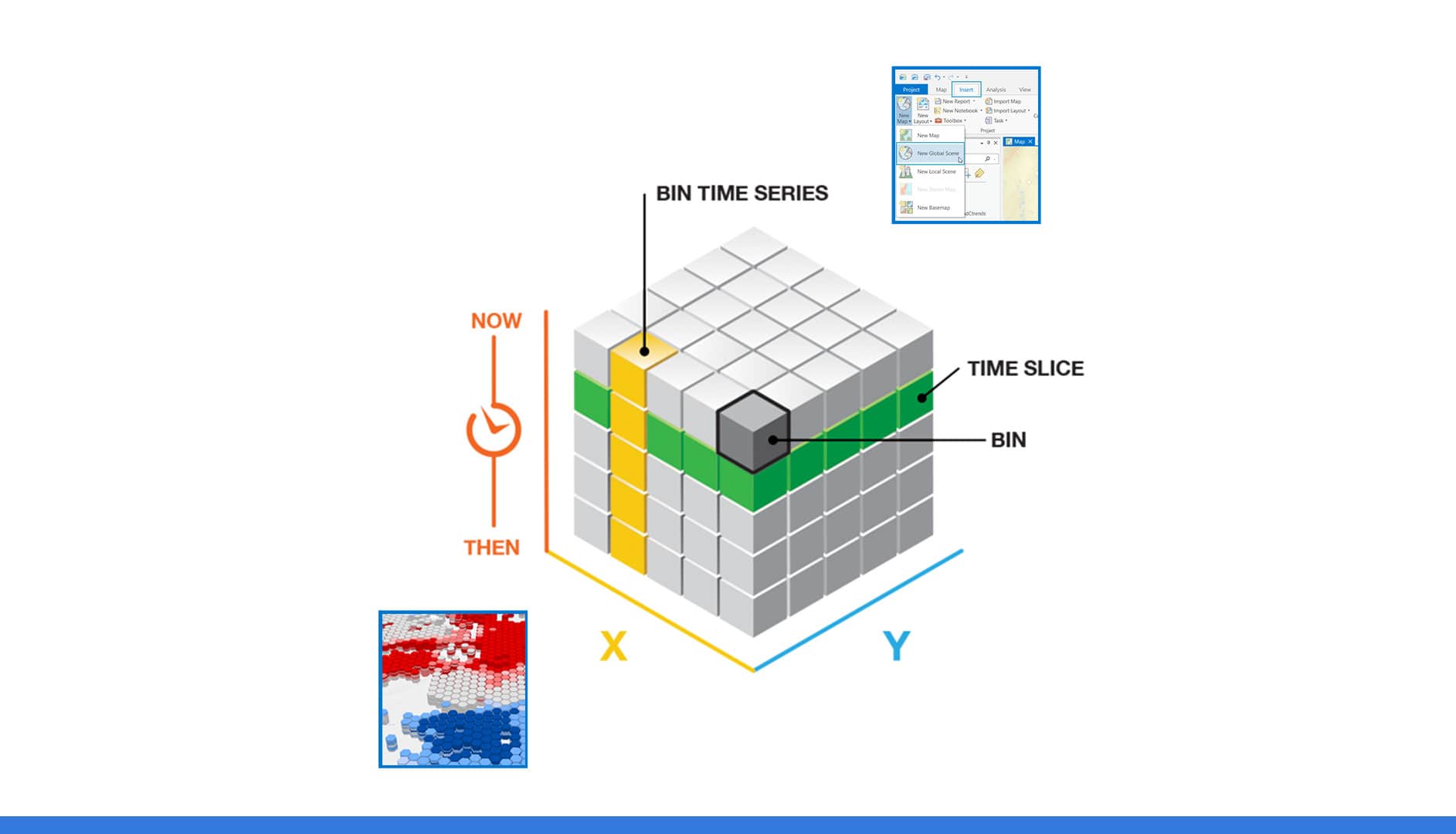
This session introduces core LiDAR concepts, collection methods, and critical quality-control considerations. We will explore modern techniques to manage, edit, and visualize 2D and 3D information products using ArcGIS Pro.

Let’s explore how a simple click can help you connect with support, resolve issues faster, and grow your GIS capabilities.

Let’s explore how a simple click can help you connect with support, resolve issues faster, and grow your GIS capabilities.

Participants will also gain practical insights into how these tools can be applied across diverse sectors—such as forestry, infrastructure, disaster management, and digital twin development
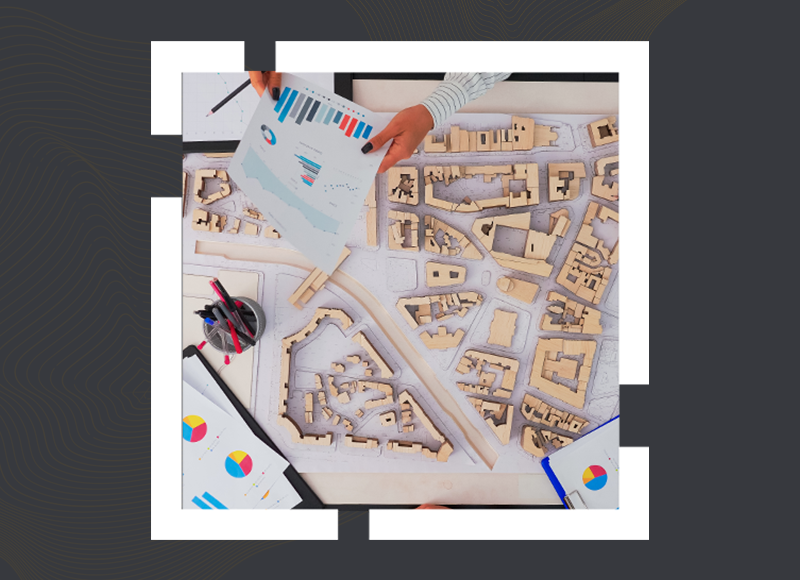
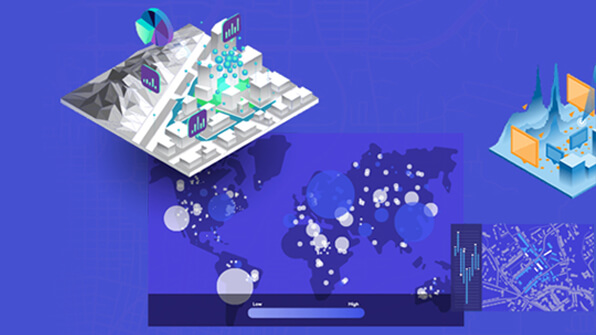
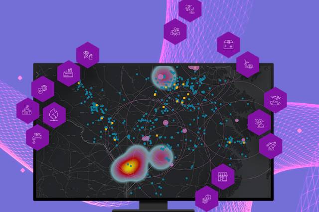
By integrating spatial data from multiple sources—such as land use, infrastructure, environment, and demographics—ArcGIS enables a unified, data-driven view of urban systems.

ArcGIS Mission is a comprehensive tactical operations solution designed to meet these evolving challenges. It enables command centres and field teams to collaborate through a shared operational view, real-time personnel tracking, secure in-app communication, and mission planning tools.
ArcGIS Workflow Manager is a scalable workflow management system that automates and simplifies many aspects of performing and managing GIS and non-GIS work in an organization.
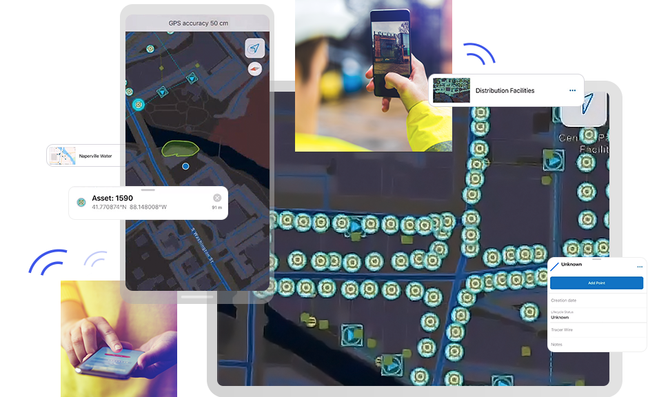
Field Apps in ArcGIS are specialized tools that empower field workers to collect, edit, and update spatial data directly from the field using mobile devices.
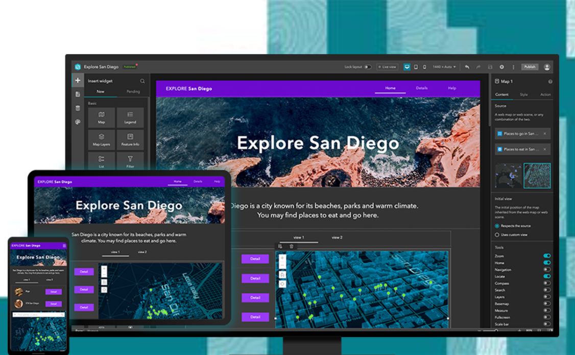
ArcGIS Experience Builder is a versatile, web-based application development platform from Esri. It enables GIS professionals and web developers to build modern, engaging, and responsive web experiences—without writing code.
GeoAI is revolutionizing geospatial data analysis by integrating advanced Artificial Intelligence (AI) techniques. With ongoing advancements in GIS technology and AI capabilities, GeoAI empowers organizations to identify hidden patterns, make data-driven predictions, and streamline complex workflows.

Digital Twins are revolutionizing how we manage, analyze, and interact with complex systems. Learn how integrating them with GIS capabilities, enables smarter planning, enhanced decision-making, and greater efficiency.
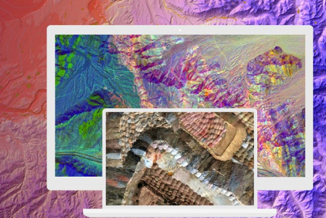
The emerging field of Hyperspectral Remote Sensing or spectroscopy deals with imaging narrow spectral bands over a continuous spectral range, producing the spectra of all pixels in the scene.
Geostatistical Analyst provides advanced tools for spatial data analysis and prediction, particularly focusing on geostatistics, which is the branch of statistics used to analyse and predict the spatial distribution of phenomena.
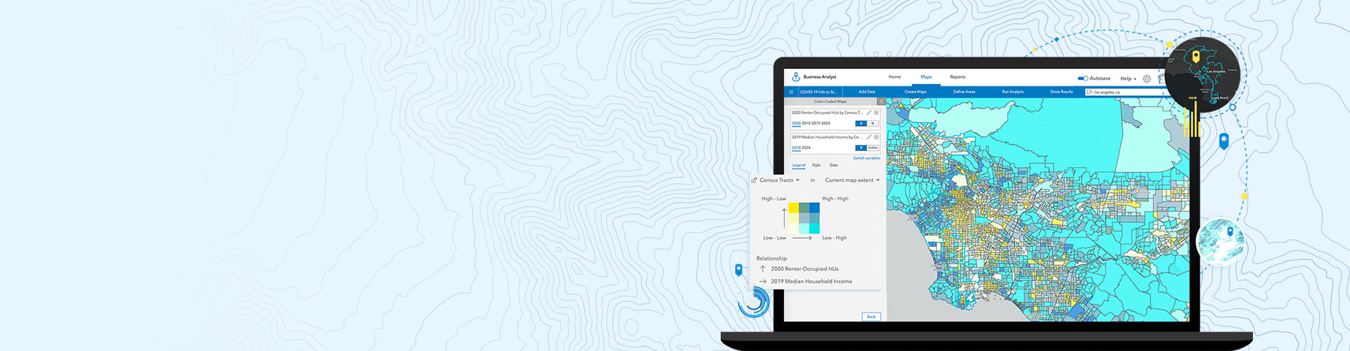
Embracing the capabilities of spatial analytics in ArcGIS empowers you to confidently address questions and extend your decision-making abilities beyond mere visual interpretation.
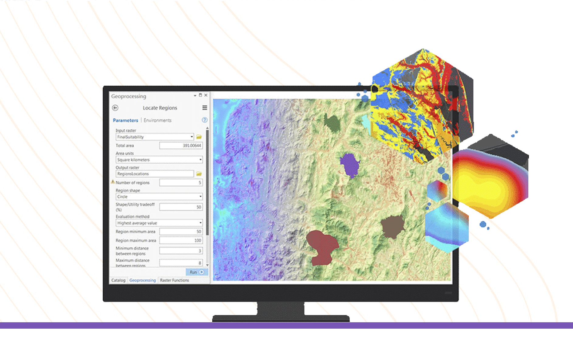
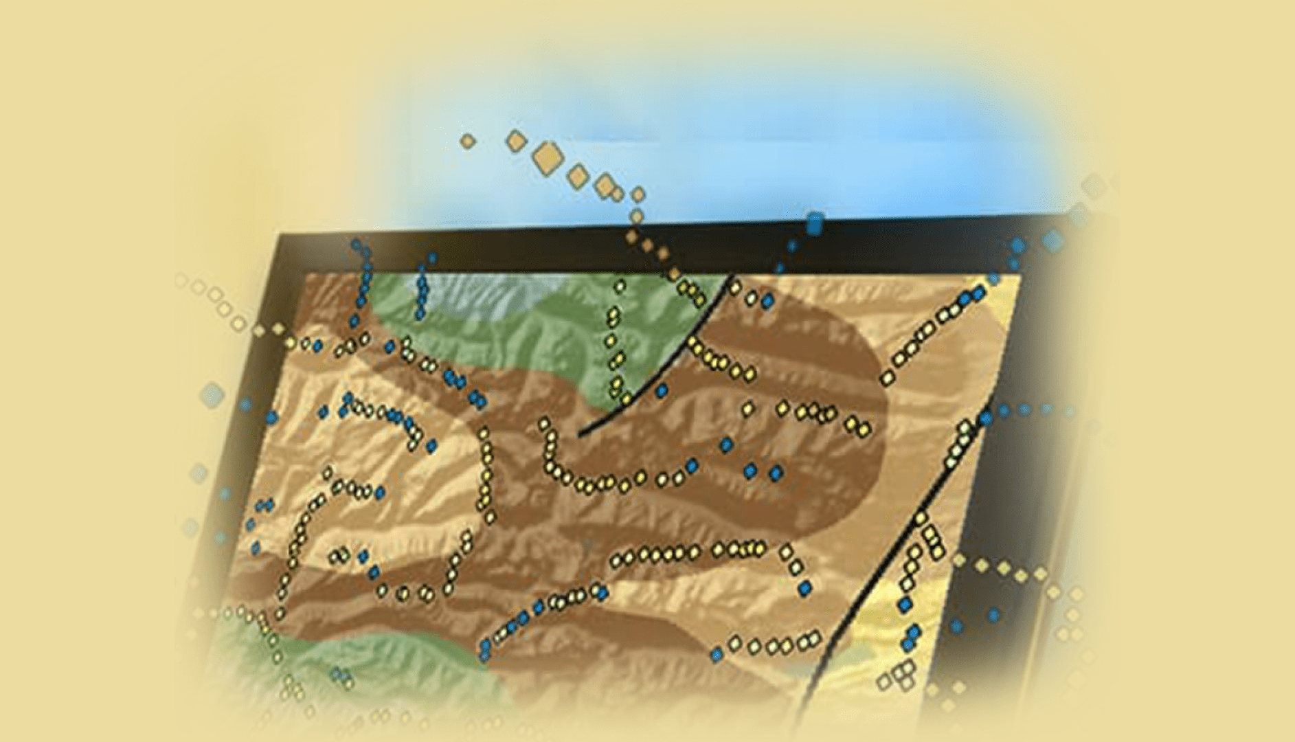
The extension facilitates terrain analysis, enabling the creation of accurate surface models and the extraction of crucial elevation-related information.
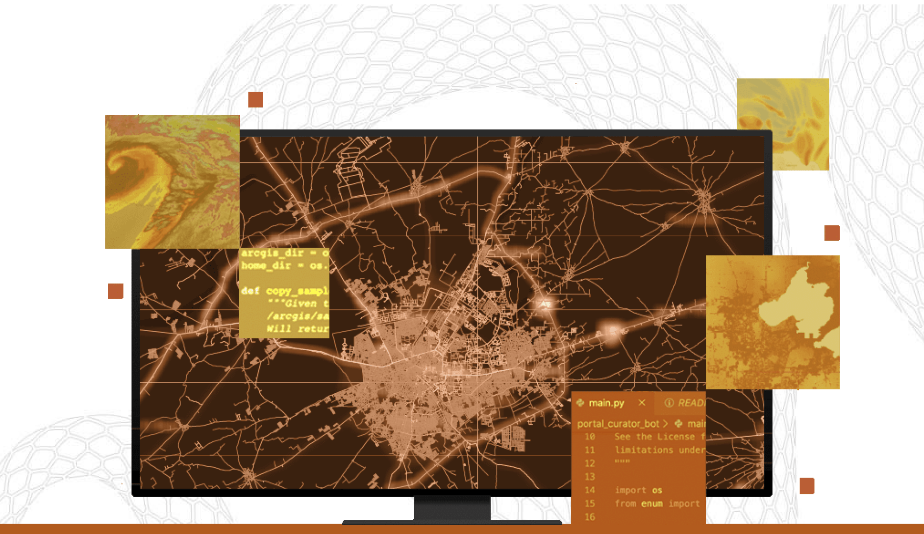
Python with ArcGIS has become paramount as organizations seek efficient ways to harness the power of scripting in their geospatial workflows.
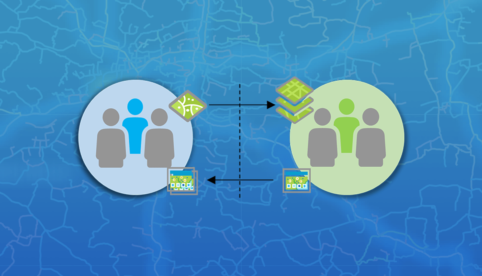
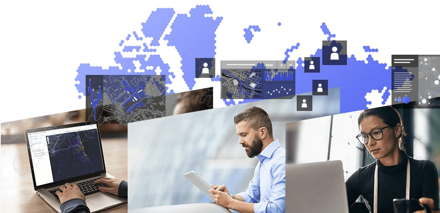
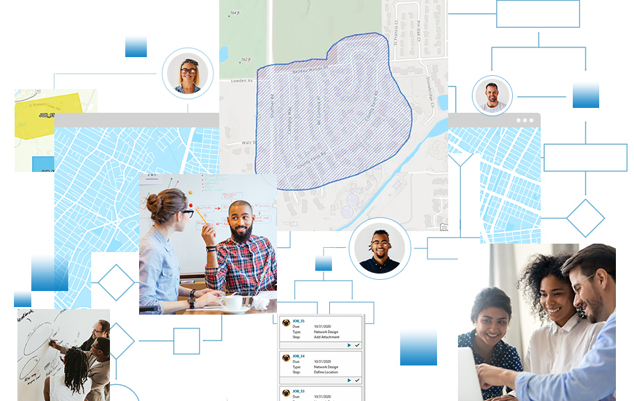
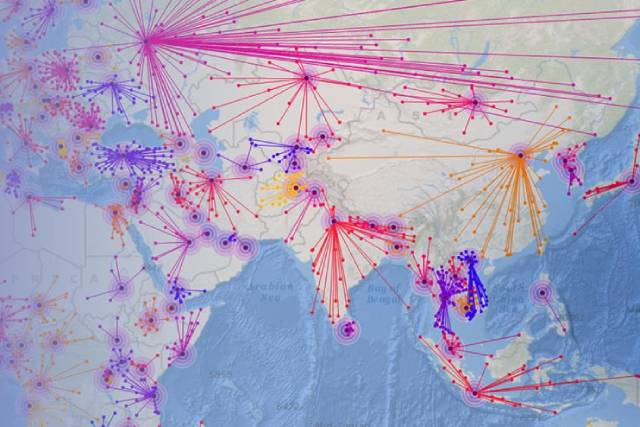
In today's interconnected world, collaboration is the linchpin that drives progress, and nowhere is this more evident than in the realm of Geographic Information Systems (GIS).

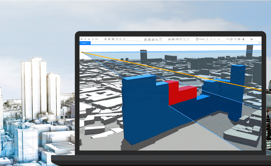
3D Across ArcGIS has various facets, including the desktop softwares, extensions, Web GIS support, dedicated web apps, VR experiences and much more.
A digital twin is a virtual representation of the real world, including physical objects, processes, relationships, and behaviors. GIS creates the data mesh for digital twins and uniquely integrates many types of digital models
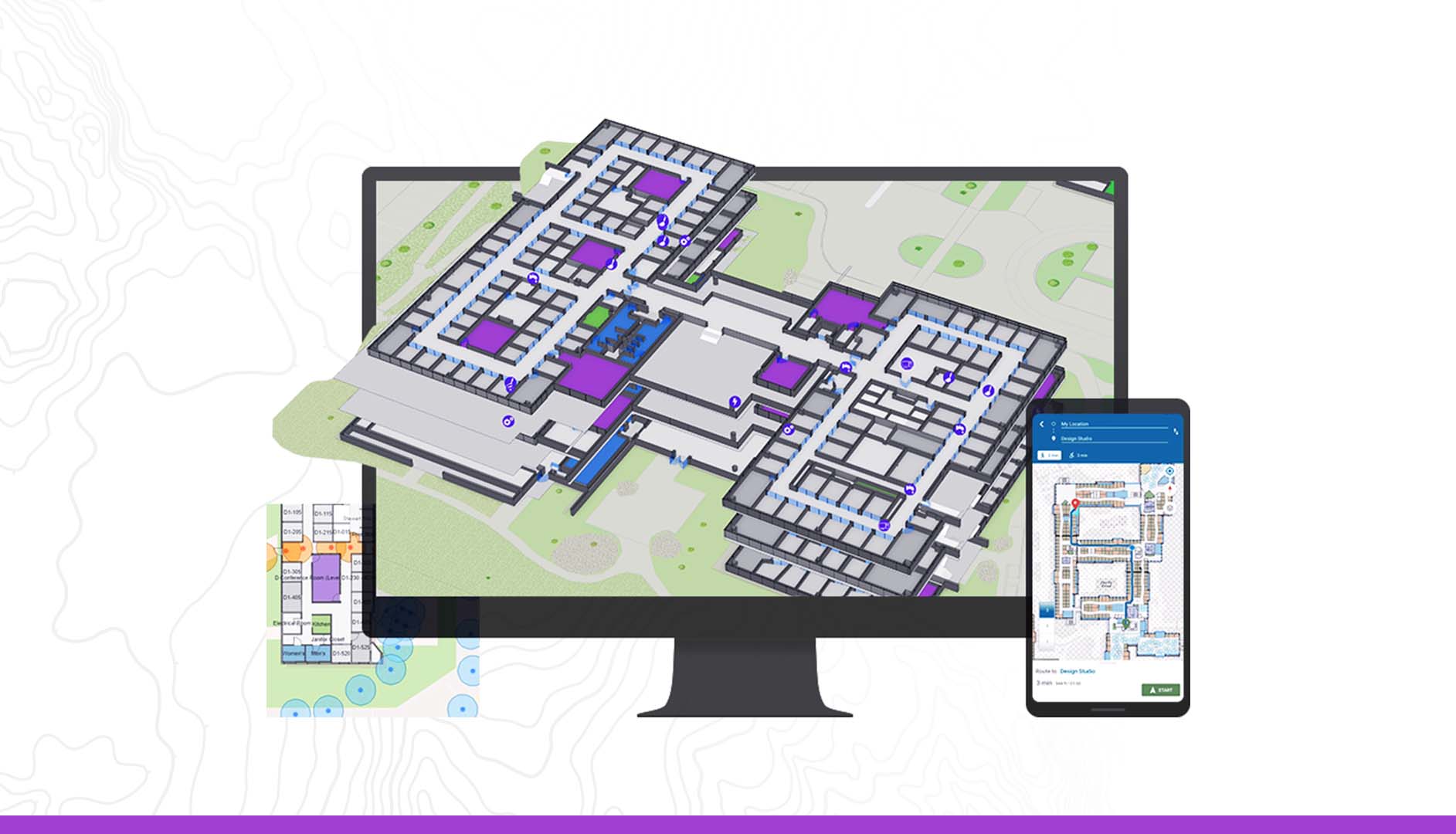
ArcGIS Indoors offers a solution for organizations to revolutionize indoor spaces using the power of GIS technology. By providing detailed indoor mapping, real-time positioning, space utilization analysis, indoor routing, and facilities management capabilities, ArcGIS Indoors empowers facilities managers, architects, and professionals across industries like retail, healthcare, hospitality, and tra
Whenever we look at a map, we inherently start turning that map into information by finding patterns, assessing trends, or making decisions. Harnessing the power of spatial statistics in ArcGIS enables you to answer questions confidently and make informed decisions beyond mere visual analysis.
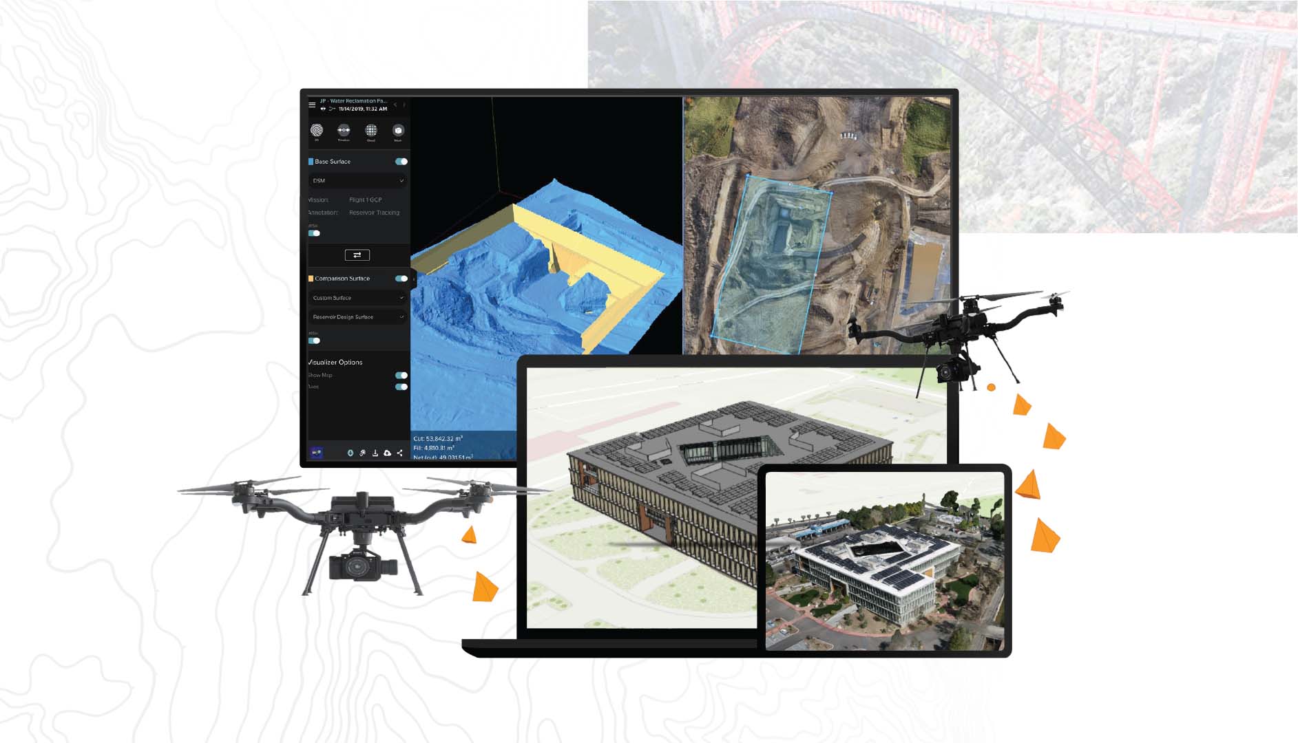
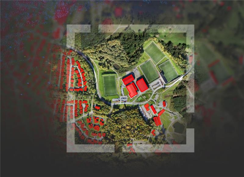
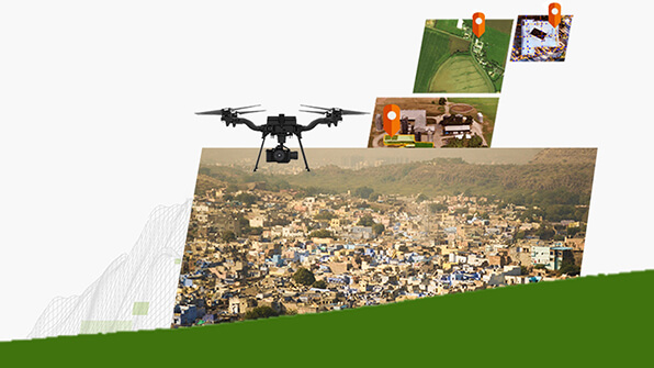
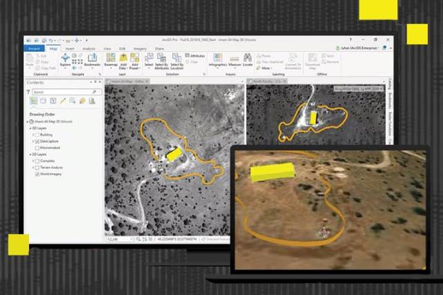
Drone Data Processing and Analysis, provided by ESRI, is an innovative platform that allows organizations and professionals to process and analyse drone-acquired data efficiently. This solution enables users to derive valuable geospatial insights and make informed decisions by leveraging high-resolution aerial imagery.
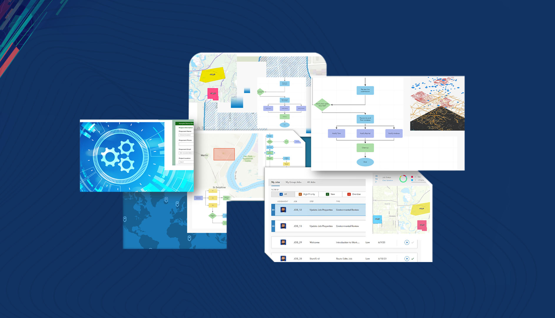
ArcGIS Workflow Manager is a powerful tool that enables organizations to automate and streamline their mapping workflows. By implementing this system, businesses can significantly increase their operational efficiency and productivity.
Learn how ENVI SARscape puts powerful capabilities into the hands of analysts to extract meaningful results quickly and easily from SAR data sets
Learn how ArcGIS for Office's superior mapping capabilities transforms your data into interactive maps within Excel and Power BI environments.
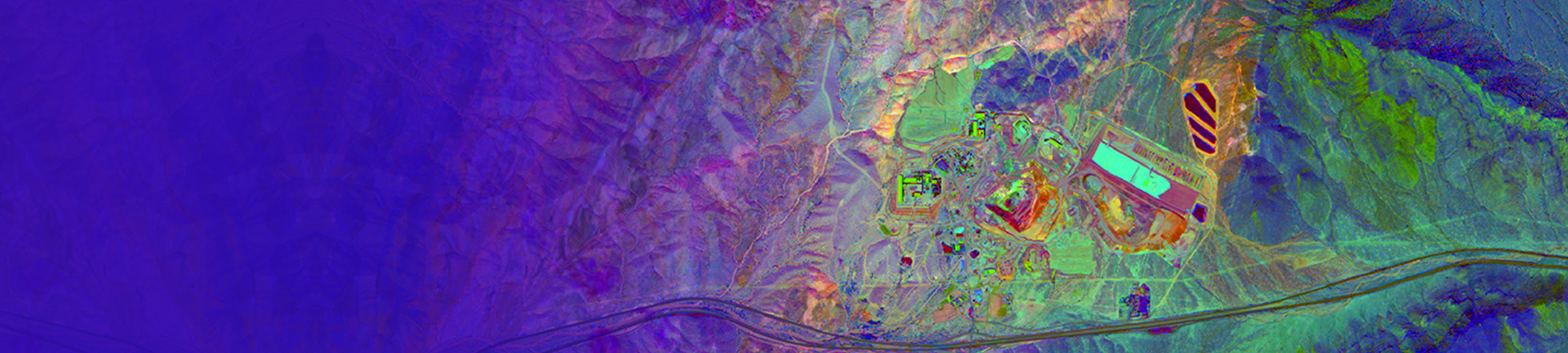
Learn how Advanced Image Analysis capability enables users to save resources, reduce fieldwork, and solve challenges faster to maximize profit.

Learn how ArcGIS Knowledge powers graph analytics to analyse spatial, non-spatial, unstructured, and structured data for faster decision-making.
The webinar is designed for key stakeholders who are leading and driving the Svamitva Project and will provide insights on how Geospatial Applications can support the wider goals of generating the Property Information System of the Villages.
Learn how you can seamlessly integrate ENVI and ArcGIS to enable users to work with microwave data and perform analysis across both the systems.
Learn how you can empower stakeholders with spatial information quickly using easily configurable templates tailored for specific industries.
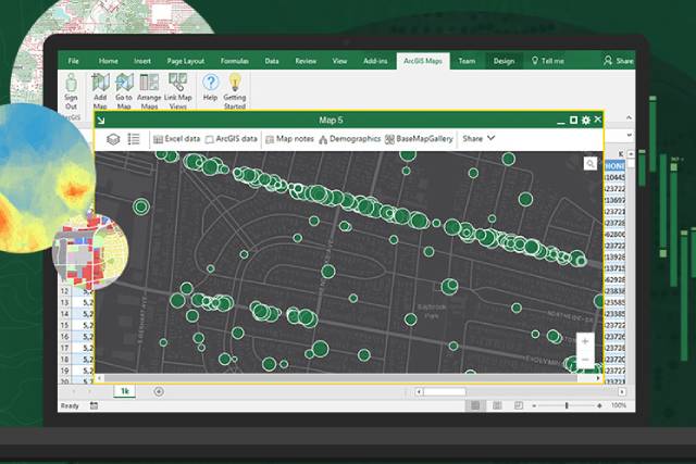
Learn how you can leverage ArcGIS platform to digitally transform your excel sheets using the power of location into interactive and exploratory maps.
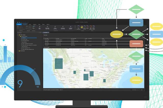
Learn the new functionalities, application use cases of ArcGIS Workflow Manager and how you can use it to organize, centralize, and standardize project workflows.
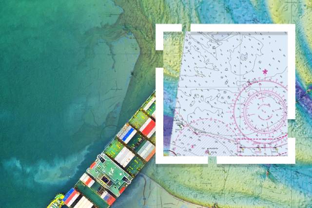
Explore maritime and charting capabilities in ArcGIS and understand how it provides a comprehensive GIS system for Maritime industry needs.

Experience new and modern functionalities of ArcGIS Experience Builder; understand various workflows for creating responsive web applications in a snap.
Get a detailed view of the ENVI and ArcGIS Pro capabilities for processing hyperspectral imagery data.
Learn how ArcGIS Pro and ENVI can be used to manage, visualize and extract information from scientific multidimensional data.
Learn how to perform advanced analytics using ArcGIS Pro Extensions.
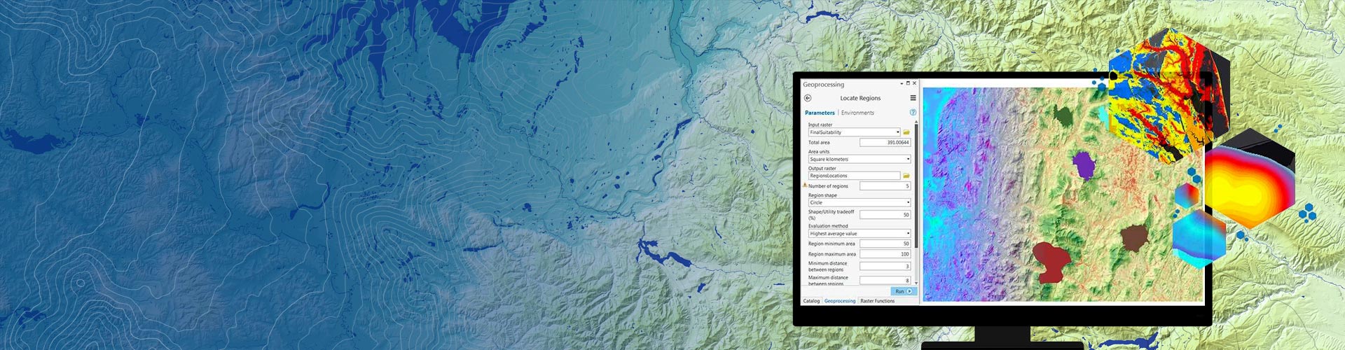
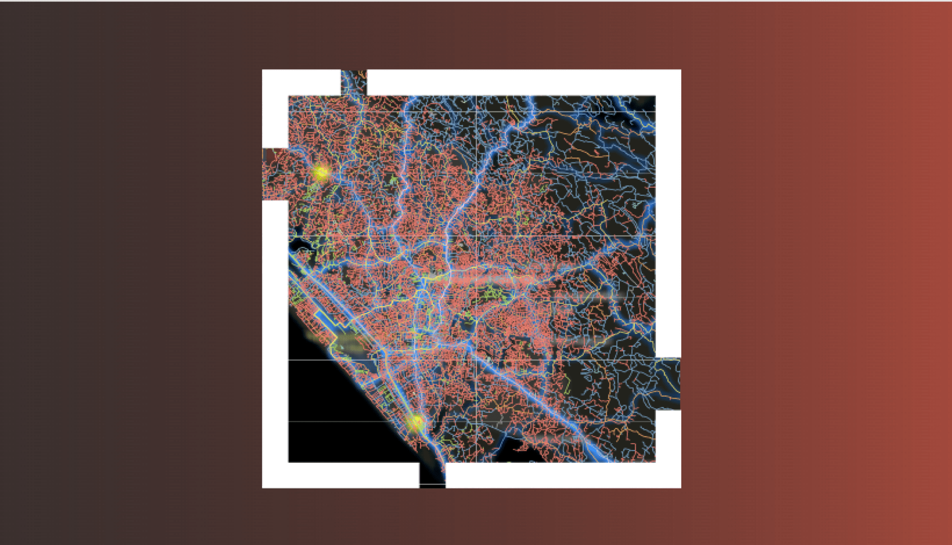
Learn how to use ArcGIS Pro analytical tools to solve complex location-oriented problems, find patterns, assess trends and make decisions.
Experience new and modern functionalities in ArcGIS Pro to jumpstart your GIS journey.
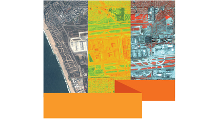
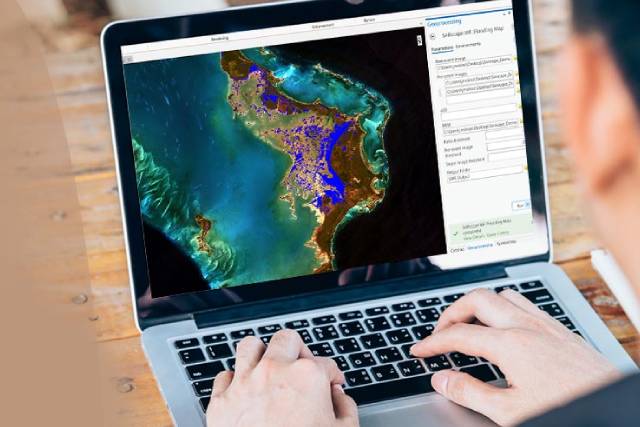
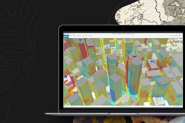
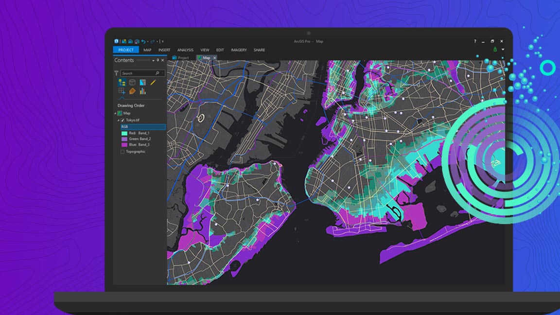
ArcGIS Pro provides complete imagery suite for the management, analysis, and sharing of remotely sensed data including large collections of imageries. This webinar provides an overview of ArcGIS Pro capabilities to visualise, manage and analyse imagery including LiDAR, drone and Multi-Dimensional raster data. Understand how raster functions allows to define processing operations that can be applie
Learn how you can define your data, do analysis and optimize powerful geospatial decision using ArcGIS Network Analyst Extension.
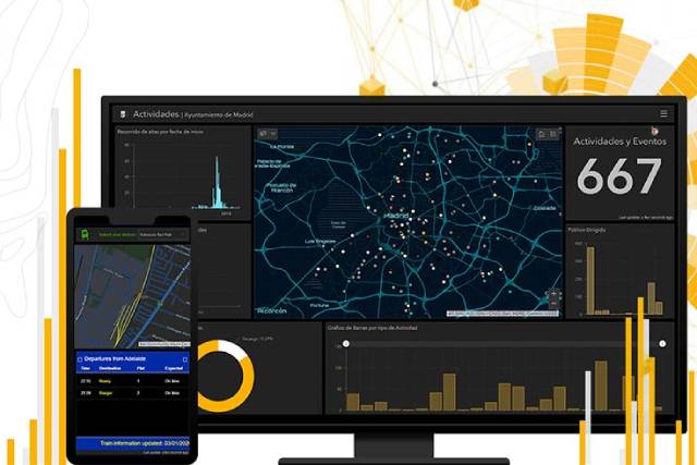
Explore how you can use ArcGIS Dashboard to easily configure a dashboard to keep track of your strategic, operational or tactical KPIs in real-time, anywhere.
Explore some of the latest features and new functionalities and see how you can enhance your mapping and analytics capabilities.
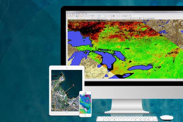
Remote sensing is being used more frequently to acquire information about a geographic area of interest prior to putting resources on the ground, reduce the need for field work, minimize environmental impacts, ultimately save costs and achieve results faster.

Learn how to integrate your real-time data streams into existing GIS and IT infrastructure to give you the right spatial context for deeper understanding and better decision-making.
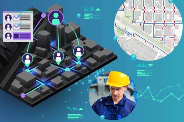
Learn how ArcGIS field apps - Collector for ArcGIS, Survey123 for ArcGIS, Workforce for ArcGIS, Navigator for ArcGIS, Explorer for ArcGIS, Tracker for ArcGIS and ArcGIS Quick Capture work together. Explore how you can use leverage the field app ecosystem in all phases of field work.
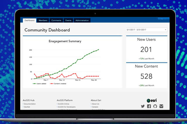
ArcGIS Hub is a community engagement platform that provides this bridge between your organization and the community it serves. Organizations of any type and any size, including government agencies, nonprofit groups, and academia, can maximize engagement, communication, collaboration, and data sharing using the ArcGIS Hub initiative-based approach.

Learn how agencies can configure Esri’s ArcGIS Hub Coronavirus Response template to engage, collaborate and share near real-time data with citizens and decision makers.
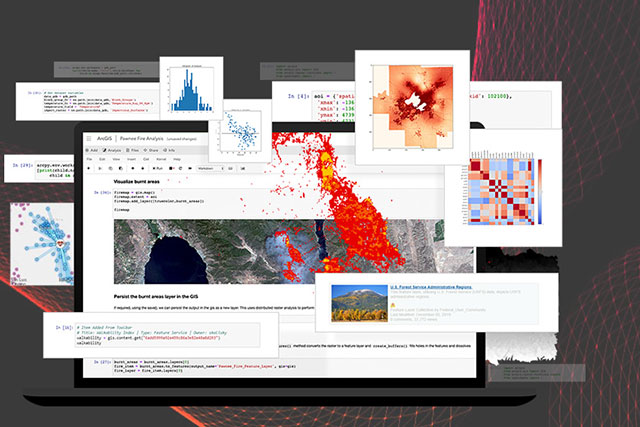
Spatial data science allows analysts to extract deeper insight from data using a comprehensive set of analytical methods and spatial algorithms, including machine learning and deep learning techniques. Tools such as Python and Jupyter notebooks are most widely used by data analysts and data scientists to explore and analyze their data and to facilitate their analytics workflows.
Learn how urban planners can leverage the design and analytics capabilities of ArcGIS to streamline the design possibilities.
Get deeper insights into how you can optimize your rich data stores by geo-enabling unstructured data in ArcGIS.
Discover new functionalities of ArcGIS Pro, including new start up experience, deep learning, 3D analysis, handling of unstructured data, advance editing, reporting tools and dimensions as annotation.
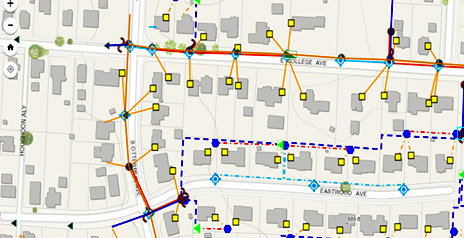
Understand how utilities can leverage GIS in their asset management.

Explore how with a location strategy, you can put the power of place at the center of your business decisions.

Understand the steps you can be taking today to develop your operational intelligence.

Understand how new platform based GIS enables digital transformation.

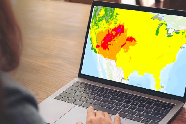
Understand how to leverage GIS to analyze, plan and manage the risk exposure in your portfolio.
Find your local Esri India office and get answers for your questions.
Search available positions, or contact our human resources team.
Talk over the phone